This is a summary of our trip to Central and South America, if you are planning a flight in a light airplane over there, you may find this information helpful. Please read other posts from individual legs of this trip below.
We flew about 9,000 nautical miles in 59 tach hours (65 on Hobbs), including local sightseeing trips, over 23 days and we are happy to be back home.
Permits
Most of the countries require overflight and landing permits, which you need to obtain before departure. You can contact FBO at your destination to arrange them or use a travel coordinator such as Air Journey or Caribbean Sky Tours to get them for you. The latter option is more expensive but gives you a single point of contact to arrange for any routing changes.
In Colombia, if you stay more than 48 hours, but less than five days, you will need operational permit, which is $120 (as of this writing). Make sure you list all the airports you will be landing at, or even might be landing at. Landing at an airport you didn’t list may expose you administrative hassles and fine. If you stay over 5 days, you will need special import permit, which is $416 (in addition to the operational permit), but than you can land at any towered airport. Both expire when you leave the country. Make sure to forward your handler flight plans and gendecs so that they forward them to the authorities to prove you left the country.
At each stop you or your handler will need to file a flight plan and most likely it will be an ICAO paper copy. You need to know all the right ICAO abbreviations. In addition, you will need a General Declaration (gendec). You may want to print several copies with your information, so that the only thing to add is the departure and destination airport and a date. Both flight plans and gendecs will be stamped several times, you should carry them with you to the next stop.
Handling and fees
We significantly underestimated cost of handling, permits, airport and ATC fees, When flying in US, we usually don’t pay any fees. We flew many times to Mexico, we never used any handlers and the landing and parking fees are nominal. The moment you cross the south border of Mexico, not only handlers become often mandatory, but various fees extracted by the administration become a big factor. You will pay landing fee, ramp parking, passenger fee, flight protection, customs notification, flight plan filing, facility use, administration fee, agriculture inspection, agriculture disinfection, communication fee, overflight permit and handling fees. Not necessarily in that order. It is not unreasonable to budget $500-$600 per airport if it includes a handler and an international leg. Consider contacting local flying club to reduce the cost. For example, we were hosted by Aeroclub of Colombia in Guyamaral and Aeroclub de Pacifico in Cali.
Even if you use a US based travel coordinator, get written quotes from each FBO before leaving. If there are multiple FBOs at an airport, get quotes from all and negotiate. Even fees for permits are negotiable.
Packing
Pack light and in a way that is easy to take luggage out of the airplane. At each border crossing and some domestic stops, we had to take our luggage out of the airplane, through X-ray machines and back in. While most of the time, there were people to carry luggage between the airplane and offices, I had to take them out and put them back into baggage compartment so that they can fit in.
IFR
It is much easier to fly IFR, particularly if you cross borders. Most of the time, ATC is accommodating and they accept requests for routing and altitude changes. They are perhaps less used to pilots unwilling to accept their instructions, so I ended up not asking for permission, but rather doing what was necessary for safety and informing them, which seemed to work better. Here is a real example of VFR departure from Guyamaral, where I had to pick up IFR clearance in the air. Instead of:
N823FW, request 12,000 to maintain VMC
consider this
N823FW, unable to maintain VMC at 10,000, climbing to 12,000.
You need to be mindful of MEAs, which over Andes can go pretty high. W86, the shortest airway between Bogota and Popayan has a MEA of FL210. We were sometimes surprised by the number of instrument approaches. An easy airport such as Guayaquil (SEGU) has four ILS (W, X, Y and Z) approaches to runway 21. Nearby SESA as eight, starting from S. You will always get an instrument departure procedure, so study them before to know what to expect. We got an arrival only once and ATC obliged with vectors when we couldn’t find it on the charts.
I bought Jepessen travel kit covering both Central and South America and used them on Foreflight. I also downloaded the free JeppFD, the IFR enroute charts on that app show terrain, unlike on Foreflight.
If you are willing to invest some time in learning VFR procedures, it can be much more rewarding to ignore MEAs and see more of terrain. You should review the AIP (Aeronautical Information Publication) of the country you are flying over. This is something US pilots are often unaware of, but each ICAO country publishes one, usually in their own language.
Cash
While credit cards are accepted almost everywhere, we had to pay cash for fuel in few places. Cash was also handy when dealing with our maintenance problem. At least in countries we traveled to, dollars were always accepted. In fact, in Panama and Ecuador, there is no national currency, they use USD.
Distribute cash between yourself and the airplane, so that it is not all in one place. If I had to do this trip again, I would take $3,000 in cash.
Schedule
Different people tolerate different maximum duration of a leg. For us, we can fly one four hour leg and one two hour leg in a day and I planned for one day of flying and one or two days at each stop. This was for us an excellent schedule, but due to mechanical failure, we had to fly for five days in a row coming back home, which was exhausting.
It is prudent to plan for at least one hour per airport, whether you arrive, leave or just get gas, as long as you use handlers. We didn’t use them on a domestic leg from Popayan to Cali and it took us 30 minutes to file a flight plan in the tower. We didn’t use them in Cali for an international departure to Ecuador and it took us 5.5 hours.
Documents
Have all your important documents scanned and available electronically in the cloud, you never know what you are going to need.
- Copies of
- Passport photo page. If you loose them, it will be so much easier.
- Pilot license and medical
- Aircraft airworthiness and registration
- Pages from insurance policy documenting geographical coverage and limits.
- For Mexico, multi-entry authorization, which you get when you enter the country for the first time in a calendar year
- For Colombia, we were asked engine serial number and owner authorization. Our airplane is owned by a LLC and they wanted a notarized letter from the owner authorizing the pilot to fly the airplane to Colombia. We had both of them in our cloud account.
- For Ecuador, they wanted a proof of recent training or that the pilot recently flew as PIC. I don’t remember the exact requirement, but I just forwarded them a copy of my electronic logbook.
- Collect stamped flight plans and gendecs from each stop and keep them.
Summary
It was expensive, it was exhausting, but it was a wonderful adventure. I already started to think what next. Maybe Galapagos or all the way south to Ushuaia?
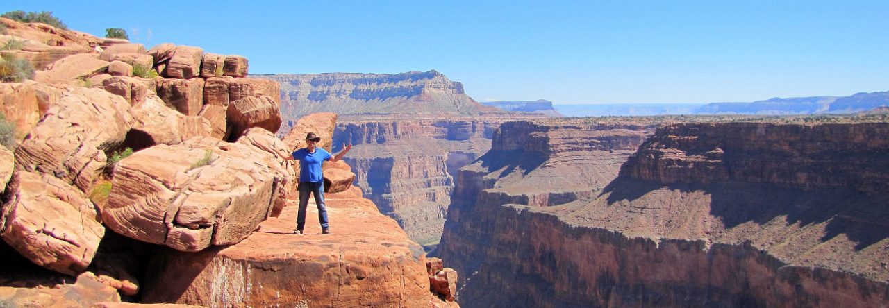
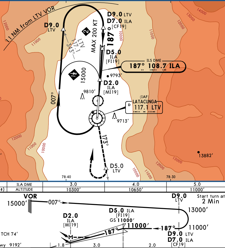
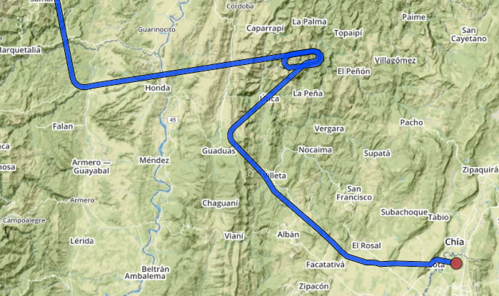
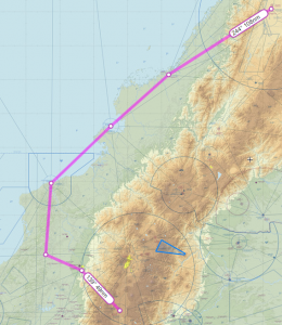 The straight route from Cali to Latacunga is 305 nm, via G675, however the MEAs are at FL180. Looking at Skew-T diagram it was obvious we would be in IMC and above freezing level, not a nice combination over the mountains. We instead opted to take longer route along the shore, via Tumaco and Esmeralda VORs, before heading East. Although longer (400 nm), that route allowed us to stay at 14,000 feet, below freezing level with balmy 6 degrees and also VMC for almost all the time. However, when close to AROTO, we had to climb to 16,000 for terrain and we got into clouds. The temperature was between 0 and +2 degree, so I primed and used TKS on low settings. Few miles before ORETA, we got switched to Quito approach and received vectors for the approach to Latacunga. One must admire the effort Ecuador put to provide radar coverage in between peaks of Andes, it was unexpected and very much welcomed. I had TAWS on the MFD and it was painting red in front of us even at 16,000. The zoom-in of the final segment shows why.
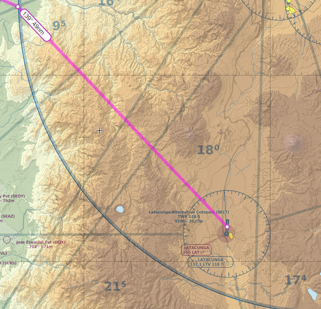
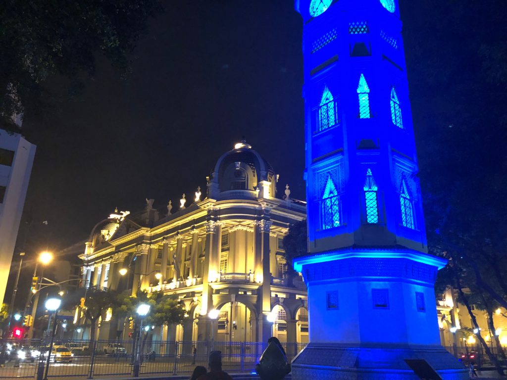
 The first day we visited the city with our friend Inès, starting with
  and the controller simply acknowledged and switched me to a new frequency. We eventually climbed to 14,000, which was the correct altitude according to hemispherical rules and were mostly VMC between layers, with occasional light turbulence in clouds. Later on, we had to climb to FL180, because MEA on the dogleg before Popayan was that high, a remainder that Andes are not far. Michael was first and he reported that at that altitude he was in IMC and picking up ice very fast, John had FIKI on, so I requested and got FL200 to remain on top. We arrived to Popayan VOR at FL200 and the airport is at 5,600.
 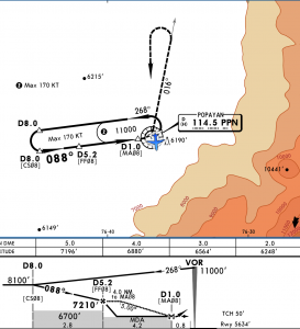 The VOR Y approach is designed to facilitate arrivals, because you can descend in hold. I did one turn in hold and when Michael landed, I requested and got a descent to 16,000. Few minutes later John went missed, because he arrived over the airport at 11,000 in IMC. At that time, I was close to 8 DME west of PPN and could see the ground through a large hole. Bases were about 9,000 and with airport at 5,600, there was more than enough clearance, so I cancelled IFR, spiraled down to 12,000 and went visual to the airport.
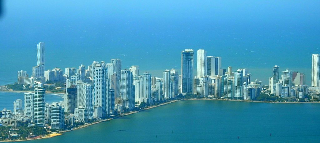
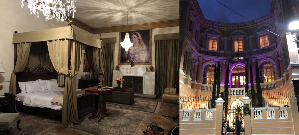
 We spent 2 days, 3 nights in Panama City, staying in
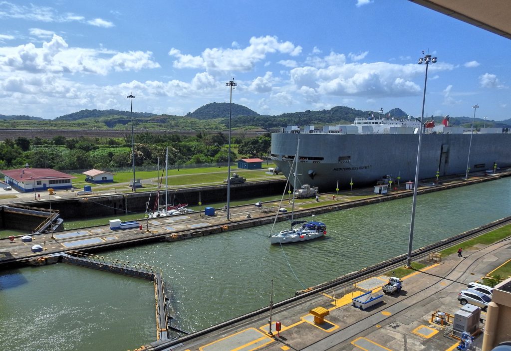
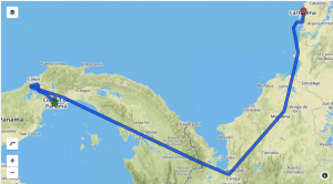 Departing Gelabert, we requested the canal overflight and we flew West toward Lake Gatun. Unfortunately, it was too hazy to take great pictures. It was an easy 2.5 hour flight to Cartagena and as usual we were staggered at altitude: Michael the highest at 17,000, I started at 11,000, but climbed to 15,000 and John staying at 11,000. Since not many people fly at those altitudes over here, ATC is usually quite accommodating.
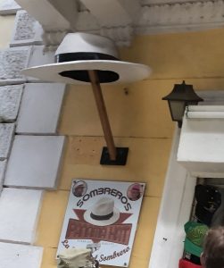
 Oaxaca is beautiful town, we didn’t have much time to visit, but we were lucky to be there for the
 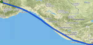 The flight to San Salvador, Ilipango airport was uneventful, but we started to hear unfamiliar ATC facility names. Merida Center, Sandino Approach as we overflew Managua, Nicaragua and finally Salvador Control. We were IFR, because it makes border crossing much easier, but upon arrival to Ilipango, I cancelled and entered on extended left base to runway 33. The approach took us over a beautiful lake, but the runway is in mediocre shape and in spite of textbook landing, I got bad nose shimmy. It couldn’t be bad technique, could it? It must have been bad runway.
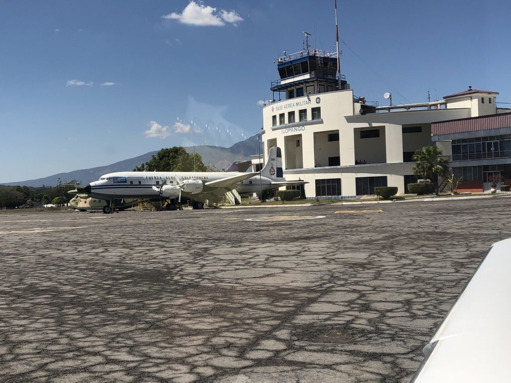
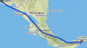 The last leg took us from Ilipango to Gelabert airport in Panama City. Salvador Control handed us to Coco Control, but not before giving us an option of either rerouting, which would add 40 nm, or climbing to 15000 feet. At this point, the fuel totalizer was showing 18 gallons remaining at the destination, which was very close to my hard limit (16 gallons). We had about 25 knots left quartering headwind, so I elected to climb, not wanting to add any more distance, and hoping that the wind would turn counter-clockwise with altitude, as forecasts were saying. Plus, of course, we are more efficient higher up. The wind did turn, after leveling off at 15000, I pulled the power back to 15 gph and the totalizer was now showing 24 gallons at the destination.