
This is the first blog entry describing our flying in New Zealand. The second part contains practical information for pilots, such as license validation and differences compared to flying in the US.
I was invited to a CPPP (Cirrus Pilots Proficiency Program) in November 2024 in Port Macquarie, Australia, to give a series of Cirrus Perspective training courses. It is a long flight from San Francisco, so we decided to stay a little longer and visit. While flying in Australia was tempting, New Zealand was on my bucket list for a long time, so we decided to head there. An obvious choice was to sign up for one of the Flyinn trips. They are based in Wanaka on the South Islands and offer three itineraries, 8, 11, or 19 days. Choosing that option would relieve me of many PIC responsibilities, but this is precisely what I find interesting in flying in different countries. Learning how they do things differently, airspace, radio phraseology, dealing with weather and countless other PIC tasks. It would also mean that we would always have another pilot in the cockpit, with my wife relegated to the back seat. Finally, while the itineraries are very well selected, I prefer to make my own choices. All that led me to choose a truly self-flying option.

Tauranga

The Tauranga Aero Club offers a well-equipped Cessna 172 for hire and handles license validation. ZK-TAI that we flew had a 180 hp engine, Garmin GTN750, G500TXi, and KAP140 autopilot. We arrived in Tauranga on a Monday, and on Tuesday afternoon, I had in my hands a validated New Zealand pilot license. Our original plan was to arrive there on Monday afternoon and launch for our trip on Thursday, but a weather system would make flights difficult on Thursday. The Aero Club graciously accommodated our schedule change request, and we were able to launch on Wednesday, ahead of the system.
Tauranga is a small town. We stayed in the Hotel on Devonport, which had convenient accommodations. We quickly learned that there wasn’t much to do, particularly on Mondays, our first day there; all the restaurants were closed, and the town was deserted. We finally found a pedestrian street with a couple of Chinese restaurants open, saving us from starving in the evening.
The first day showed already the need for flexibility when flying around in a light airplane. Our original plan was to fly to Nelson and spend a day there visiting Abel Tasman National Park. It was clear that if we did that, we would be stuck in Nelson for more than a couple of days and sailing in rain is not my idea of fun. I decided to head all the way down to Wanaka, which was our base on the South Island, to visit the area. It is a 530 nm straight line distance from Tauranga to Wanaka, fine in an SR22 but stretching both mechanical and biological limits in a 172. We needed a fuel stop in between.
Omaka is a grass-only aerodrome in the Marlborough region and home to a famous aviation museum. We launched for Omaka on Wednesday morning in fair weather and cumulus scattered layer between 4000 and 7000 feet. In a Cirrus, I would go on top without further thought, but in a 172, I decided to stay below, concerned that tops would rise higher. We flew West of Mount Ruapehu, a 9000′ volcano shrouded in clouds, and then had to navigate the military area around Ohaeka. I called Ohakea approach and requested “controlled VFR”, which is similar to flight following, and they cleared me through all of that at 4000. I was expecting a handoff to the Wellington approach, but they dropped me as soon as I cleared their airspace. Since I couldn’t go higher due to the clouds, we dropped below 2500 to cross the Cook Strait to the South Island. I should have requested “radar monitoring” for the crossing, where at least they look at you while you are below the controlled airspace. Approaching Omaka, I descended to 1500 to follow a transit route through Woodbourne class D.

Omaka has three intersecting grass runways, and only some have runway markings. When I dutifully arrived at 1500 over the field for an overhead joint, after making a couple of turns to figure out the wind, I became disoriented about which runway was which, so I continued to turn around. That didn’t help, and a pilot on the ground who wanted to depart asked, “TAI, are you planning to land?” To which I replied, “Sure, as soon as I figure out how.”

The aviation museum in Omaka is amazing and worth the visit. Many of the airplanes on display came from the collection of Peter Jackson, the director of Lord of the Rings. The museum also has exhibits from World War I and World War II. We didn’t have time for both, so we chose the first one. After a quick lunch at the cafeteria, we launched for the second leg to Wanaka.
Wanaka
The weather on the East Coast was broken and overcast, so I elected to follow the West Coast. The mountains were covered in broken cumulus layers, and we could only glimpse Mt Cook, the highest mountain in New Zealand, 12,200 feet. I started to be concerned about how we would cross the mountains towards Wanaka, but we found a path between clouds and mountains, followed a valley, and the Haast Pass to Lake Wanaka. New Zealand VNC charts have a very useful feature, where mountain passes are annotated with altitude, making flight planning easier in a low power aircraft.

We landed in Wanaka and left the airplane with Twenty24 for 50 hours of maintenance; it was due for an oil change. This worked great because the weather was supposed to be unflyable for the next couple of days, with low ceilings and high winds, and the airplane was safely tucked in a hangar. Wanaka Car Rental left a car for us at the airport, with the keys on a tire, and we drove to our Airbnb. We originally had a reservation at the Moorings Hotel, but we had to change it after we changed our travel dates.
The next day, Thursday, it was indeed cloudy, and we drove for about an hour to Queenstown. After a short visit to this beautiful but quite touristy city, we signed up for Shotover River Jet Boats. It is a fun ride in a river canyon, blasting at 60 miles an hour a couple of feet from canyon walls. We got splashed a little, just enough to whet our appetites for lunch at Gibston Winery. The weather improved slightly on Friday, but not enough for sightseeing flights. We drove around lakes Wanaka and Hawea, walked by the famous Wanaka Willow tree, and visited Rippon Winery. In the afternoon, we signed up for another jet boat tour with Lake Land Wanaka on the Clutha River.

At last, Saturday brought some clearing weather. We drove to the airport and took off for a sightseeing flight of the Doubtful Sound. I flew over Lake Dunstan and into Nevis River valley, but the ceiling became overcast and lowering and I had to do a 180 back. Instead, we overflew Lake Wanaka and through “The Neck” over Lake Hawea.


Wanaka has great restaurants. We had a fabulous steak dinner at Tititea, an eclectic chef surprise menu at Kika, and amazing views of the mountains and the lake, together with great wine at Bistro Gentil.
Sunday was a great day. The weather cleared, and the lake was beautiful, with the mountains in the background. I hired a local flight instructor for a day of flying around. While I felt comfortable flying in the mountains, I wanted him to show me the best sightseeing spots. We flew around Mt Aspiring towards the coast, and I accepted the challenge to land at a cute, short 1300-foot airstrip at Neils Beach. It took me three go-arounds, being too fast or too high, before finally making it.

The short field takeoff distance of 172 at max gross and 20°C on a paved runway is 860 feet, and the 50-foot obstacle distance is 1470. We were not at max gross, but the “paved” adjective shouldn’t be taken literally for that strip. There was a small mound at the end of the strip, which certainly wasn’t 50 feet high because we did clear it using a modified short field technique: rolling takeoff due to gravel, flaps initially up to minimize drag, and I dropped 10° flaps when close to the rotation speed.
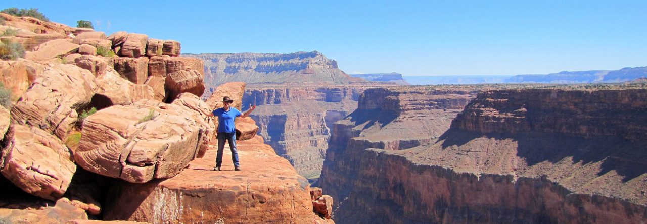
From Neils Beach, we followed the coast to St Anne Point, which is the entrance to Milford Sound. It is impossible to describe how impressive the flight into Milford Sound is; the canyon’s vertical walls drop into the blue waters of the Tasman Sea. Luckily, the video camera attached to the wing worked and captured that flight. We landed at the airport and walked 10 minutes to a marina to board a small cruise ship. We wanted to see the sound from the sea level as well. These cruises are relatively short, only about 1.5 hours, and we returned to the airport for the flight back.
When planning our trip, we considered doing another cruise at Doubtful Sound, landing at the Te Anau Manapouri airport. That, however, would be a full-day affair with buses and boats. Instead, we settled on the overflight of Doubtful Sound on the way back to Wanaka. While less impressive than Milford Sound, Doubtful Sound is worth visiting, and I was happy we could see it from the air. We continued over Lake Wakatipu, which has great views of Queenstown.

Nelson
This was the end of the South part, and on Monday, we took off from Wanaka for Nelson, in the North part of the South Island. Crossing the mountains, we had fantastic views of Mt Cook, and the Cessna climbed smartly to 7500, which was sufficient to cross back to the West Coast via Lake Tekapo and Sealy Pass. I had enough fuel, but we had plenty of time, and I decided to land in Hokitika to top it off just in case and to stretch the legs. That was a fortuitous decision because we found out later when departing Nelson that the fuel pump over there was broken.

Nelson is a mid-size airport with commercial service, but GA parking is on the grass. The concept of FBO doesn’t exist in New Zealand, and if you expect a Signature-like well-equipped lobby with coffee, vending machines, and rental cars, you will be disappointed. I chose a rental car company that was a quarter-mile from the parking area. I left the airport through a simple pedestrian gate, picked up a car, and drove to the town.
We were staying at Tides Hotel in downtown and left to find a restaurant for dinner, forgetting that this was again Monday. At 6 pm, the town was deserted, and everything was closed. After half an hour of walking, I suddenly saw a human being walking half a mile away. Not everybody was dead, after all! We still managed to find a funky dinner place at Boat Shed Café.

The next day, we drove for an hour to Kaiteriteri Beach and boarded a catamaran for a full-day cruise in the Abel Tasman National Park, all the way to Towers Bay and the famous Split Apple Rock. We were again lucky with the weather. The morning was warm and sunny, but clouds came over in the late afternoon. That made us pleasantly hungry for an excellent dinner at Hopgods.
Wellington
Our original plan was to fly from Nelson to Blenheim and then continue to Wellington, but due to the advanced start of our trip, our reservations at the Hotel d’Urville in Blenheim were for two days later, and the hotel didn’t have availability earlier. Instead, we decided to brave the crossing of the Cook Strait four times instead of two and flew to Wellington.

Wellington is the capital of New Zealand, and the airport has commercial traffic. A US pilot would expect a nicely equipped and expensive FBO, but Wellington doesn’t even have any GA parking. I called the Wellington Aero Club a day ahead, and they graciously offered to put our Cessna in their hangar. If you google wind in Wellington, you will find entries such as:
Because of its location in the Roaring Forties and its exposure to the winds blowing through Cook Strait, Wellington is the world’s windiest city, with an average wind speed of 17 mph.
The Kiwi capital is extremely windy. It’s not just reputation. Some days, especially in October, you might have problems walking on the street.
It wasn’t that bad when I was landing; the wind was 20G32 at 20° from the runway, and I managed a decent touchdown. I was happy to leave the Cessna in the hangar, though. The pilots at the Aero Club were great. They first pulled a bunch of other airplanes from the hangar to make space for our TAI, and we chatted about flying in New Zealand and the United States.
In Wellington, we booked the Naumi Hotel downtown, right on Cuba Street, which has plenty of restaurants. We got a large, beautifully equipped room on one of the top floors, with glass walls on two sides. After an authentic Italian lunch, we went for a walk on Cuba Street, and Ania did some shopping. We had a great dinner at a nearby Turkish restaurant.

The next day, we took Uber to the cable car and walked down to the town via the botanical garden. In the afternoon, we drove to Weta Workshop, which is famous for making props, costumes, and creatures for many films, including Lord of the Rings, Chronicles of Narnia, King Kong, and Avatar.
Blenheim
On Thursday, we jumped into our Cessna and flew from Wellington back to Blenheim, landing at the Omaka airport again, this time with much less confusion. There is no Uber in Blenheim, but there are two taxi companies; they picked us up at the airport and drove us to the Hotel d’Urville. In the afternoon, we went for a walk in town and found a great wine-tasting place, Fidelio Café and Wine Bar, located in an old train station. Next to it, there was a Visitor Center, and we booked a wine-tasting tour for the next day.

I wasn’t particularly impressed with wines in the Otago region, so I was a bit apprehensive about the Marlborough District, particularly since it is known for its Sauvignon Blanc, which isn’t my favorite grape. The short version is that I was wrong. We visited Lawson Dry Hills, tasting their unexpectedly interesting Sauvignon Blanc, Clos Saint Clair where we had lunch, No 1 Family Estate and their champagne methode traditionelle, Gibson Bridge Vineyard and their outstanding Pinot Gris. It was good that our guide was driving the car; otherwise, we probably wouldn’t find our way back to the hotel.


This was our last flying stop, and it was time to return to Tauranga. We crossed Cook Strait one last time and followed the coast before veering inland. Mount Ruapehu was again covered in clouds; we flew around it and along the west shore of Lake Taupo. Landing in Tauranga felt like returning home, probably more for ZK-TAI than for us, and we were sad to say goodbye to the little Cessna, who took care of us during that time.
A short hop aboard a New Zealand Air flight brought us to Auckland, where we stayed overnight and then flew back to Sydney in the evening.


