It’s been a long, long time since I flew in a glider so while driving through French Alps towards Mediterranean, it occurred to me that this would be the perfect place and time to remind myself what the joy of soaring is all about.
There are many soaring places in the mountains and I reached out to a friend who helped me identify a few: Saint-Crepin, Sisteron, Gap, Vinon, Fayence. After couple of phone calls, I had an appointment at Aeroclub Alpin in Gap for a 45 minutes discovery flight.
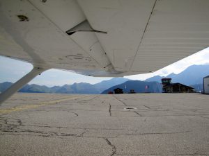
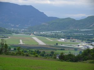 The Gap-Tallard airport turned out to be a pretty busy place with one main runway 03/21 (3,100 feet), a “mini” runway 03/21 (1,450 feet) and a grass runway 03/21 (2,300 feet). In one description I read that everything that flies is present there, or almost and I found it to be true. Upon arrival, we had lunch in a very busy airport restaurant and than I walked to the club for my glider ride.
Since it’s been a while since my last glider flight, I didn’t know local terrain nor how one operates at this airport, I hired an experienced pilot and instructor in the back seat to help me get back into the saddle. The first surprise was how they towed the aircraft for the launch by simply attaching it behind a truck. With a wheel dolly attached under one wing, there was no need for any additional help. After a quick preflight, we were ready for our flight in a Grob-103, a glider I am very familiar with.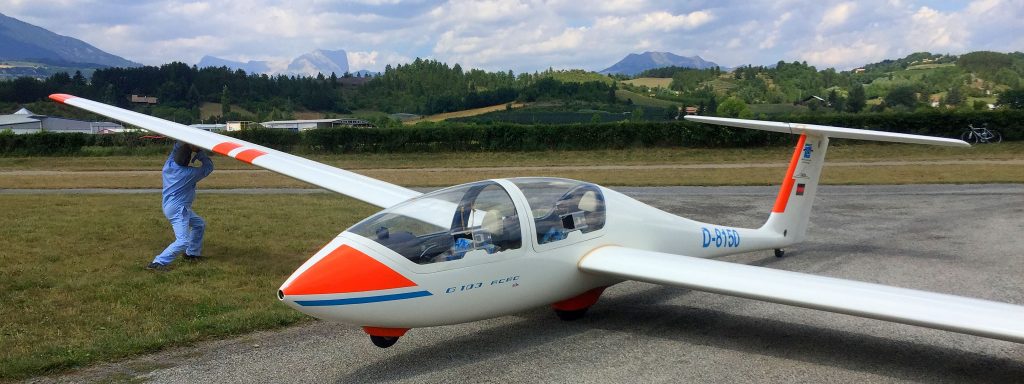
We launched from the runway 21 and detached from the tow plane at about 3,000 feet AGL. The goal was to reach a nearby mountain, about 10 miles away, shown with the arrow below.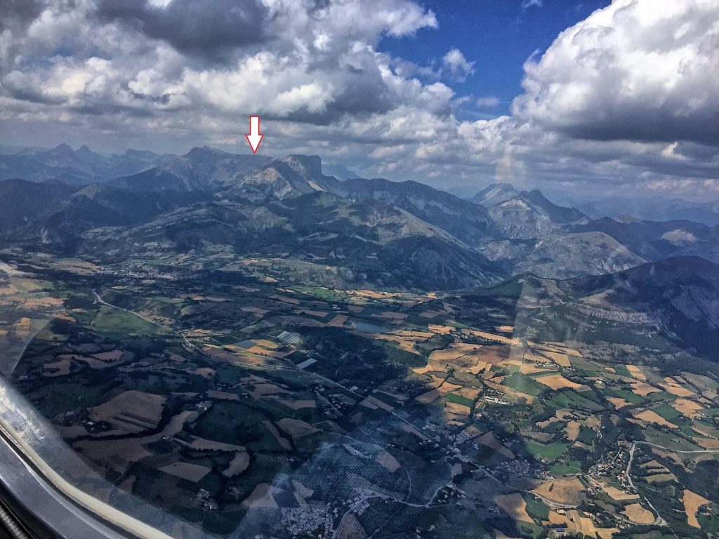
Ten miles doesn’t sound like much, but let’s not forget that a glider doesn’t have an engine and the only way to advance is to loose altitude, which altitude has to be first gained. There are several ways that a glider can climb, all using the fact that air moves up in certain places and if the glider happens to be there, it rises together with the air.
The most common technique, which we used that day was thermal soaring. It occurs when a column of air is heated near the surface and rises, typically until a cumulus cloud that caps the ascent. So off we went chasing one cumulus after another. Once you feel the lift and it is sometimes literally is a bump, which starts raising one wing or the whole aircraft, you enter a tight turn trying to circle within the thermal. That is easier said that done, since you can’t see that raising air, only a variometer (a sensitive vertical speed indicator used in gliders) shows if you are climbing or descending.
In addition to thermal soaring, we also tried ridge soaring, where you use the fact that wind blowing into a hill is deflected up by the terrain. For that, you have to be pretty close to the said ridge, hundred feet or less.
The instructor kept asking me how I was feeling. I forgot somewhat how tight the turns are in thermals and how long they last. The turns together with bumps made me a bit dizzy, but not enough to say anything else than a valiant “Great!”. He was so happy to finally fly with somebody who wasn’t airsick, that what supposed to be a 45 minutes flight turned out to be about three hours. He told me later that he often has to terminate discovery flights after 15 minutes.
That day it took us over an hour to get to our mountain, the gods of lift where making us work very hard. But when we finally got there, it was magical.
Here is where flying a glider is so much fun. You get to fly to much closer to terrain, you have an impression of wearing an aircraft instead of sitting in it, the noise is much less and different and you can never forget how far and how high you are.
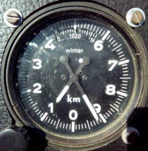 Speaking of height, it turns out that gliders in France use meters for height, while power planes use feet. In addition, the altimeter in this particular glider was inverted, with the zero at the bottom, so I first had to think what the arrows were really telling me and than convert it into feet, so that I know what it means. I thought that only French would be devious enough to invent such an instrument, but apparently this is used in gliders in other countries too.
If you never flew a glider, find the closest place that offers the training and get a glider license. In the Bay Area, you’ve got NCSA at the Byron airport, where I used to tow gliders a while back and Hollister Soaring Center. You will learn about flying from that and you will become a better pilot.