Emboldened by how simple it was to depart Popayán, we decided against using the handler in Cali. As Julia Roberts said in Pretty Woman: BIG MISTAKE. We drove to the terminal and started to run between offices. Remember, Cali is a big city (pop 2.4 million) with important airline traffic and we are talking about two large terminals.
- Flight plan office, where we got bunch of papers to fill, including General Declarations (gendec). I had mine, but Michael had to fill his.
- Operations office, where the said paid papers where copied several times and handed back to us.
- Immigration, located in international terminal. The immigration officer, who was sitting in a booth where they check your passport had no idea what to do with is. We didn’t have airline tickets, no charter papers. Eventually, he figured out that if he stamps all our papers sufficient number of times, we would go away, which indeed we did.
- Customs, downstairs in the international terminal. The officer actually knew what to do with us, filled in some additional paperwork, gave us more stamps and we walked away back to the domestic terminal.
- Police office, where a very nice police officer wrote a letter for us that we are requesting leaving Columbia, which we signed. She put a wrong date, perhaps still having in mind her Valentine day, which was the day before and which was scoffed at as a debutante mistake by subsequent officials. We also got some new stamps and left behind copies of gendec.
- A weird office at the ground floor with no clear purpose, which was closed and nobody was there. After 15 minutes a stately matron showed up, took one of our gendecs and stamped the remaining ones.
- Back to the operation office, where we paid $55 and got a receipt, with full name, address, phone number and email. As you can imagine, typing those for two airplanes took some time.
- Back to the flight plan office, where we filed flight plans, got a photo taken and that was it.
That was it for phase one, there was still phase two. We drove back to the Aeroclub, jumped into airplanes and taxied to the international terminal ramp. We parked there and waited. After couple of minutes a guard showed up, curious what we were doing there. He called a police officer, who showed after couple more minutes. Everybody conferred what to do with these unexpected visitors and eventually decided all four of us should go inside the international terminal, to the same place as in step 3. Unfortunately, in the meantime, the shift changed so a different immigration officer had the same bewildered look on her face, trying to figure out what to do with us. Eventually, she entered our passports into a database, we got the required stamps and passed through.
The most sad thing is that up to this point, all this running around and stamping was not serving any useful purpose. Nobody was checking anything, not even that we were pilots or have airplanes in Cali. This is what happens when bureaucracy runs amok.
After going through security check (good thing we left all our dangerous knives in the airplane) and explaining to security guards why we do not have boarding passes, we returned back to the airplane. Shortly after the narco-police came over with a dog. We unpacked all suitcases from the airplane, so that the dog could sniff them. He than jumped into baggage compartment to sniff there. Since the tarmac was quite hot and it was hurting his paws and the baggage compartment was in shade, he really didn’t see a reason to get out. I remembered a story of a friend who had a brand new Cirrus and a police dog who urinated on his seats. This fellow was however well behaved and after mandatory handshakes (with police officers, not dogs), all that troupe left and victory, we could take off. Oh, but not so soon. It turned out that they took our flight plans with them. Why would police need our flight plan, which curiously was in a single copy is inexplicable. Michael taxied to the gate and requested a copy, I didn’t want to shut down the engine and just left, I had it already entered in my iPad.
Ah, but that could have been a mistake. It turns out that you have to send back stamped flight plan and gendec to the handler who processed your entry into the country, who forwards them to the authorities so that the authorities know you left the country. The fact that the said exit was entered into dozens of forms and computer screens was obviously insufficient. Luckily, I took iPhone snapshots of both documents and could send them.
I suppose that after reading all this, I don’t have to convince you to take a handler when in Cali. All the people we interacted with were nice and were clearly doing something, it is just that the whole process is absurd.
We arrived at the airport at 8:30 am, we took off at 2 pm. This photo tells it all.
This systems employs dozens of people shuffling papers around and doing nothing useful. It also sustains handlers business, since nobody in his right mind would not use a handler in Cali, and if fact in most of Colombia airports. In fact, handling fees and various airport fees were substantially higher than what we budgeted. In the view of authorities, private airplane owners are rich people and each country goes out of its way to milk these cash cows as much as possible.
Here is the kicker. On our return flight from Ecuador, we stopped in Cali, I know that Einstein said that doing the same over again and expecting different result is the definition of insanity, but this time we did hire a handler. It isn’t a fair comparison, because it was what’s called a technical stop. We flew from Ecuador, took fuel, departed for Panama, so we didn’t really enter Colombia. The whole process, including bathroom stop, refuel and flight plans took 20 minutes.
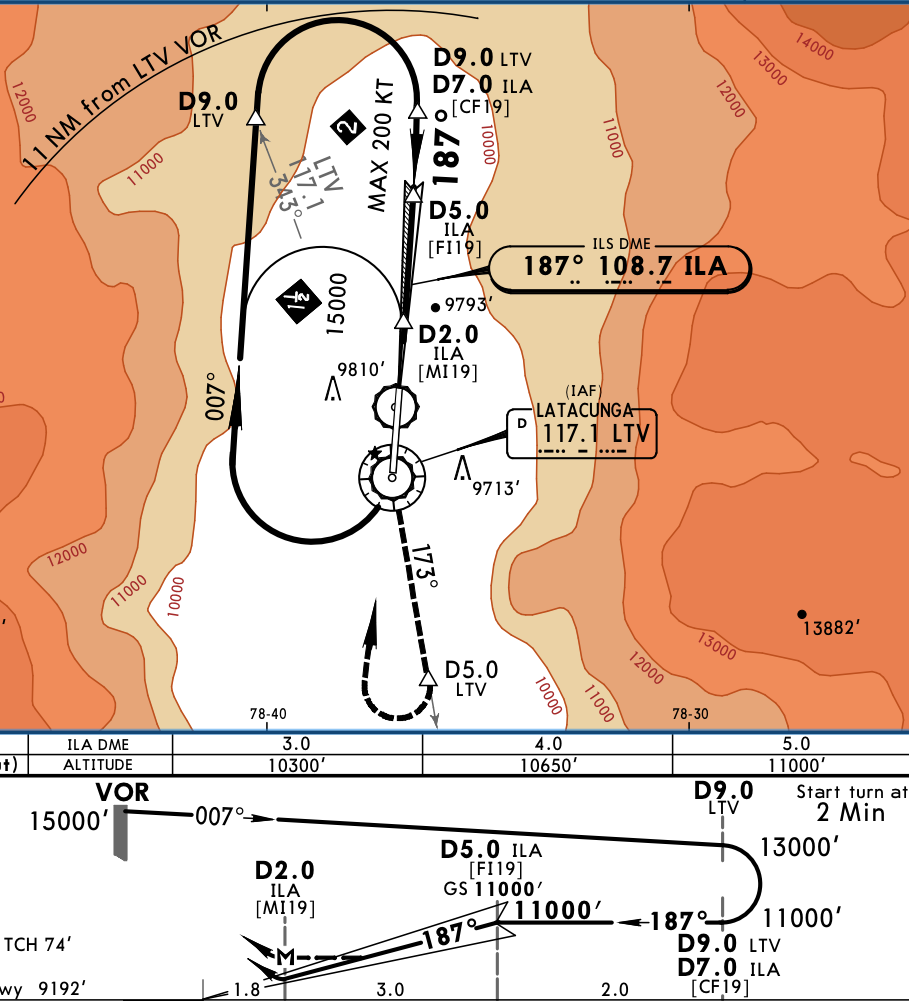
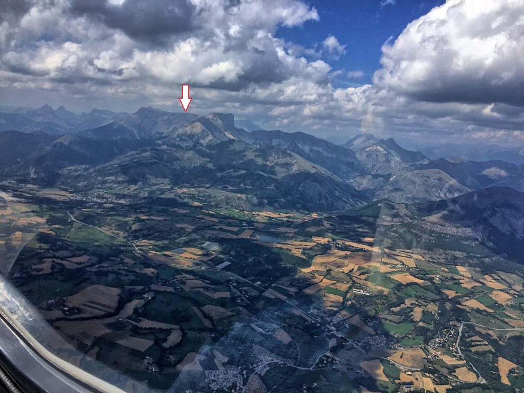
 The straight route from Cali to Latacunga is 305 nm, via G675, however the MEAs are at FL180. Looking at Skew-T diagram it was obvious we would be in IMC and above freezing level, not a nice combination over the mountains. We instead opted to take longer route along the shore, via Tumaco and Esmeralda VORs, before heading East. Although longer (400 nm), that route allowed us to stay at 14,000 feet, below freezing level with balmy 6 degrees and also VMC for almost all the time. However, when close to AROTO, we had to climb to 16,000 for terrain and we got into clouds. The temperature was between 0 and +2 degree, so I primed and used TKS on low settings. Few miles before ORETA, we got switched to Quito approach and received vectors for the approach to Latacunga. One must admire the effort Ecuador put to provide radar coverage in between peaks of Andes, it was unexpected and very much welcomed. I had TAWS on the MFD and it was painting red in front of us even at 16,000. The zoom-in of the final segment shows why.
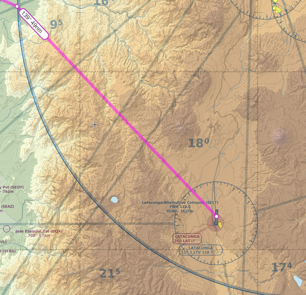
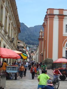 The first day we visited the city with our friend Inès, starting with
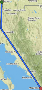
  and the controller simply acknowledged and switched me to a new frequency. We eventually climbed to 14,000, which was the correct altitude according to hemispherical rules and were mostly VMC between layers, with occasional light turbulence in clouds. Later on, we had to climb to FL180, because MEA on the dogleg before Popayan was that high, a remainder that Andes are not far. Michael was first and he reported that at that altitude he was in IMC and picking up ice very fast, John had FIKI on, so I requested and got FL200 to remain on top. We arrived to Popayan VOR at FL200 and the airport is at 5,600.
 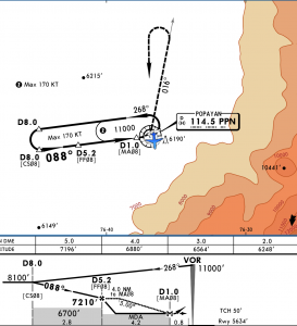 The VOR Y approach is designed to facilitate arrivals, because you can descend in hold. I did one turn in hold and when Michael landed, I requested and got a descent to 16,000. Few minutes later John went missed, because he arrived over the airport at 11,000 in IMC. At that time, I was close to 8 DME west of PPN and could see the ground through a large hole. Bases were about 9,000 and with airport at 5,600, there was more than enough clearance, so I cancelled IFR, spiraled down to 12,000 and went visual to the airport.
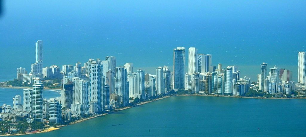
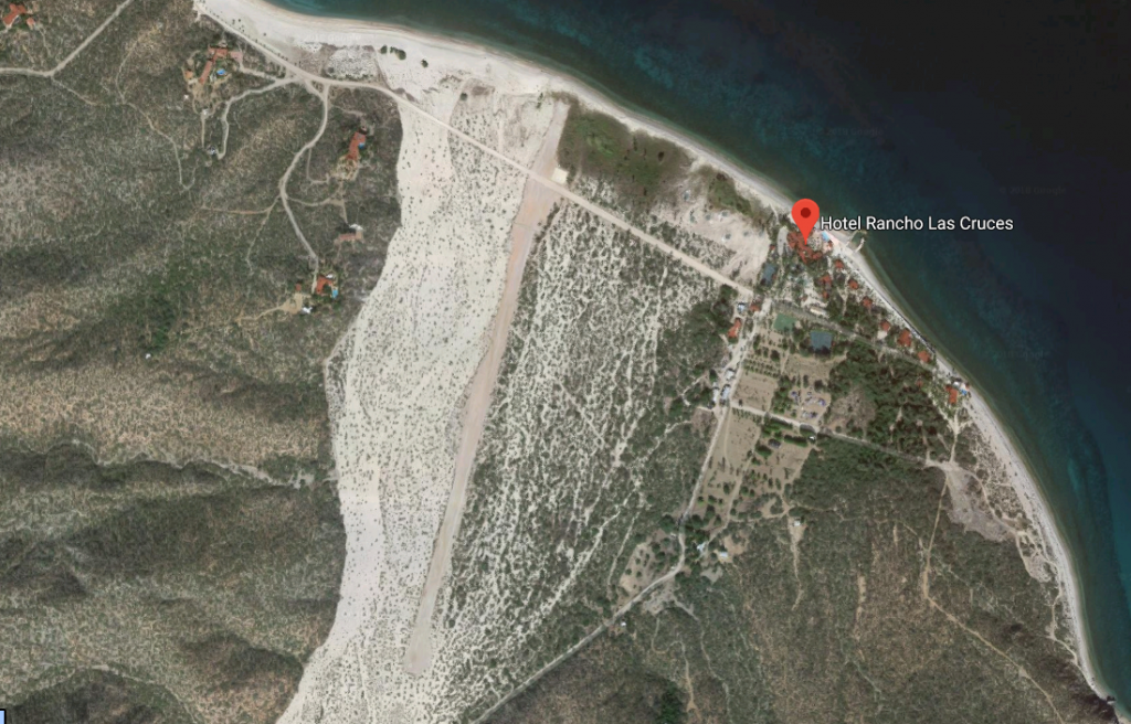
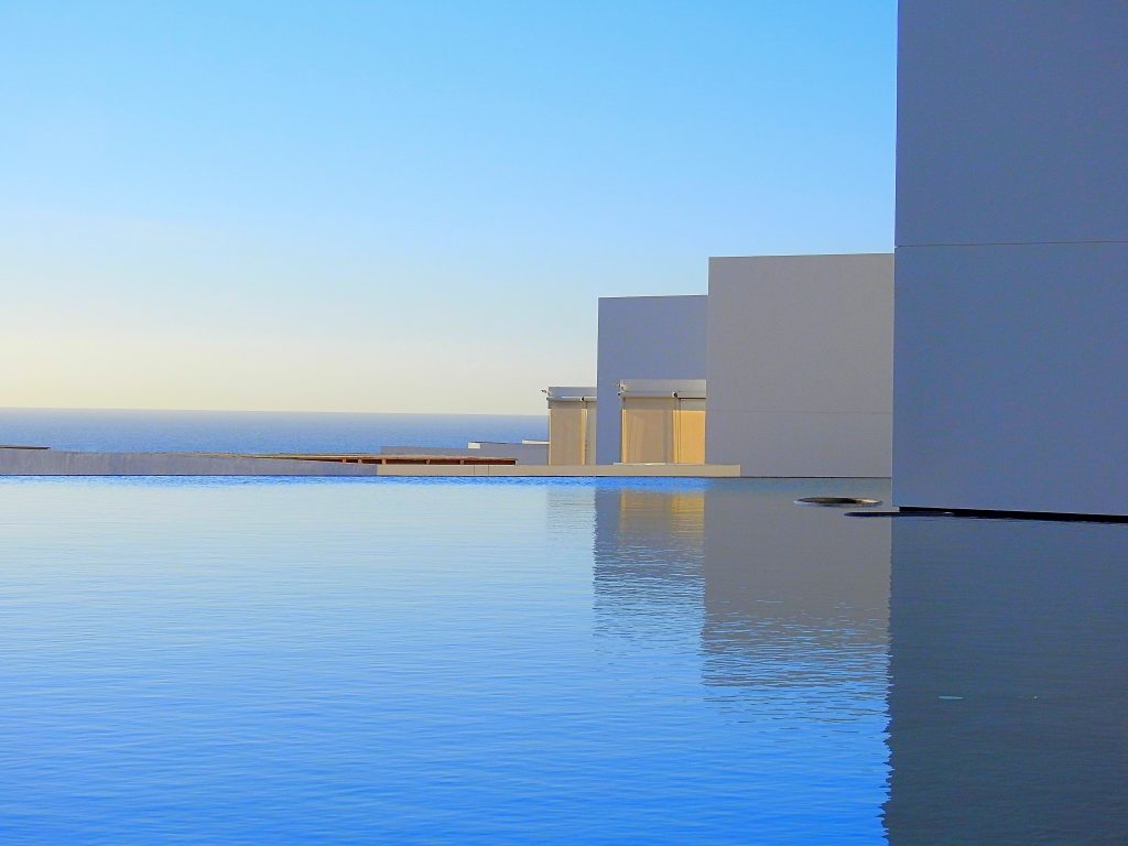
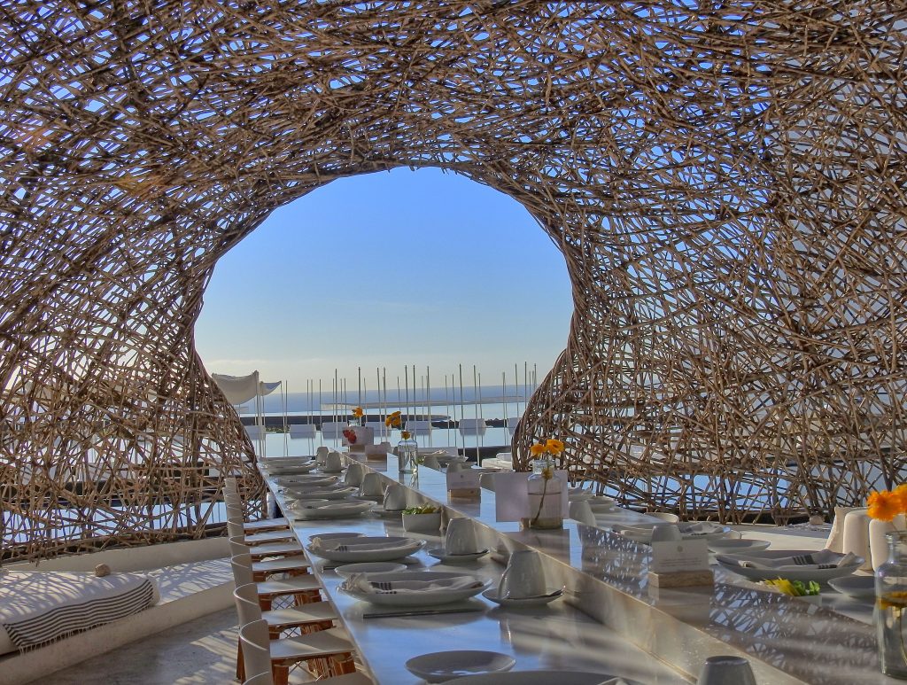
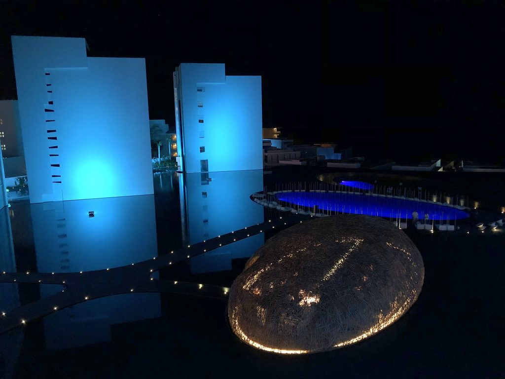
 We spent 2 days, 3 nights in Panama City, staying in
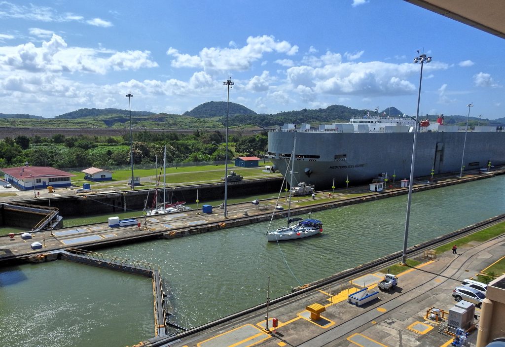
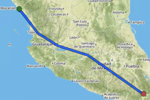
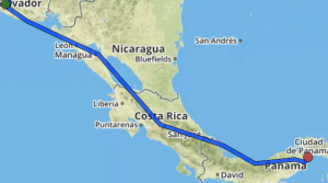
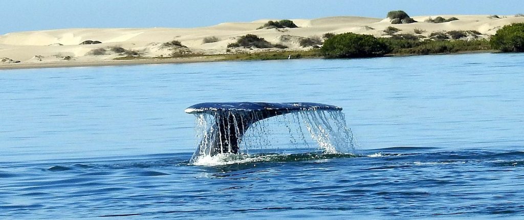
 Departing Gelabert, we requested the canal overflight and we flew West toward Lake Gatun. Unfortunately, it was too hazy to take great pictures. It was an easy 2.5 hour flight to Cartagena and as usual we were staggered at altitude: Michael the highest at 17,000, I started at 11,000, but climbed to 15,000 and John staying at 11,000. Since not many people fly at those altitudes over here, ATC is usually quite accommodating.
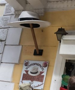
 Oaxaca is beautiful town, we didn’t have much time to visit, but we were lucky to be there for the
 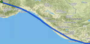 The flight to San Salvador, Ilipango airport was uneventful, but we started to hear unfamiliar ATC facility names. Merida Center, Sandino Approach as we overflew Managua, Nicaragua and finally Salvador Control. We were IFR, because it makes border crossing much easier, but upon arrival to Ilipango, I cancelled and entered on extended left base to runway 33. The approach took us over a beautiful lake, but the runway is in mediocre shape and in spite of textbook landing, I got bad nose shimmy. It couldn’t be bad technique, could it? It must have been bad runway.
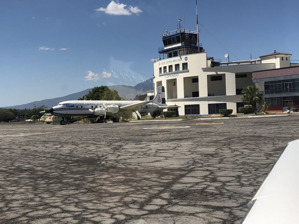
 The last leg took us from Ilipango to Gelabert airport in Panama City. Salvador Control handed us to Coco Control, but not before giving us an option of either rerouting, which would add 40 nm, or climbing to 15000 feet. At this point, the fuel totalizer was showing 18 gallons remaining at the destination, which was very close to my hard limit (16 gallons). We had about 25 knots left quartering headwind, so I elected to climb, not wanting to add any more distance, and hoping that the wind would turn counter-clockwise with altitude, as forecasts were saying. Plus, of course, we are more efficient higher up. The wind did turn, after leveling off at 15000, I pulled the power back to 15 gph and the totalizer was now showing 24 gallons at the destination.
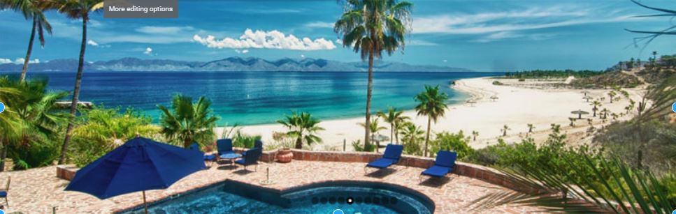
 The Gap-Tallard airport turned out to be a pretty busy place with one main runway 03/21 (3,100 feet), a “mini” runway 03/21 (1,450 feet) and a grass runway 03/21 (2,300 feet). In one description I read that everything that flies is present there, or almost and I found it to be true. Upon arrival, we had lunch in a very busy airport restaurant and than I walked to the club for my glider ride.
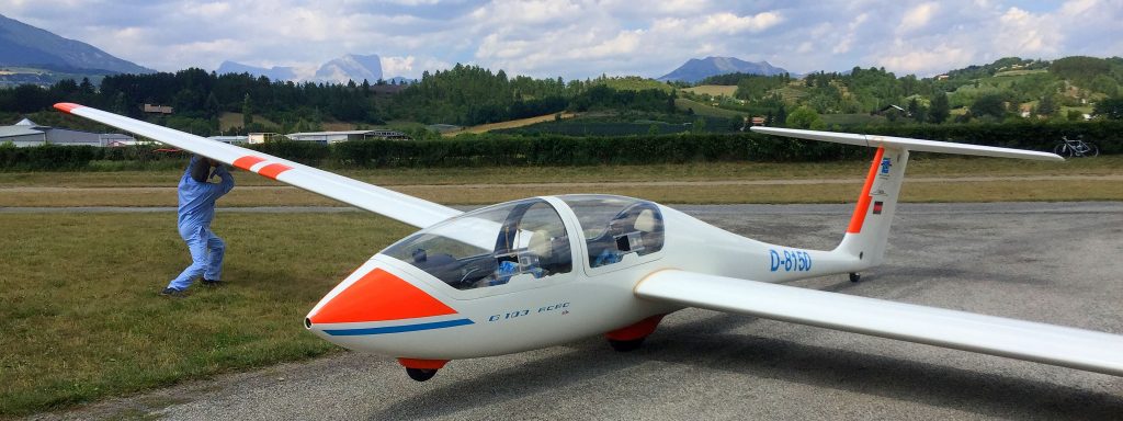
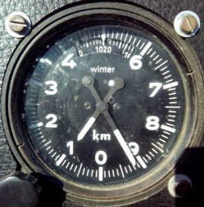 Speaking of height, it turns out that gliders in France use meters for height, while power planes use feet. In addition, the altimeter in this particular glider was inverted, with the zero at the bottom, so I first had to think what the arrows were really telling me and than convert it into feet, so that I know what it means. I thought that only French would be devious enough to invent such an instrument, but apparently this is used in gliders in other countries too.