I flew in South Africa, Zimbabwe, Botswana, Mozambique, Tanzania, Rwanda and Kenya. This isn’t perhaps a terribly vast experience, but if you contemplate flying there, you might find the following observations useful.
It is vast, it is beautiful and it is remote. Africa total area represents 20% of Earth landmass but only 16% of Earth population and you could fit there US three times over. You have to plan flights accordingly with respect to fuel and survival equipment.
General aviation is incredibly bureaucratic and you need permits for each country, sometimes for individual airports. You should plan to secure those permits well ahead of time, preferably using local resources.
It is very useful to have somebody in a “back office” tracking your progress and being able to help with permits, flight plans, aircraft parts while located in a place with good internet and good access to parts, mechanics and information.
Plan for minimum of two hours for each stop at each airport. You may get lucky, but this is a reasonable estimate to file flight plans, pay landing fees and any other required fees, pass security checks or, if required, immigration and customs.
You will get frustrated and perhaps angry at the absurdity and slowness of the processing at different airports, at having to haul you luggage thru x-ray machines, at having to file paper flight plans, at the interminable waits. Plan for that and don’t let it spoil the adventure.
Don’t sweat about ATC, airspaces, prohibited, military or restricted areas. If you manage to talk to ATC, great, but if not, that’s fine too. Different airspaces exist on paper, but with the exception of few really large international commercial airports, nobody will pay any attention if you fly through them.
Always call ahead to the next airport to verify they have fuel and how much. If there is fuel, top it off and top off you jerrycans if you have them. You never know when you will need it.
Bring cash in US dollars, I take $300/airport. Credit cards machines are often “broken” and you will need to pay for fuel and for the fees in cash. Make sure you have survival equipment, PLB, satellite messenger or phone. While cell phone coverage at airports is usually quite good, you can’t count on that.
Print sufficient number of copies of general declaration with your basic data, so you only need to fill departure and destination. At many airports they don’t have blank copies, but they still require that you give them gendecs.
Know how to fill ICAO flight, including your equipment codes, how to put permit numbers, search and rescue requirements and estimates to FIR boundaries in remarks.
Keep the duct tape and basic tools handy.
Above all, be ready to adapt your plans as the circumstances change, keep your cool and you will have the most incredible flying adventure of the whole life. I was lucky to fly there twice, feel free to contact me if you have any questions.
This is the third part of our trip, we flew from South Africa, through Mozambique to Zanzibar and traversed Tanzania East to West. This part is about close encounters with mountain gorillas and chimpanzees, also flying without fuel cap and fuel exhaustion. We were a group of friends flying in four Cessna 182 and 206 airplanes.
We left Mbali Mbali Soroi lodge when it was still dark and witnessed sunrise while driving to the Seronera airstrip.
Serengeti at sunrise
After a short flight Mwanza, refueling, customs and immigration, this time without taking suitcases out of airplanes, we launched for Kisoro in Uganda. There are quite high mountains on the direct line, up to 14,000 feet and we decided to fly around them to the North, which was a fortunate decision, because about half an hour after departure we got into an area of low ceilings and rain with reduced visibility. Let’s just say it was marginal VFR, although I usually call something like that “African VFR”. At one point we seriously considered turning around, but Chris who was flying first called with an update that weather was improving further north and we continued.
Flight from Mwanza to Kisor
The solid red you see above, this is terrain higher than 7,000 feet. The African VFR happened about half way, so over relatively low terrain.
Bwindi Impenetrable National Park
Flying over Bwindi Impenetrable Park we could see the mountains we were to explore the next day. Landing in Kisoro was refreshingly simple, there was an immigration officer already waiting for us, he efficiently stamped our passport, we didn’t have to pay anything extra in spite of the fact that Kisoro is definitely not an Airport of Entry. There was no customs, so nobody checked our luggage. We boarded vans for an hour ride to Mutanda Lake Resort.
Lake Mutanda
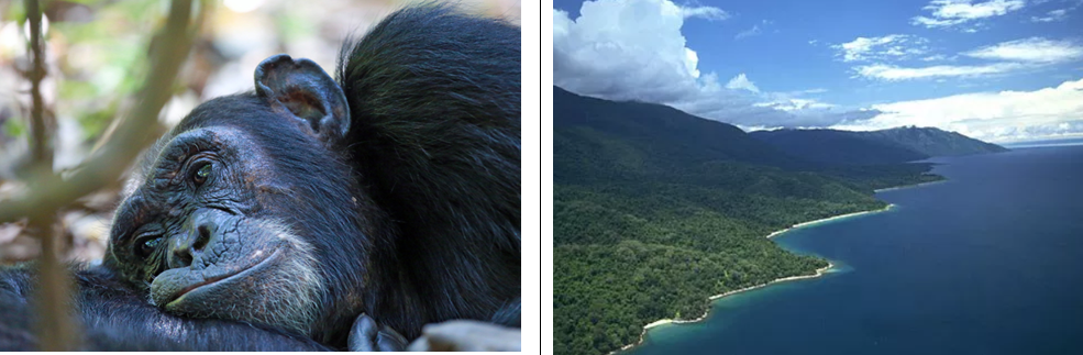
Mutanda Lake is beautiful, with little islands sparkling in water and mountains around. The resort not so much, it is one of those places where internet photos are heavily photo-shopped. The next day we drove another hour to enter the park for the gorilla trekking. After a briefing about what to do when in close proximity to gorillas, we got an option to hire porters. I had just a backpack, so we thought one porter would be sufficient, but we hired two to support the village. This turned out to be the best decision of the day. The trek involved descending and climbing over very steep slopes in the jungle, lasted six hours and at the end, we were all beyond exhausted.
This snapshot from iPhone Health app says it all. Porters helped us not only with the backpack, but by literally pulling us uphill and holding us during the descents. If you ever do this trek, make sure you have one porter per person. We did manage though to get very close to the apes, within 3-5 feet and we could observe them for about an hour. They didn’t pay much attention to us and kept eating leaves. The alpha-male silverback was impressively large, even when seated. The effort spent to get that close to them made the whole experience even more precious.
Close encounter – no zoom used in with this photo
We could barely walk next day, I was feeling muscles I didn’t even know I had, descending steep inclines makes you more sore next day than climbing, but we boarded the van again for a ride back to Kisoro airstrip. This time, customs was there and insisted on inspecting every piece of luggage, which was really driving me nuts. The field is at 6,200 feet and has a terrain rising to the south. We had between 10 and 15 knots of wind coming from the south, so we decided to takeoff in that direction, which turned out to be somewhat challenging. At Vx, I had an impression that the airplane is not climbing and that we will settle in the trees. Finally, we cleared the hills and flew back over the lake for some last-minute pictures. In hindsight, it would have been preferable to take off with tailwind. The flight to Kigali, capital of Rwanda was beautiful, in spite of strong headwinds.
Refueling from drums in Kigali
On arrival the approach controller was querying us in flight about our permit numbers, upset that we were coming from Kisoro and not from Mwanza, as if that was important, told us first to turn to a heading which would send us into a hill (unable), then told us to fly a DME arc (unable, we were VFR), then told us to hold and finally switched us to tower, who cleared Robert to land while an airliner was taxing onto the runway for takeoff in the opposite direction. Clearly, Kigali is not used to VFR and light airplanes and indeed they have no avgas. We refueled from drums, which we had shipped there ahead of time and this is when I found that my left wing fuel cap was gone, again.
Remember departure from Wonderboom and losing the same fuel cap? I will never know if I was distracted and angry by the ridiculous luggage inspection in Kisoro and didn’t properly secure the cap after checking fuel level or if the cap had a problem, since it was the same one we lost in FAWB. I decided to turn this into a positive event, by promising myself I will never allow myself to become excited and emotional prior to takeoff. A mental trick I use now is to visualize that fuel cap whenever I feel I might lose focus. Lack of fuel cap presented us with two problems. How to secure the left tank and how to get from Kigali to Tabora, our next refueling point? We were supposed to fly to Kigoma (180 nm), then to Mahale (84 nm) and only then to Tabora (194 nm), total distance of 460 nm with three takeoffs, too far on only the right tank.
Universal airplane repair tools
We resolved the first issue by the universal airplane repair tool: duct tape. While I wasn’t sure it would actually prevent fuel from leaking, there was only about 8 gallons left in the left tank and I was planning to only use the right tank. As to the second issue, when we were in Mwanza, we applied another universal rule for flying in Africa: when you see fuel, you take fuel and we filled four 20 liters jerrycans, just in case, without knowing it would become so useful so quickly. Twenty gallons in jerrycans combined with forty gallons in the right tank gave me an endurance of five hours, which was cutting it a bit too close with less than 30 minutes reserve. That problem was in turn resolved by stopping at a gas station in Kigoma and filling another twenty liter jerrycan with mogas. The 206 had a STC for mogas, but Marcus warned us to use the minimum necessary – in this case, we were only mixing 8 gallons of mogas with 40 gallons of avgas so I felt this was reasonable.
The flight from Kigali to Kigoma made us overfly Burundi. While we had overfly permits, we never managed to talk to Bujumbura Approach. Half over the country is covered by a TMA, so it was theoretically required, although it didn’t bother me at all we couldn’t. When arriving to Kigoma, I was trying to raise Kigoma tower on the radio. After landing, somebody finally replied asking why we didn’t call tower. I said we did, many times, on 118.4, frequency listed on Skydemon and Jeppesen charts, to which he replied “ah yes, we recently changed it 133.5”. Flying in Africa.
We stayed one night in Kigoma Hilltop Hotel, a comfortable but uninspiring hotel on the shore of Lake Tanganyika and after another security checks, launched for Mahale, one of the most stunning parks in Tanzania, with sand beaches, behind which rises a range of imposing mountains, clad in verdant tropical vegetation.
Resting and thinking
Mahale National Park is home to around 1,000 chimpanzees. Most significantly, one group of Mahale chimps – the Mimikire clan – has been habituated by researchers since 1965. Currently led by an impressive alpha male, Alofu, the M-group, as they are commonly known, has around 56 chimps. They go where they want and when they want but are relaxed near people, so it’s possible to track and observe them from very close quarters. For the good of the chimps’ health, all human visitors on chimpanzee safaris are required to wear surgical masks.
DCIM\100MEDIA\DJI_0234.JPG
We stayed in Mbali Mbali Mahale, an idyllic lodge with luxurious bungalows, great food and very attentive staff. The next day we went to see the chimpanzees and I could still feel my legs after the gorilla visit. This was however incomparably less strenuous and we got chimpanzees passing couple of feet from us – not paying much attention to what we were doing, which was really just taking as many pictures as possible. In the afternoon, part of the group went for fishing and caught our dinner, but we stayed at the lodge, just relaxing.
Our last day started very early, with breakfast at 6 am and departure from the hotel at 7 am for 1.5 hour boat ride to the airstrip and 2 hours flight to Tabora. My fuel consumption was as planned and we arrived with comfortable margin. This time, I filled both tanks, but failed to follow the universal Africa fuel rule: when you see fuel, you take fuel – we didn’t fill the jerrycans. I put a little square of hard plastic made from plastic water bottle over the opening in an attempt to isolate the duct tape from the fuel and covered it with tape. We went thru usual hassles of immigration, customs, paying the fees and filing the flight plans and launched for the 4 hours flight to Mombasa. I was the first and immediately after the takeoff we noticed fuel streaming from the left tank.
Applying duct tape with staff watching and the end resultAircraft “inspection”
I returned back to the airport and we attempted to put more duct tape over the wing. When satisfied with the result, we wanted to launch again, but the whole airport staff and a fire truck was there – the airport manager said he couldn’t let me go because the airplane was not safe. What followed was a ten minutes discussion, we were explaining that a Cessna 206 has two fuel selector position, left and right and even if we lost all fuel from the left tank, we still had enough to fly to our alternate, Arusha. Finally, he made me write and sign a release and agreed to let us go.
We couldn’t see fuel streaming on the second takeoff, so I hoped the tape would hold and it seemed it did for a while. Fuel gauge on the left tank was moving towards zero too fast, but then it stopped moving at a quarter tank. I set myself a limit – I was flying on the left tank and if I could delay switching to the right tank until 300 nm from the destination (about 3 hours with headwind we had), I would continue to Mombasa, otherwise I would divert to Arusha. Things were going on nicely, but then at 330 miles, engine stopped. That’s always an unpleasant event, but particularly when you are over middle of Tanzania with nothing but low brush below – lions and leopards are much less cute when observed from a crashed airplane. I was obviously spring-loaded for that situation, immediately switched to the right tank, fuel pump, and the engine restarted few very long seconds later. I now had dilemma – continue to the destination and land with couple gallons of fuel or divert to Arusha. In any normal country, it would be a simple call, but in Tanzania we already exited the country, Arusha is a domestic-only airport and I recalled experience of my friend John who declared emergency over Medellin, Colombia and was stuck there for four days resolving paperwork. I thought about it for couple of minutes, redid fuel calculations and announced on our air-to-air frequency that we were diverting to Arusha. My calculations showed that if reduce power and lean brutally, I most likely would made it to Mombasa, but with less than half an hour reserve and “most likely” together with “less than half an hour reserves” didn’t sit well with me. I didn’t have fuel totalizer. fuel flow indication was an analog gauge and I wasn’t 100% sure how accurate it was. I recalled another experience in Bogota, Colombia when I broke my one hour fuel reserve landing with 45 minutes and how I promised myself I would never do it again. Well, here I was again, what’s the point of making yourself promises and setting up limits before departure if you are not prepared to respect them?
All the others continued to Mombasa, they couldn’t help us in Arusha and in fact would have made the situation worse by having four, instead of one aircraft in an irregular situation. Approaching Arusha, I called Kilimanjaro Approach and explained that I had a fuel leak, I was diverting to Arusha to make a technical stop. After being cleared to land, we taxied to fuel and took 42 liters (11 gallons) into the right tank. I most likely would have made it to Mombasa, but most likely was not good enough. I went to the tower and explained the situation there, hoping they would let me leave on my existing flight plan. After few phone calls it became clear that they had no clue what to do with me, so finally they found a solution allowing them to get rid of the problem altogether. “This is a domestic airport, you are flying to Kenya, you need to receive the clearance from Kilimanjaro Approach”. Whatever was getting me back in the air was fine by me, so we back-taxied and took off. We called Kili Approach, who thought we were coming for landing at Kilimanjaro International, but I explained we were on the fight plan to Mombasa and they just requested we stayed at or below 5,500 when in the control zone.
When we left the CTR and I switched the frequency, we knew we were going to sleep in Mombasa that night. Soon we entered Kenya airspace and proceeded to the destination. The 30 minutes turnaround in Arusha will most likely remain a record hard to beat for years to come.
It was hard to believe this trip was now over. We flew 3,625 nautical miles in 34.4 hours Hobbs, landed at 19 airports in 6 countries and brought back 120 GBytes of pictures and videos. You can see the map on the right in more details on Google Maps.
This is the second part of our East Africa trip, after flying from South Africa through Mozambique, we now traversed Tanzania from Zanzibar to Lake Victoria. We were a group of friends flying in Cessna 182 and 206 aircrafts.
Dar es Salaam TMA (terminal control area) extends 100 nm around the city, from 1,500 AGL to FL245. TMA is controlled airspace and you should theoretically be in contact with ATC to enter it. Well, good luck raising anybody more than 20 nm from Dar. The CTR (control zone) extends 15 nm from the airport and it is generally frowned, even in Africa, to fly there without clearance. I finally managed to talk to a controller, who tried to send me 20 miles east of the airport, which would 10 miles offshore. After a bit of negotiation, we got that down to 10 nm, which I arbitrarily reduced to 8, on account of unreliable navigation instruments. We still had to fly over water, the island of Zanzibar is 18 nm from the shore, but at least we didn’t spend more time than the minimum necessary. That big red circle on the left side, that’s a prohibited area HTP6(E). We didn’t need to fly through it, but I wouldn’t think twice about it if I had to.
Zanzibar is an interesting place. It used to be an independent country, before it merged with Tanganyika to form Tanzania. There are still very strong feelings on the island against that union, as explained to us by a guide who took us on the walking tour of the Stone Town. It is indeed a mélange, Arab, Black, European, Indian all mix together. The city is falling apart, but you see some nice renovated building and above all, you see a peaceful coexistence of these many different cultures and religions. We stayed at Zanzibar Serena hotel, a colonial building from the time gone, but well preserved. We went to Africa House for sunset cocktails and walked the town narrow street avoiding motorcycles and bicycles. One day was not enough to get a real feeling of the town.
As much as we were happy to arrive to Zanzibar after our magneto and starter problems in Mozambique, departure was a different story. It took over two hours and literally tons of money to pay for the required permits and file flight plan. Tanzania general aviation infrastructure is abysmal, you pay exorbitant fees in cash, because the credit card machines are usually broken, it takes hours to process, computers are down, employees barely move, in summary it is an aviation hell. We finally left to fly towards Moshi and Arusha to see Mount Kilimanjaro, but the visibility was about ten miles and we could hardly see anything. Half way through, we took a decision to fly direct to our destination, Ngorongoro Crater with an airstrip that is at 7,800 feet on the rim of the crater. I cajoled our 206 to climb to 8,000 and later to 9,000, which she did very reluctantly. The approach and landing were spectacular, with the crater caldera below us at 5,000 feet.
Ngorongoro Crater TakeoffView from the hotel on the caldera and the crater rim
Ngorongoro Serena lodge is about 10 minutes from the airstrip. The hotel has amazing views on the crater, rooms are functional, each with tiny private balcony and the restaurant and bar remind a mountain resort. The next day we boarded safari cars for a game drive in the crater. It is hard to describe the combined effect of thousands of animals grazing around and crater rim looming above.
Ngorongoro caldera
We saw lions, leopards, hyenas, elephants, rhinos, zebras, buffaloes and antelopes. At one point, two hyenas attacked a wildbeest (gnu antelope), which was trying to escape. Hyenas are normally scavengers, but they also attack live animals, they have extremely powerful jaws, second only to crocodiles. They managed to bite the wildbeest on the side, but it looked like that hunt might take a long time, when suddenly we saw two lions coming over. The wildbeest run towards the cars, which at this point were converging from all directions, so that the tourists could witness the killing. It didn’t take lions more than a minute to finish the wildbeest and they started to eat it, with by now about two dozen cars around. While it was fascinating, in perhaps morbid sense to witness the killing in nature, I couldn’t shake the sense of disgust having all of us congregating around to see the spectacle. Don’t watch the video if you don’t want to see a killing.
Lions killing a wildbeest
The next day we visited a Masai village. Masai are usually nomads, but that tribe settled in the current location and allows tourists to visit and photograph their village, in exchange for a fee of course. The huts were extremely primitive, it was hard to imagine people living in such conditions. They had sandals made of used tires and colorful blankets to guard against cold. The village chief was a young 25 old guy, who spoke very good English. At one moment we said something in French and he replied in that language. After the visit, we drove again to the crater for more game watching.
Masai women
On Tuesday, we were planning to fly to Arusha, refuel, fly towards Mount Kilimanjaro and Lake Natron for sightseeing, but weather early in the morning was showing 2,000 overcast in Arusha, which soon turned into low level fog. Plan B was to fly directly to our next destination, Seronera airstrip about 60 miles away. We had enough fuel to reach it and to continue to our next fuel stop, Mwanza, but not enough for any sightseeing.
We thought that Seronera would be like Lumbo, no other airplanes around, but it turned out to be a very busy airstrip, with Coastal Air Cessna Caravans bringing in tourists to visit Serengeti. This was when we realized none of us had an idea what frequency to use to self-announce. On long final, a Caravan cut in front of me from left base and I had to do a 360 to let him land. After landing the pilot came to me and said he saw me on TCAS and he tried to talk to me. It turned out that uncontrolled fields in Tanzania use 118.2, which was something Marcus told us about in a pre-departure briefing, but we forgot.
Mbali Mbali Lodge In Serengeti
We were picked up by cars from Mbali Mbali Soroi lodge, our hotel for the following three nights. We had a picnic lunch and went for a game drive on the way to the lodge. The lodge is located on a hill, with amazing views on the valley below. The staff told us that during the time when Migration passes there, which usually happens late June, early July, you could literally sit on the chair and see thousands and thousands of animals passing by. We were a month late, unfortunately. If you are planning to visit Serengeti, make sure to choose a lodge which is close to where Migration is when you arrive. In our case, the animals were already in Kenya and we missed it. In spite of that setback, we did go for game drives both days and saw giraffes, elephants, zebras, buffaloes, antelopes, lions, leopards and hyenas. Many times, the animals were couple of feet from the car.
Leopards from really close
Departing Seronera for Mwanza, we showed at the airstrip with all our luggage and were told we had to go through security check. This is a problem everywhere in Africa, and if fact the same was the case in Central and South America. They just don’t understand there is something like private airplane and apply the same security checks as for commercial flights. I simply refused to follow their admonitions and loaded two of our four suitcases into the airplane bypassing the security checks. A guard grabbed however the remaining two, opened them and started to check the content. He found a hair spray and triumphantly told Ania: “you can’t take it with you to the cabin”, to which she had a brilliant reply: “oh, don’t worry, this is in the checked in luggage”. The guy was so stumped, that he only managed to say: “ah, ok then” and off we went. This exchange wins the first price for absurdity.
After an hour flight to Mwanza, which is located at the shore of Lake Victoria, where we refueled and went through immigration and customs, we departed for our next destination, Kisoro in Uganda.
This is the first part of our East Africa trip, travelling from Pretoria, South Africa to Zanzibar, Tanzania along the Mozambique Indian Ocean Coast to Tanzania. We were a group of friends flying in four Cessna 182 and 206 airplanes.
We arrived to Opikapi Guest House in Pretoria after a 9-hour flight from Istanbul. There isn’t much to see in Pretoria, but we still did a half day guided tour, visiting the center, Voortrekker monument, Nelson Mandela statute and Kruger house museum. The following day it was time to meet our airplanes. Marcus from Bushpilot Adventures proposed that I take a Cessna 206, instead of 182 originally planned and I agreed, but I forgot that a 206 has no door on the co-pilot side and the window doesn’t open. There is a door on the pilot side on the left and a big one on the right side in the back for passengers. Ania didn’t like that arrangement at all, so I ended flying the whole trip from the right seat.
A test flight didn’t start well. Unlike smaller 172 or 182, it is pretty much impossible to reach the fuel cap without climbing on the wing, so Marcus checked the fuel. He is the owner of Bushpilot Adventures from whom we rented the airplanes. Right after the takeoff we had a plume of avgas streaming from the left wing and we returned immediately back for landing. Airport truck found the missing cap on the runway and the second pattern was uneventful, except this being my very first landing in a 206, I managed to pancake it on the runway like a pre-solo student, which was made worse by Chris, who went with us for a ride watching it all from the back seat. A timeless lesson out of that: when you have two pilots, you have to be twice as vigilant, I was a PIC and I should have checked that the fuel cap was secure.
Wonderboom to Maputo
Friday morning was the day of departure, we loaded all our bags into the airplane – a 206 is well known for its load carrying capabilities and launched from Wonderboom to Kruger. It was a good thing that we were departing and returning to FAWB, because I was only understanding half what the controllers were saying, between unfamiliar phraseology and strong South African accent, I would have made a fool of myself if we were to fly there more. It was a short, less than two hours flight to Kruger and I decided to climb to 7,500 to see how the airplane flies – I had an impression it took forever to get there, which will make it interesting when taking off from Ngorongoro at that altitude. Strong crosswinds in Kruger made a landing in a still unfamiliar airplane somewhat interesting, but we survived. The following leg to Maputo was even shorter, landing was already decent and we were in Mozambique.
As a general rule, more miserable a country is, higher the hurdles at the border and Mozambique is not an exception. We didn’t have a visa and had to wait two hours in line to get one on arrival. While fuming about the delay, I recalled that I did have to wait two hours at immigration arriving to San Francisco once, so I guess this can happen anywhere. We were hoping to see the city, but the delay and frustration made us stay in the hotel for an early dinner – after mandatory gin and tonic in the bar of course. The “Grand Dame” of Africa, as the Polana Serena Hotel is widely known, is a must-see historical landmark in Maputo. The elegance and splendor of its façade are the living memory of bygone colonial times.
Polana Serena Hotel
On Saturday morning, we returned to the airport to find out that the fees we paid the previous day went directly to the pocket of the guy who was doing our paperwork and that we had to pay them again. It was the only real cheat on that trip, but it only made the bad taste for Maputo worse. We launched for a 3.5 hours flight to Vilankulo along the coast. When departing, Maputo tower advised all of us individually and solemnly to “avoid overflying the military base”, to which all four pilots replied without hesitation “roger, we will stay clear”. When I asked after we arrived, none of us had a slightest idea where the “military base” was.
The flight was beautiful, the coast amazing, we stayed at 1,500 all the way while the others went a bit higher in search for favorable winds. We landed in Vilankulo, took fuel, paid fees and launched for Bazaruto Island. Well, some of us actually did. Two airplanes were already taxing to the runway when I tried to start the engine and heard only a faint click when I turned the key. That was really an unpleasant surprise. Chris stayed with us while I called Marcus at Bushpilot Adventures for help.
While he was conferring with mechanics, we moved one of our suitcases to Chris 182, with the idea that they will fly to Indigo Bay, Bazaruto, about 10 minutes flight and come back to pick us up after unloading the airplane there. In the meantime, Marcus called back and asked that I remove the cowl and locate the starter. I did that and he said to tap lightly on the solenoid and harder on the starter, three times with a wrench. Seriously? You know when the IT support asks you “sir, please make sure your computer is plugged in” as the first step in debugging, I felt the same, but I obliged and tapped three times each. Back to the cabin, master on, turn the key and …. the prop turns. Unbelievable, this is African black magic, even more impressive because done remotely. I put the cowl back, we hop into the airplane, I ask Ania to cross her fingers, master on, fuel pump on to prime and off, turn the key and the engine starts. We fly to Bazaruto, land by huge sand dunes advancing onto the island from the ocean side and race to the bar for a well-deserved gin and tonic.
Anantara is a luxury resort located on Bazaruto Island, about 10 nm offshore, with a staff attentive to any guest requests and is all inclusive – including the gin and tonic. Staff welcomed us at the airport dancing and singing local songs. We spent the next day relaxing at the resort and recovering from the previous day adventures. We also went on a tour of the island, searching for and finding flamingos, but they were too far for taking good pictures.
Takeoff from Indigo Bay, Bazaruto Island
All too quickly it was time to depart, our original plan was to refuel in Quelimane, about half way to our next stop, but Quelimane had no fuel, we had to refuel in Beira, which still allowed us to fly to Lumbo, the airport of our next stop at Isla de Mozambique and continue to Pemba. It was only an hour to Beira, engine started fine at Indigo Bay, so we thought we were in good shape. They did have fuel in Beira, but when I turned the key, I was met with the same clicking sound as before. Voltage went to zero, we had a short somewhere in the starter. This time, no amount of tapping on various components made a difference. Calling back Marcus, conference with mechanics, they suggested turning the prop counter-clockwise, but still no luck. We were getting ready to hand-prop the airplane, but decided to check it one last time and the prop turned. We now had a strong suspicion this was heat related – about an hour after we removed the cowl and the starter cooled off, the short disappeared. Not exactly comforting, but better than the alternative. Cowl back on, engine starts and we launched for Lumbo.
Lumbo is an uncontrolled field and I got an impression that nobody landed there yet in this century. We had a local school running over to see four little airplanes with eight crazy white people and few dozen suitcases pack into Coral Lodge van. In the meantime, we negotiated with a local policeman a fee to guard the airplanes, it started at $100/airplane for two nights, but we couldn’t reach an agreement. In the end, we paid half of it, after the intervention of the hotel manager. We drove through a narrow bridge from mainland to the Isla de Mozambique, but we couldn’t see where the hotel could possibly be. Turned out we had to jump (literally, from the beach) onto a boat and now it started to rain and it was dark. We arrived soaked and cold to the hotel for another mandatory gin and tonic.
Low tide Coral Lodge
Next day we are greeted by scattered clouds, but the sun soon punched through. It was low tide and we walked along the beach and on sandbars, I took the opportunity to test fly my drone, annoying our neighbors. I generally don’t like lobsters, but this was the only choice for dinner and it was divine. Coral Lodge is a wonderful hotel, very remote, but definitely worth a visit. We took a boat back to the island and went for a short tour, there was a local museum with interesting artifacts and no tourists. Ilha de Mocambique used to be the capital of the country a while back, but now is very remote and very few people manage to get there. These days it is a treat to see an interesting and empty museum. The only way in an out of the island, other than a boat is by a single lane bridge. This makes it for interesting situations when two cars drive from opposite directions.
Single lane brige; somebody has to back up
It was Tuesday evening, time to leave Wednesday in the morning and we learned there was no fuel in Pemba. Nacala never had it, our only option was Nampula, about 80 miles inland, not exactly in our way, but there was no other choice. We still didn’t have permits to fly into Tanzania, but Marcus is told that all was arranged, they were only waiting for a Very Important Person to sign them off. The VIP was supposed be in the office in the morning to sign it. The fuel in Nampula was supposed to show up in the evening and be ready for us in the morning. Together with our ongoing starter problems, we seemed to be in great shape for pressing into Tanzania. In the morning we learned that fuel did show up and the VIP also, so we left the hotel and drove to the Lumbo airport. Our airplane started fine, but Chris reported a backfire during the takeoff roll. He aborted and repeated the runup, which was fine, so we all flew to Nampula. Turns out the fuel was there, but while the VIP did sign off our permits into Tanzania, their “IT system is down” and they couldn’t generate them.
Remember what I said about poor countries and their bureaucracy? Tanzania is richer than Mozambique, but they are even more backward for supporting general aviation. The said permits have exactly zero utility, Marcus started to work on them weeks earlier and these morons were stringing him until the last day, just to find out they weren’t even able to run their computers. In the meantime, we went through the usual circus of paperwork in Nampula, with landing fees, security fees, filing flight plans, all the time hoping that permits would come through. We couldn’t wait too long, because we could only fly during the day and it was 4.5 hours flight to Zanzibar – we needed to arrive before dark. Finally, we decided to launch without permits. We had about an hour flight to Pemba, if the permits come through, Marcus would send them to our satellite text messengers, if not we would divert to Pemba. Talk about “Just in Time” concept.
Chris has a bad magneto
With all this commotion, I didn’t even think about my starter. It didn’t work when I tried right after refueling, but I hoped that it would work when the engine cooled off and indeed it did. That’s when Chris radioed out that he had a magneto failure and shut down the engine. We checked it again and yes, no RPM drop on the right magneto and engine dies on the left. This was now looking pretty bleak. Bad starter, bad magneto, no flight permits and in Nampula, Mozambique. We looked around and there was a hangar of Ambassador Aviation – it is a charter and humanitarian air charter company and they have maintenance. Dave, a pilot and a mechanic graciously put the 182 in a hangar, disassembled the magneto and confirmed it was dead. While they fly a fleet of Caravans and 206s, they use Bendix, not Slick mags and he couldn’t help. We called Marcus in Pretoria, who in the meantime already found a starter to tell him that he needed to also find a magneto. It was now clear that we were stuck in Nampula, the question was only for how long. For us to depart the next day, the following had to happen:
Marcus needed to find a magneto and they are not manufactured anymore.
He had to find a flight bringing him from Pretoria to Nampula latest by 9 am.
Dave had to be able to replace and time the mag and replace the starter by noon.
We had to redo the paperwork for international departure from Nampula.
Geniuses in Dar-el-Salaam needed to issue the all-important permits.
It all looked like a piece of cake. We found a hotel in Nampula and the gloom factor deepened when we found out there was no bar and no alcohol. We were in Muslim country. Surprisingly, the hotel had an Indian chef who prepared great food and we had curry with mineral water and Coke Zero.
Dave at work on Chris magneto
We woke up Thursday morning and drove back to the airport – in fact Dave’s friend offered us a ride in both directions in his pickup truck. He refused any payment – today I help you, tomorrow you will help somebody else. In the meantime, we learned that Marcus was on a flight landing in Nampula at 8:10 am, with magnetos and starter. He flew to Maputo the day before late evening after “begging” airline officials to let him check in the airplane parts. The said begging included a charitable donation to official causes. Permits arrived and if only we could replace the parts in time, we might be on our way after all. This indeed what happened, Marcus replaced the starter and the solenoid, while Dave worked on the magneto and we were able to launch at noon for our 4.5 hours flight to Zanzibar. We landed at 5:30 local time, exhausted but happy to be out of Mozambique and with working airplanes.
1,800 nm in 16.,8 hours on Hobbs over 4 days of flying.
I’ve been organizing trips to Mexico for a while now, and this was our 6th. We had 11 airplanes and 24 participants flying to Oaxaca, San Cristobal de las Casas and Palenque, you should check out the itinerary.
It didn’t start well. We were planning to leave on Friday afternoon, but when I checked on the airplane on Thursday, battery #1 was dead. Given that’s the one that powers the starter, it didn’t seem wise to fly. Searches of nearby shops came empty, so I looked online. and found an outfit in Texas, that was shipping overnight for $280. A bargain. Battery came in at 2 pm on Friday. I run to the hangar, installed it, checked voltage and all look good. As I was closing the hangar, I realized I didn’t have my cap. Open the door and look everywhere, I couldn’t find it. There was only one place it could have been. I opened the cowl and sure enough, my cap was on the intercooler.
This is another example how important it is to walk around the airplane before starting the engine and examine engine compartment for foreign objects before closing the cowl. Particularly if in hurry or stressed.
We left before 4 pm for Phoenix. I was watching weather all the week and it didn’t look good. However, skew-T diagrams along the route were showing that tops where below 17,000 with freezing levels around 3,000. It was unstable environment with some convection activities building up. I decided we should be able to climb on top with TKS on and indeed, the wings got trace ice before we climbed on top.
Next day, we flew to McAllen, TX, to meet about half of the group. Mighty tailwinds made it possible to make that flight without a stop, but we wanted to stretch our legs, perhaps also grab a bite and decided to land in Fort Stockton. Coming in on short final I saw barriers on the runway, at about one third. I added power to go over, but the rest of the runway looked fine, so we landed. It turns out there was indeed a NOTAM for runway resurfacing, luckily only the first third of it. Lesson learned: RYFN (Read Your Freaking Notams). Airport was deserted, so we took gas and a granola bar and left.
There isn’t much to say about McAllen, other than it is a convenient launch point for Mexico and allowed us a direct flight to Oaxaca, our first destination. On the way, we could admire Citlaltépetl volcano, the highest peak in Mexico.
Oaxaca
To say that Oaxaca is a slow AOE (Airport of Entry) would be polite. First, they directed us to custom and immigration, which was reasonable, but then we got to the operation office where they told that we should have first closed our flight plan so that immigration and customs can apply required stamps. Than they proceeded to laboriously fill in seven Multi-Entry Authorizations, each of 8 pages. It took about 2.5 hours and we left disgusted without authorizations, which they promised to have ready for the next day.
The city itself is however wonderful. First, the food, this is a culinary capital of Mexico and if you ever visit, make sure to stop for mole at El Catedral and for tacos de lechón at Pitiona. Then, the city itself with its 16th century Church of Santo Domingo, the central Zócalo square, Palacio de Gobierno, with coloful murals depicting regional history. We wondered to Mercado 20 de Noviembre and couldn’t resist to stop at Chocolate Mayordomo, a museum and a tasting room with classes where you can learn to make your own chocolate drinks.
Monte Albán was founded in 500 BC on the top of a mountain dominating Oaxaca and functioned as the capital of Zapotecas from the beginning of our era until 800 AD. At its time of greatest development, Monte Albán had about 35,000 inhabitants, who lived mostly on the terraced slopes of the mountain devoted to agriculture.
Tuxtla and San Cristobal de las Casas
It was a short one hour flight from Oaxaca to Tuxtla Gutierrez, where we boarded a bus for a half an hour drive to Chiapa de Corzo, lunch and a boat ride in the spectacular Cañon del Sumidero. The canyon’s creation began around the same time as the Grand Canyon, by a crack in the area’s crust and subsequent erosion by the Grijalva River, which still runs through it. Sumidero Canyon has vertical walls which reach as high as 1,000 metres (3,300 ft), with the river turning up to 90 degrees during the 13-kilometre (8.1 mi) length of the narrow passage.
San Cristobal de las Casas was the capital of the state Chiapas until 1892, and is still considered the state cultural capital. The city’s center maintains its Spanish colonial layout and much of its architecture, with red tile roofs, cobblestone streets and wrought iron balconies often with flowers. We checked into Hotel Casavieja, a very simple but adequate place very close to the center and went out for dinner.
The most interesting and intriguing place to visit is actually 6 miles outside of the city, the Tzotil town of San Juan Chamula and its Iglesia de San Juan Bautista. The church is filled with colorful candles, and smoke from burning copal resin incense, commonly used throughout southern Mexico. Along the walls of the church are Catholic saints resting on tables posted in the church, but they represent Mayan gods. Candles are lit and the people sit on the floor and pray below the saints. The local form of Catholicism is a blend of pre-conquest Maya customs, Spanish Catholic traditions, and subsequent innovations.
It is forbidden to take pictures inside the church, so you will have to come and see yourself.
Palenque
It was even a shorter flight from Tuxtla to Palenque, but it turned out that the destination was overcast and unlikely to clear up. We didn’t want to file IFR and suffer through 16,000 feet MEAs, so we launched VFR planning to request a pop clearance at the destination. The overcast layer was only few thousand feet and we cruised in VMC on top. Arriving over Palenque we dutifully request IFR clearance for the VOR/DME Rwy 10, but a relaxed controller replied simply: “roger, report turning inbound”. I think this was the first time I flew an IFR approach in actual conditions on 1200 squawk code, but come to think about it, what’s the point of having a discrete squawk code if there is no radar?
We checked into our hotel Piedra de Agua and the next launched for a visit of the Palenque archaeological site. The city was founded during the late pre-classic, which corresponds to the beginning of the Christian era. After several centuries, about 500 A.D., the city rose to be a powerful capital within a regional political unit. The total area of the archaeological site is about 1800 hectares and 1,400 buildings have been recorded, of which only about 10% have been explored. Older than the ensemble at Tikal, whose major monuments were constructed a hundred years later, the group of ceremonial buildings at Palenque is an outstanding example of a ceremonial and civic site corresponding to the middle of the Classic period in the Maya area.
It takes about half a day to visit a day to visit the site and in the afternoon we drove to see and take a dip in Agua Azul waterfalls. These waterfalls consists of many cataracts following one after another, taken from near the top of the sequence of cascades. The larger cataracts may be as high as 6 meters (20 feet) or so. During much of the distance the water descends in two streams, with small islands in the middle. The water has a high content of calcium carbonate and other minerals, and where it falls on rocks or fallen trees, it encases them in a thick shell-like coating of limestone and gives them unique color.
It was refreshing to take a swim in one of the natural pools. On the way back, we stopped to admire yet another waterfall, Cascada de Misol-Ha.
Return home
It is 2,000 miles from Palenque to San Carlos, our home base, so we decided to stop on Saturday night at Hacienda de los Santos, our preferred hotel in Mexico. The flight took us first to Queretaro for refueling and we then battled strong headwinds on the way to Alamos (MM45). All was however forgotten with the first sip of margarita!
Altogether, we flew about 4,500 nautical miles and visited three wonderful locations.
I had a pleasure to ferry N1501C, a gorgeous Cirrus SR22 from Hayward, California to Rifle, Colorado. The airplane was flying to a new owner and I am sure that the seller had to regret seeing the airplane leaving. He clearly put much love into what started as a G1 Cirrus, but ended with a new engine, a FAT Supercharger, MT 4-blade composite prop, Avidyne R9 avionics, LoPresti LED lights, LoPresti wheel pants, Aerox built-in oxygen and new interior.
The original plan was to leave Wednesday morning and return the same day with United. I had a busy week and Wednesday was the only day free. Flying over mountains in the West in winter really requires turbines, if the weather doesn’t cooperate. I know some people fly in SR22T FIKI in IMC over Sierras and I did it also once in a normally aspirated clean wing SR22. It is sufficient to say that I won’t do it again.
Weather for Wednesday looked dicey, barely possible. Winter storms were coming over the destination, with low visibility in snow. I thought that I might find a window. On the left is a forecast from Monday 9 pm (for a Wednesday flight) and on the right, the forecast from 10 pm.
In case you wonder, these are screenshots from WeatherSpork, really cool, same say the best general aviation weather app. Perhaps apart the name.
On Tuesday afternoon that little green square at KRIL closed also and I got a text message from United advising me of winter storms in Colorado and recommending a no-fee rebooking for a different day. Simultaneously, my Thursday afternoon flight got cancelled and my morning flight became a student solo flight (different recommending instructor). Suddenly, my Thursday was free! I know a hand of providence (god, fate, or whatever is your fancy) when I see it, so I promptly changed my United tickets to Thursday, called the buyer to let him know about one day delay and proceeded to thoroughly enjoy a do-nothing Wednesday.
On Thursday morning weather forecast was for clear sky all the way to the destination and I left home early planning for an early departure. Arriving to the airport at 7 am I found N1501C where I left her, but with frost on the wing. What, frost, in California, Bay Area? After couple of minutes staring at that interesting phenomenon in disbelief, I recalled that I had a scrapper in my own hangar. Scrapper worked fine and in fact didn’t leave a trace on the wing, but it was hard work. By the time I was done, it was close to 8 am.
After uneventful departure and climb to 15,500 (that airplane was climbing in a hurry), I put on oxygen. I have on-demand system in my airplane with small cannulas, but this was standard, continuous flow system, so I could enjoy a lovely mustache.
Crossing over Sierra I was rewarded with magnificent views of the snow over the mountains.
and Mono Lake covered in thin mist of clouds.
I was hoping to make it non-stop to Rifle, 700 nm trip, with light tailwinds and started playing with Avidyne R9 to explore all that it can offer. Avidyne was the first company that Cirrus chose to offer “glass” cockpit for early SR22. Well, technically that is not true, the very first MFDs were from Arnav, but that is already prehistory. Our Cirrus, N823FW has Avidyne PFD and MFD, so called version 8. Version 9 (hence R9) was designed as revolutionary upgrade and indeed it was at the time.
With synthetic vision, well thought layout, MFD with traffic and weather, digital autopilot (DFC100) and a keyboard to enter waypoint and frequencies instead of twisting knobs as on than contemporary GNS430, it was very much ahead of time.
Unfortunately, development took very long time (Avidyne perennial weakness), politics and business got involved and Cirrus selected Garmin as the supplier for the next generation avionics, the Perspective. Avidyne offered R9 as a (extremely expensive) upgrade and few owners did upgrade.
For little fun, notice that the keyboard on R9 is Qwerty. Garmin either decided to do different or had a brain fart and designed alphabetical keyboard. After all instructors finally got used to that contortion, they finally fixed that mistake with Qwerty keyboard in Perspective+.
All that reminiscence and knob turning took some time, so when I finally decided to check the weather at the destination, I was in for a little choc when looking at my iPad, which was connected to Stratus ADSB receiver.
Yes, these red blobs, that’s my destination. Clear everywhere, except where I needed it. Visibility 3/4 mile is snow, ceiling, well, with that visibility it hardly mattered. I was still an hour away, so I decided to continue, while evaluating plans B and C.
Plan B would be an instrument approach into Rifle. If that visibility improved, I could fly RNAV Y runway 26. I could see well in front of me, so I knew that the it would be relatively shallow layer of IMC with not much time in it. And the visibility could very well improve, it came fast, it could go away fast, weather in the mountains changes rapidly. However, I would only have 15 gallons of fuel when arriving over Rifle and I still had to fly out before making a procedure turn back to catch the glide path. Notwithstanding the fact that I could very well have to go missed. Far, far too little fuel for these kind of games.
Time for plan C, which was to land in Grand Junction, refuel and call the buyer to ask how it looks in Rifle. Nothing like a pair of eyes, pilot eyes, to evaluate the situation. To keep my options open, I switched on TKS to see how well it worked, waited for couple of minutes and didn’t see a trace of glycol neither on the wings nor on the windshield. That instrument approach into Rifle suddenly became much less appealing.
Just as I was about to congratulate myself for my planning skills, the airplane pitched to the right and a message “SERVO LIMIT” popped up. I disconnected the autopilot and tried to trim the airplane, but she stubbornly decided to keep rolling to the right. Hand flying out of trim airplane for an instrument approach in the mountains with only superficial familiarity with avionics and no anti-ice? Plan B was promptly pushed out of the alphabet and plan D became to overnight in Grand Junction.
Fighting the trim didn’t leave much time to keep checking weather in Rifle, but when I was landing, the road leading to Rifle looked passable. You know, different kind of IFR “I follow the Roads”. After landing and taxing to the fuel pump, I opened the door and … ouch! It was -12 degrees C outside. I refueled as quickly as I could, jumped back into the airplane and checked the weather in Rifle again. This time, I was in for a good surprise. Visibility 10 miles, ceiling 4,000 and all these red and yellow gone. Little bit of green, but not much. What mountain gives, mountain takes, or something to that effect.
Departing VFR, short hop to Rifle, delivered the airplane to the new owner, who graciously drove me back to Grand Junction, for a United flight back home. I landed at SFO at 9 pm.
Our trip to South Africa in 2017 was magical, but Africa is addictive, once you’ve seen it, you can’t help to want to see it again. And again. So we return to Africa.
We have even more grandiose trip scheduled for July 2019 – it is long time to plan, but it is not your garden variety of cross-country flight. To wet the appetite, here are the highlights:
Departing Johannesburg, South Africa
Maputo, Mozambique and follow the coast northbound
Vilancoulos and Bazaruto Island
Isla de Mozambique
Zanzibar and its Stonetown
Fly around Mount Kilimanjaro
Game viewing at Ngorongo Crater
Great Migration in Serengeti from the ground and from the air
Bwindi Impenetrable Park in Uganda and mountain gorillas
Chimpanzees viewing at the shore of Lake Tanganyika
over to Mombasa, Kenya traversing Tanzania
It will take us three weeks and the schedule is built to allow for one day of flying, followed by one or two days at a given location. The majority of flights are less than 2 hours, with not more than 3 flights per day in Cessna 182. It will be a small group, four or five airplanes flying together.
First part of the trip takes us through Mozambique and the unspoiled beaches of Indian Ocean, I plan to stay low at 500 feet to enjoy the scenery. After visiting the capital, Maputo, we are heading to Bazaruto Island. One of the greatest pleasures of traveling in a light airplane is when you can land on a dirt strip and walk to your hotel.
Our second stop is to visit Ilha de Moçambique half way up the coast, a small crescent shaped island where time stopped, tourists didn’t yet arrive and African, Portuguese, Swahili, French and Goan flavors mix in a potent melange.
We will continue heading North along the Indian Ocean coast, cross into Tanzania and head towards the island of Zanzibar. When Tanganyika and Zanzibar joined each other in 1964 to form the United Republic of Tanzania, Zanzibar kept a semi-autonomous status, with Stone Town as its local government seat. Its architecture, mostly dating back to the 19th century, reflects the diverse influences underlying the Swahili culture, giving a unique mixture of Arab, Persian, Indian and European elements.
While we will not be able to overfly it, since it rises to almost 20,000 feet, we will fly by and around Mount Kilimanjaro after a 2-hour flight from Zanzibar and land in Moshi, the town at which the majority of trekkers start their Kilimanjaro ascent, and as such has a vibrant feel while still being typically laid-back African.
Departing Moshi, we will route past or over the volcano of Mt. Meru and continue towards Ngorongo Crater. This is our highest altitude airfield at 7,800 feet, with a view into the crater on final approach. Approximately 2.5 million years ago, the Ngorongo crater was a huge volcanic mountain, rivaling Kilimanjaro in size. This changed when the top of the mountain collapsed, creating the biggest volcanic caldera in the world. The park is teaming with wildlife, with animals such as zebra, buffalo, hyenas, wildebeests and lions thriving in the area.
After couple of days at Ngorongo, we will fly north towards Kitumbeine Ol Doinyo Lengai volcanoes, over the oddly-colored Lake Natron sporting colonies of flamingos before turning west towards Serengeti, taking our time in the air and go in search of the Great Wildebeest Migration – it’s a true privilege to be able to see the sheer size of this spectacle from the air and piloting one’s own aircraft provides the freedom to explore all corners of the Serengeti at will.
After leaving Serengeti plains we will head towards the mountains of Rwanda, first Kigali and than Ruhengeri to admire the Volcanoes National park from the air before entering Uganda and stopping for the night at Lake Mutanda. We will spend the next day at Bwindi Impenetrable National Park, an ancient mountain and lowland forest spanning 128 square miles and home to the largest population of mountain gorillas. There are fewer than 900 of them in existence and we will have a rare opportunity to observe the everyday interactions of these gentle, mysterious primates. To see them from few meters away, we will pay a price of couple of hours hiking in the forest.
Time to return to Rwanda and fly back into Tanzania for an overnight stop in Kigoma, relaxing with unparalleled views on the Lake Tanganyika, before following the lake shore next day for a flight to Mahale.
Very different from anything else Tanzania has to offer, Mahale Mountains National Park is set in the far west of the country. Remote and beautiful, this off-the-beaten-track destination is quite possibly the best place in the world for chimpanzee safaris. We hope to come close to them during our next day hike in the forest.
Time to head back – after a refueling stop in Tabora, we will cross Kenya border and terminate the trip in Mombasa.
Three weeks, about forty hours of flight time, four thousand nautical miles, we expect to bring back terabytes of pictures and videos and the most precious – memories.
This is a summary of our trip to Central and South America, if you are planning a flight in a light airplane over there, you may find this information helpful. Please read other posts from individual legs of this trip below.
We flew about 9,000 nautical miles in 59 tach hours (65 on Hobbs), including local sightseeing trips, over 23 days and we are happy to be back home.
Permits
Most of the countries require overflight and landing permits, which you need to obtain before departure. You can contact FBO at your destination to arrange them or use a travel coordinator such as Air Journey or Caribbean Sky Tours to get them for you. The latter option is more expensive but gives you a single point of contact to arrange for any routing changes.
In Colombia, if you stay more than 48 hours, but less than five days, you will need operational permit, which is $120 (as of this writing). Make sure you list all the airports you will be landing at, or even might be landing at. Landing at an airport you didn’t list may expose you administrative hassles and fine. If you stay over 5 days, you will need special import permit, which is $416 (in addition to the operational permit), but than you can land at any towered airport. Both expire when you leave the country. Make sure to forward your handler flight plans and gendecs so that they forward them to the authorities to prove you left the country.
At each stop you or your handler will need to file a flight plan and most likely it will be an ICAO paper copy. You need to know all the right ICAO abbreviations. In addition, you will need a General Declaration (gendec). You may want to print several copies with your information, so that the only thing to add is the departure and destination airport and a date. Both flight plans and gendecs will be stamped several times, you should carry them with you to the next stop.
Handling and fees
We significantly underestimated cost of handling, permits, airport and ATC fees, When flying in US, we usually don’t pay any fees. We flew many times to Mexico, we never used any handlers and the landing and parking fees are nominal. The moment you cross the south border of Mexico, not only handlers become often mandatory, but various fees extracted by the administration become a big factor. You will pay landing fee, ramp parking, passenger fee, flight protection, customs notification, flight plan filing, facility use, administration fee, agriculture inspection, agriculture disinfection, communication fee, overflight permit and handling fees. Not necessarily in that order. It is not unreasonable to budget $500-$600 per airport if it includes a handler and an international leg. Consider contacting local flying club to reduce the cost. For example, we were hosted by Aeroclub of Colombia in Guyamaral and Aeroclub de Pacifico in Cali.
Even if you use a US based travel coordinator, get written quotes from each FBO before leaving. If there are multiple FBOs at an airport, get quotes from all and negotiate. Even fees for permits are negotiable.
Packing
Pack light and in a way that is easy to take luggage out of the airplane. At each border crossing and some domestic stops, we had to take our luggage out of the airplane, through X-ray machines and back in. While most of the time, there were people to carry luggage between the airplane and offices, I had to take them out and put them back into baggage compartment so that they can fit in.
IFR
It is much easier to fly IFR, particularly if you cross borders. Most of the time, ATC is accommodating and they accept requests for routing and altitude changes. They are perhaps less used to pilots unwilling to accept their instructions, so I ended up not asking for permission, but rather doing what was necessary for safety and informing them, which seemed to work better. Here is a real example of VFR departure from Guyamaral, where I had to pick up IFR clearance in the air. Instead of: N823FW, request 12,000 to maintain VMC
consider this N823FW, unable to maintain VMC at 10,000, climbing to 12,000.
You need to be mindful of MEAs, which over Andes can go pretty high. W86, the shortest airway between Bogota and Popayan has a MEA of FL210. We were sometimes surprised by the number of instrument approaches. An easy airport such as Guayaquil (SEGU) has four ILS (W, X, Y and Z) approaches to runway 21. Nearby SESA as eight, starting from S. You will always get an instrument departure procedure, so study them before to know what to expect. We got an arrival only once and ATC obliged with vectors when we couldn’t find it on the charts.
I bought Jepessen travel kit covering both Central and South America and used them on Foreflight. I also downloaded the free JeppFD, the IFR enroute charts on that app show terrain, unlike on Foreflight.
If you are willing to invest some time in learning VFR procedures, it can be much more rewarding to ignore MEAs and see more of terrain. You should review the AIP (Aeronautical Information Publication) of the country you are flying over. This is something US pilots are often unaware of, but each ICAO country publishes one, usually in their own language.
Cash
While credit cards are accepted almost everywhere, we had to pay cash for fuel in few places. Cash was also handy when dealing with our maintenance problem. At least in countries we traveled to, dollars were always accepted. In fact, in Panama and Ecuador, there is no national currency, they use USD.
Distribute cash between yourself and the airplane, so that it is not all in one place. If I had to do this trip again, I would take $3,000 in cash.
Schedule
Different people tolerate different maximum duration of a leg. For us, we can fly one four hour leg and one two hour leg in a day and I planned for one day of flying and one or two days at each stop. This was for us an excellent schedule, but due to mechanical failure, we had to fly for five days in a row coming back home, which was exhausting.
It is prudent to plan for at least one hour per airport, whether you arrive, leave or just get gas, as long as you use handlers. We didn’t use them on a domestic leg from Popayan to Cali and it took us 30 minutes to file a flight plan in the tower. We didn’t use them in Cali for an international departure to Ecuador and it took us 5.5 hours.
Documents
Have all your important documents scanned and available electronically in the cloud, you never know what you are going to need.
Copies of
Passport photo page. If you loose them, it will be so much easier.
Pilot license and medical
Aircraft airworthiness and registration
Pages from insurance policy documenting geographical coverage and limits.
For Mexico, multi-entry authorization, which you get when you enter the country for the first time in a calendar year
For Colombia, we were asked engine serial number and owner authorization. Our airplane is owned by a LLC and they wanted a notarized letter from the owner authorizing the pilot to fly the airplane to Colombia. We had both of them in our cloud account.
For Ecuador, they wanted a proof of recent training or that the pilot recently flew as PIC. I don’t remember the exact requirement, but I just forwarded them a copy of my electronic logbook.
Collect stamped flight plans and gendecs from each stop and keep them.
Summary
It was expensive, it was exhausting, but it was a wonderful adventure. I already started to think what next. Maybe Galapagos or all the way south to Ushuaia?
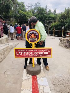
Here we are on Wednesday morning in Guayaquil, Ecuador, about 120 miles South of equator, a mere 3,400 nautical miles straight line distance from home. Staying over land adds another 900 nm and we want to be home on Sunday. The airplane doesn’t fly as well as usual, but we are determined to get back.
Wednesday
We arrived to the airport in Guayaquil around 8 am. I talked to a mechanic in Xavier’s shop about timing the magneto, but decided it would take too much time. I knew the airplane flied, it just didn’t fly well. Following the principle of great being enemy of good and a risk of further delays if something went bad, we decided to launch and we were airborne about 9 am. Flavio at Airmaster FBO handled efficiently all our paperwork.
I filed for 10,000, because I wanted to stay low suspecting there was something wrong with mag pressurization. During the climb I watched nervously manifold pressure as it kept dwindling down to 27, 26, 25 inches. The engine run fine, fuel flow was good and the airplane climbed normally, so this was clearly an indication problem. That’s what your conscious brain tells you, but after all the troubles with the mags and the associated maintenance and the fact that you are far from home and literally in the other hemisphere, your unconscious brain starts screaming. Score one for the conscious brain.
The flight to Cali took about 2:45 and we were all the time comfortable above a broken layer. We had to climb to 16,000 for the last 60 miles due to MEAs, so I just went full rich. The ILS to Cali was out of service, I requested and got cleared for RNAV Z, but they vectored me for a VOR approach. This was a formality though, because I broke into clear at 12,000 and continued visual. We landed somewhat anxious about what the delay will be, mindful of our previous exit experience. This time though we hired a handler and we are out in 30 minutes, including bathroom, refuel and flight plans.
When on the ground, I checked my messages and found that John, who was flying from Pereira to Costa Rica had a rough engine with a partial power loss, declared emergency and landed in Rionegro (SKRG) close to Medellin. Everybody was OK, airplane was fine on the ground, but the nightmare of paperwork started. Declaring an emergency in US is a non-event and most of the time, there is not even a report to file, but here we were dealing with an international incident He didn’t know how long he might have to stay in Medellin and thought he might need to fly commercial back home and return later to recover the airplane.
We launched for our second leg to Panama City, which was about the same flight time, we flew at 12,000 and the engine was having harder time keeping smooth when LOP, so I simply pull the power back and flew ROP. We had enough fuel reserves and Panama weather was fine. This time, when the Panama Approach controller asked if I was familiar with Gelabert airport, I could reply in my best pilot baritone “affirmative”. I suppose the reason they ask is that there is a hill close to approach end (see this video) and if you are unfamiliar, it may be startling.
Since leaving Guayaquil in the morning I didn’t really know where we were going to end up, I didn’t reserve any hotels in Panama City. After landing, I went on Hotels.com, found Las Clemantinas in Casco Viejo and booked it. The Mapiex FBO was as efficient as the first time and they drove us to the hotel. A surprised clerk checked our reservation and said they didn’t have rooms, something about a cleaning lady having an emergency and unable to prepare it. Another visit to Hotels.com and I found La Concorida in walking distance, we checked in and found a very nice room, huge bathroom, very helpful staff and, most importantly, nice rooftop bar. Since La Concordia is $110 more expensive than Las Clemantinas, I called Hotels.com back and they agreed to refund the difference. All things considered, that was a great day, 5:30 of flight time and we are 800 miles closer home.
There is a Cirrus Service Center in Medellin and the local mechanic came over to check John’s plane. He couldn’t find anything wrong, they went for a short test flight, where everything was OK and John wanted to leave. Well, not so fast, gringo, we have our procedures here, a test pilot must come from Bogota to certify that the plane is fine in spite of the fact that a Cirrus Certified Instructor (John) and a mechanic from Cirrus Service Center say all is good. John stayed in Medellin, but he thought he might leave the next day.
Thursday
We woke up early and were at the airport before 8 am. After departing Gelabert VFR, we had to climb to 16,000 before Costa Rica border – ROP again. We were handed over to Coco control and fifty miles before our first destination, I got vectored for the ILS Z 07 to Juan Santamaria International (MROC), expecting a sidestep to the VFR-only Pavas airport (MRPV). Then, I got vectors for the traffic and that wore my patience thin, I canceled IFR and started dropping like a rock to get down to the airport. After landing we went through the usual luggage X-ray (that’s get old after a while), got gas, paid the handler and we were on our way. Our flight plan was initially for G346 from Liberia to San Salvador VOR, but that would put us quite far offshore. I sent an email in the morning to Melani asking for a different route: A502 to Managua and A317 to CAT. It turns out that the first route is outside of Nicaragua airspace, but the second one is obviously inside and we needed Nicaragua overflight permit. Melani came through and obtained the permit in record time.
We continued through Nicaragua talking to Sandino Control and landed at Guatemala City Aurora airport. As usual, I canceled IFR during the approach and than I heard a familiar voice on the radio. It was our friend Hubert from Arizona who flew with us many times to Mexico. He was part of a COPA-organized trip to Panama City and suddenly there were 12 Cirrus aircrafts at the airport plus Michael’s and mine. We first taxied to the international ramp, went through all inbound processing and than had to cross the runway to park the airplane. Ground control was very much overwhelmed by that sudden onslaught of Cirrus.
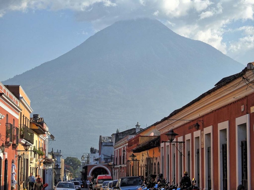
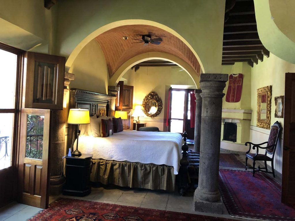
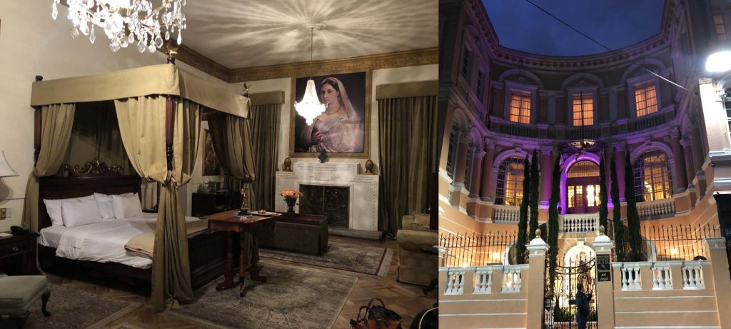
Antigua used to be the capital of the Spanish Colony of Guatemala until XVIII century, when Santa Marta earthquakes caused the capital to be moved the current location. We stayed in House Hotel Pensativo, an unexpected surprise of calm and charm, with unrivaled views of the Volcan de Agua. It is an old private house, which was enlarged and turned into a hotel. A gourmet dinner in Casa Santo Domingo made us regret that we had to leave the following day.
In the meantime, John was still stuck in Medellin. While the authorities released his airplane as airworthy, his original import permit established when he entered Colombia in Cartagena has expired. He now needed a new permit and sure enough, that couldn’t be done on the spot. Maybe tomorrow.
Friday
We learned that John got his permit and was leaving Medellin for Pavos (MRPV) in Costa Rica, planning to arrive to Antigua in the evening.
It is about 1.5 hours to drive back to the airport, we took fuel and taxied back on the other side of the runway to the international ramp. The whole processing took less than 30 minutes and we were on our way. A less than an hour flight brought us to Tapachula, Mexico, which is a mandatory Airport of Entry. As much as you can overfly any airport in Mexico coming in from the North as long as you land at an AOE, when you are coming from the South, you must use one of the two AOEs: either Tapachula or Cozumel. I know of people who paid stiff fines for going somewhere else, according to the rule that in Mexico rules are flexible. They are, but not all and you better know which ones are OK to violate. For example, it is not a big deal to fly through restricted areas or enter a TMA without talking to approach control. You theoretically need to file a Mexican version of APIS, but nothing happens if you don’t. Not landing in Tapachula is not one of those.
It was hot, really hot on the ground, we had to take out all the luggage, there was a dog who was sniffing our staff, but unlike in Cali he had boots, so as to not burn his paws. The usual flight plan, customs, immigration took over an hour, but it was a relief to pay only 120 pesos ($6.50) for using the airport. A pilot doesn’t pay anything for immigration if the stay is less than 7 days, a passenger pays 500 pesos for the visa. A helpful commandante gave us a tip to declare the passenger as co-pilot to avoid that fee. I knew about it, but thought that $26 is too low amount to use the trick.
We flew VFR from Tapachula to Zihuatanejo along the coast and it was a pleasure to not have to abide by MEAs enroute. Our original planned stop was Uruapan in the center of the country, but that would have takes us over mountains and with the bad mag timing and a suspicion of incorrect pressurization hookup, I wanted to stay low. The three hour flight was too long to stay ROP, so I pulled the power back to about 25 inches (66%) and managed to lean the mixture with only minimum roughness.
We landed at the Zihuatanejo airport in the early afternoon, took our luggage and after paying 40 pesos landing fee, we walked out of the airport, grabbed a cab and drove to town. Gringos often complain how long the processing is in Mexico, about the fees and having to file flight plans. It is true that compared to US, it is a hassle, but it is getting better each year. More importantly, this is a bad comparison. Just fly further south and you will be so happy to return back to Mexico.
While the hotel was somewhat substandard (that’s what you get without prior reservations and when unwilling to spend $500/night), it was walking distance from the beach, which had few restaurants with tables on the sand. We had two margaritas each and got positively drunk. Unlike in US, they actually pour real tequila and in non-negligible amounts into their margaritas south of the border and we haven’t eaten much during the day. The fish was delicious, the sea breeze and warm night added to the magic of the moment.
Saturday
After paying 80 pesos, filing flight plan, getting usual stamps and refueling, we took off for a 3 hours flight to Mazatlan. Same super-fast and friendly processing and refueling as during our outbound stop makes Mazatlan one of my preferred AOEs. Another 1.5 hours and we landed in Alamos for our overnight stop in Hacienda de Los Santos. It has been 10 years we are coming to the Hacienda and it is our favorite place in the whole country. We run into the owner, Jim Swickard and we told him about our adventures in Colombia and Ecuador. Jim and Nancy have built the Hacienda over thirty years into an amazing thing of beauty. It is located inland, two hours drive from Ciudad Obregon (which has commercial service to Mexico City) therefore it doesn’t attract usual cruise ship crowds. For a pilot with his own airplane, a 5,000 paved runway in Alamos is only 1.5 hour flight from US border. Throughout the years, I brought few COPA Mexico trips to Alamos and the participants became frequent Hacienda’s guests. Jim graciously offered us an upgrade to Governor suite and we were really tempted to stay one more night.
Sunday
It is always both sad and happy to return home. Our great adventure was nearing the end and the familiar trip from Alamos was, as every flight should be, boring. We stopped in Ciudad Obregon for fuel, passed immigration and customs and flew to Calexico. At 66% power and 8,500 our airplane is flying at only 160 knots. This is remainder how easy it is to get used to good things, only three years ago 160 knots was what we were always flying. The stop in Calexico beat all the speed records – probably about 10 minutes to pass inspection and take fuel.
It took us 5 days of flying to get from equator home. We were flying at most 6 hours a day and our bird was not in top shape. If time was of essence, I believe it would be pretty easy to do that trip in 3 days – three days to cross almost a third of the globe. Aren’t airplanes amazing machines? We were very grateful for how our airplane took care of us and after a tender kiss, I closed the hangar doors.
We are back home, but I already started to think about the next adventure. I know now it is possible to ship fuel to Galapagos ….
Perched high at 9,300 in between Andes peaks, Quito’s historic center has one of the largest, least-altered and best-preserved historic centers in the Americas. Quito and Kraków, Poland, were the first World Cultural Heritage Sites declared by UNESCO, in 1978. The central square of Quito is located about 16 mi south of the equator.
We landed in Latacunga, about 2 hours south of Quito, because the landing fees at the new international Quito airport are prohibitive. I was hoping we would catch a glimpse of Cotopaxi, an almost 20,000 feet high active volcano, either during the approach or when driving to Quito, be overcast skies didn’t cooperate.
The first day in the morning, we drove to La Mitad del Mundo (the middle of the world), monument and museum marking the general location of the equator. It is so named to avoid confusion, as the word ecuador is Spanish for equator. Since this is one of the main tourists attractions, they cleverly have couple of areas marked as latitude 0°0’0’’. There is the one that was established in XVIII century by Franco-Spanish geodesic mission, there is also the modern GPS version. After taking mandatory pictures stranding the equator and kissing over it, we returned back to Quito, to visit the historic center.
We stayed in Mansión del Angel in Quito, a boutique hotel that used to be the home of an Ecuadorian tobacco tycoon and which has been completely restored. The staff was wonderful and they were very helpful when we had to return to the hotel after our airplane engine troubles (read on).
The next day, we drove to the market in Otavalo, the largest outdoor market in South America. Strolling among the stalls, we bought couple of small souvenirs and than stumbled upon a colorful painting, which we both liked very much. The usual and mandatory haggling over price didn’t yield much, we only got 10% off, so we walked away. After making a tour, we came to our senses and realized how ridiculous it was to walk away from something that we both liked so much over basically misplaced ego – that the vendor didn’t want to lower the price. Considering what we were already spending on this trip, this was below noise level. We went back and bought it. That is after all the true meaning of the word souvenir. We will now remember Quito every time we look at the painting.
This was what we thought the last night in Quito and the next day we drove back to Latacunga to fly to Guayaquil, which was out of the way further South, but is Guayaquil the only place in the whole country with avgas. After a normal run-up, I was in for rude surprise in climb. The engine was unusually rough, shaking quite a bit during climb and the CHTs were rising much too high for my liking. I decided to return the airport. Redoing the mag check on the ground caused the engine to quit on the left magneto.
This wasn’t exactly the most convenient place for engine troubles. It was Sunday, nobody knew if there even was a mechanic on the field and we weren’t yet completely sure about the root cause. The airport is located at 9,000 feet, in a valley, surrounded by Andes rising up to 20,000.
After a mandatory call to Cirrus whisperer and guru Jim Barker at Aviation Vibes in Wisconsin, the consensus emerged that it was indeed a bad mag, after eliminating the competing hypothesis of bad ground wire. Great, now we just need a new mag. In Ecuador, at almost deserted airport on Sunday. Clearly, that wasn’t going to happen, so we returned to Quito, all the time on the phone in feverish search for the part. It became quickly clear there was none in Ecuador and we have to import it. There is an outfit called Aviall that specializes in rescuing AOG (Aircraft on the Ground) with spare parts worldwide. The website says:
We understand that there’s a real sense of urgency when it comes to aircraft repairs. It can lead to a tense scenario — especially if a plane is grounded until parts can be replaced. That’s why Aviall offers 24/7/365 AOG service. With our global presence and counter–to–counter delivery, we get our customers the parts they need to get the plane back in the air — fast.
That sounds perfect, so I call them:
Me: I need magneto in Quito, Ecuador. Aviall: Sir, do you have an account with us? Me: I don’t. Aviall: You need to first open an account. Our customer service department is closed on Sunday and they are the only ones who can open an account. No, I cannot take your credit card, you need to call back on Monday. Me: I’ll have somebody with an account order that for me. What about shipping? Aviall: Let me check, I’ll call you back. <calls back after 30 minutes>. We can ship it with Fedex. Me: What about customs? Aviall: Uhm? <Blank stare, if I could see it>. I am not sure.
This is a company, which website boast about helping hundreds of aircrafts. Except not on Sunday and not in Ecuador. Back on the phone with Jim who has the mag in Wisconsin, but how do we ship it? Couple of phone calls later, we realize that using something like Fedex will cause the part being stuck in customs for an undetermined amount of time. Perhaps air cargo? There is a Delta flight leaving Minneapolis at noon on Monday, arriving to Quito at midnight. Jim tries to contact them, but he is unsure about customs. I check other flights and find an Avianca flight leaving Quito at 5:20 am, arriving Miami at noon and return flight leaving Miami at 5 pm and arriving Quito at midnight. Jim calls Pete Lo Bello from Advanced Aircraft in Miami and Phil has the part. I buy a ticket and and order a taxi for 3 am Monday morning.
That just leaves us with the task of finding a mechanic. José in Cali knows a mechanic in Quito. We call Augustin and learn that yes, he works on piston aircrafts and says he can replace the magneto and time it. He doesn’t speak English though.
On the way to the airport, the taxi has a flat tire, but the driver has a spare and I manage to catch the flight first to Bogotá and than to Miami. Getting out of immigration at about 1 pm, I wait at the curb and Pete’s son arrives with the mag, hands me over the box and leaves. I’d rather put it in a bag to raise less suspicions at customs in Quito, so I try to open it, but really need a knife. At the airport’s shop, a clerk looks at me as at a simpleton: Sir, we don’t sell knives at the airport. The fact that we are outside the security zone doesn’t seem to register with her. She is willing though to open the box for me, using her own, presumably security cleared knife.
That was a bad idea, taking the mag out of the box and putting it in my bag will certainly cause it to be damaged in transit. I look for another airport shop with packing tape, reseal the box and go to the luggage shop. They have a canvas bag that fits the box. I check in the bag at Avianca counter for the return flight. Pete has a friend in Quito who might help with the mechanic. I call Javier, who is a pilot, but he gives me the number for Xavier, who owns a maintenance shop in Guayaquil. Xavier can send in a mechanic, but only on Monday afternoon. The mechanic would have to fly commercial from Manta, where he has a scheduled job in the morning to Quito and than drive to Latacunga. In the meantime Xavier calls Augustin to chat with him about what needs to be done and calls me back to reassure me that Augustin is fully capable of doing the job. I decide to stick with Augustin.
With all these calls, it is already 4 pm and I board the return Avianca flight to Quito via El Salvador. Arriving to Quito at midnight, I anxiously wait at the baggage claim. Yes, my bag is there. It is black, with red FRAGILE stickers, because I recently read a travel tip that fragile items tend to come out first. Approaching customs, I see that they put everything through an X-ray machine, but the agent is chatting with the second agent and not even looking at the screen, which shows big black hole with my mag in it. I grab a taxi and arrive to the hotel 22 hours after departure. It is now 2 am Monday morning.
Wake-up at 6 am and we leave the hotel at 7 am for a 2 hours drive back to Latacunga. Skies are clear and we can see the famous Cotopaxi volcano on the way, maybe a good sign?
Augustin is waiting for us, we drop the cowling and he starts to work to remove the bad magneto. Each time he unscrews something, I can’t stop wondering if he will know how to put it back. The mag is off in short order though, he puts the new one and we need to time it. On a TN aircraft, to get to top plugs, one has to have either a special wrench, which we don’t have or to remove the intercooler. We don’t have the former and I don’t like the latter, so I call Jim and he says to just use bottom plugs. I am also able to confirm that the mag was indeed bad, turning the drive shaft doesn’t turn the plastic gear and that we replaced the correct mag. Augustin puts everything back, I do a ground mag check and engine works on each mag. I do a short test flight in the pattern, lean the engine and it is fine. I would like to make a longer test flight, but I don’t have that much fuel. The only place with avgas in the whole country is Guayaquil, our destination. Augustin charges us gringo fee for the 2 hour work, but we are just happy to have a flyable airplane and pay him cash without usual haggling. He seems a bit surprised.
We hop in, open our IFR flight plan to Guayaquil and take off. Leveling at 16,000 we enter IMC, but the temperature is positive so no risk of icing. When I try to lean the mixture, the engine starts shaking violently. Not a pleasant thing in IMC over the mountains with 20K peaks around, so I return full rich. My fuel reserves are dwindling down dangerously, but the fuel totalizer doesn’t know I will be descending from 16,000 feet to sea level. We land in Guayaquil at 4 pm on Tuesday afternoon with 20 gallons. That’s pretty good, we are only 54 hours behind our schedule, but I am exhausted so we stay for the night. Fifty hours to locate the part, bring it to Latacunga, locate a mechanic and replace the part. I am proud of the pilots’ and mechanics’ help network that made it possible and I silently thank everybody who helped me, but in particular Jim and Pete.
We have a dinner at the malecon and walk around a city a bit, the waterfront building are nicely illuminated.
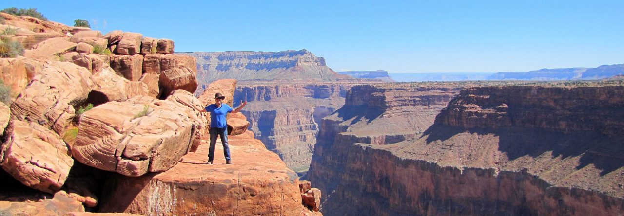
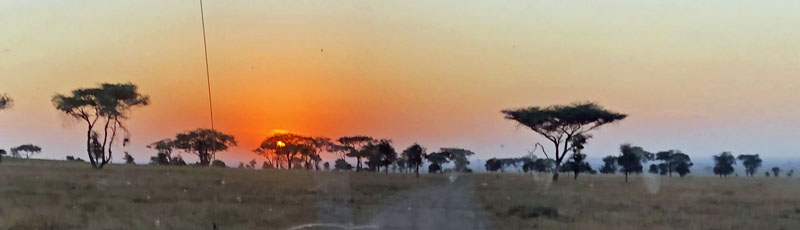
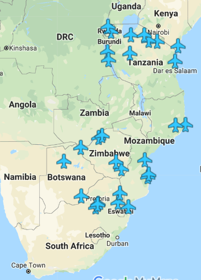

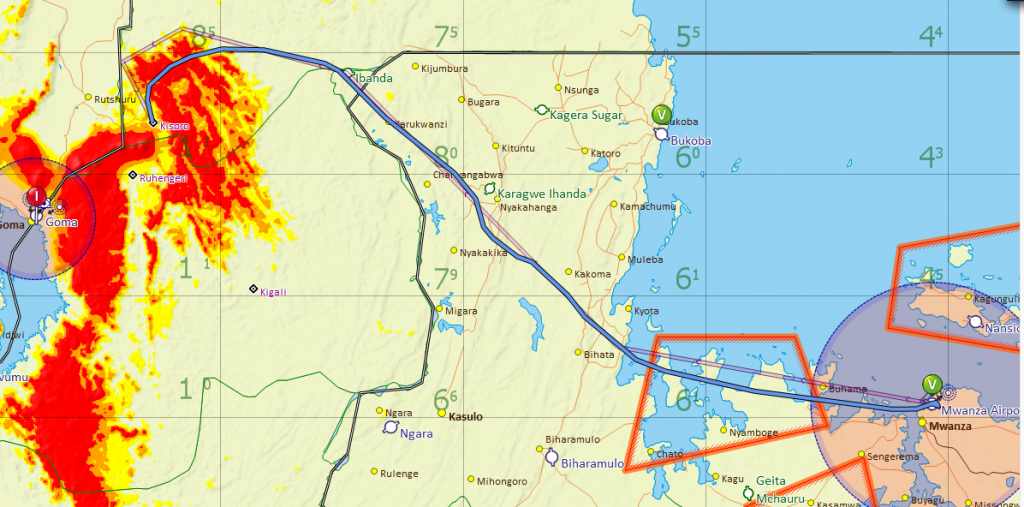
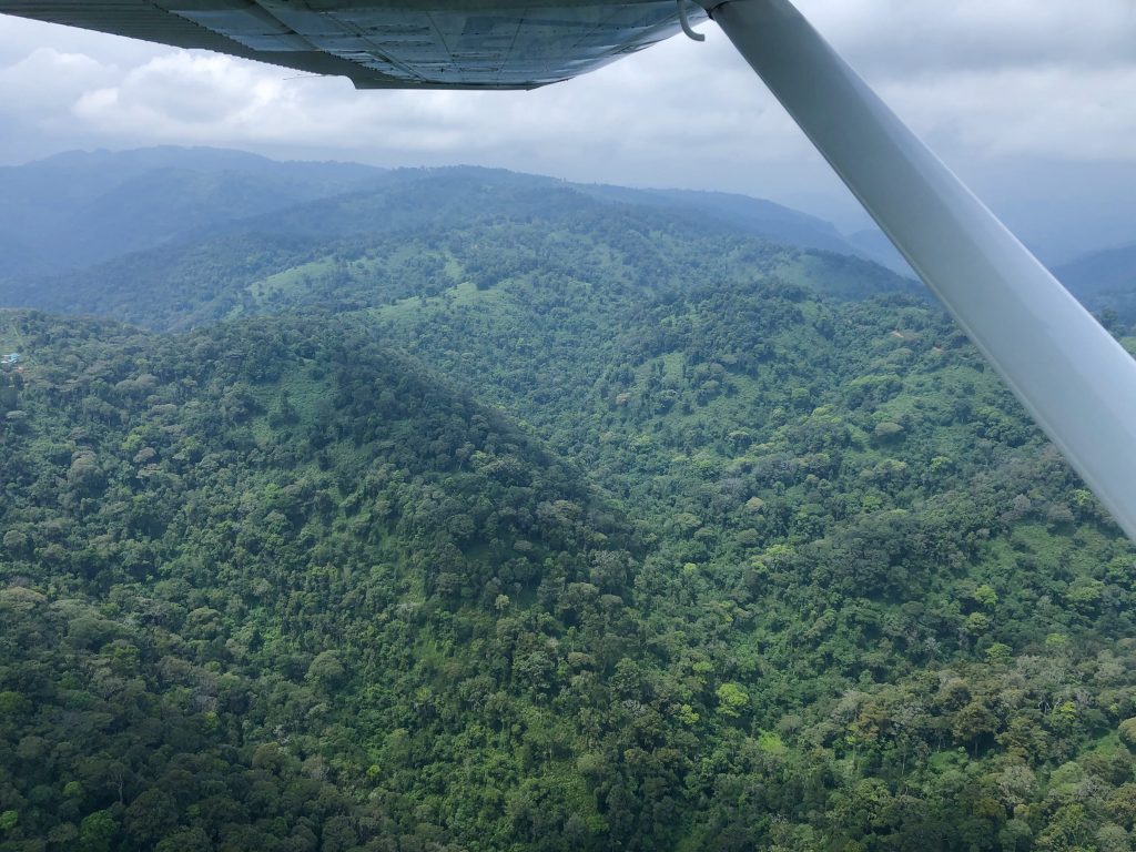
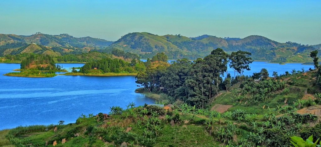
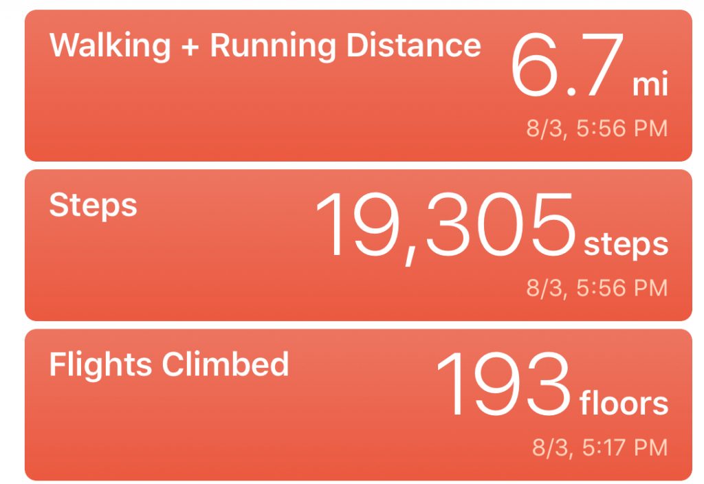
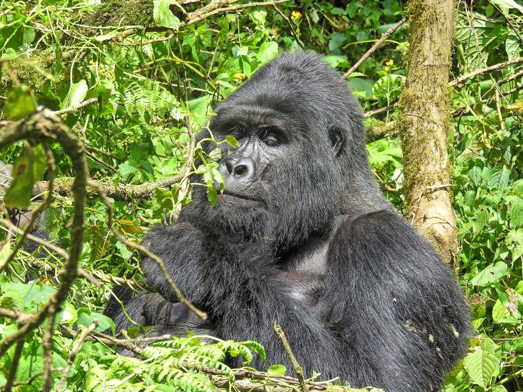
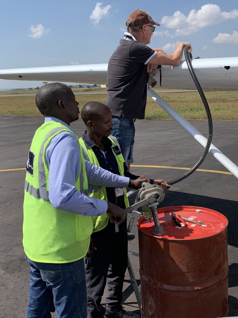
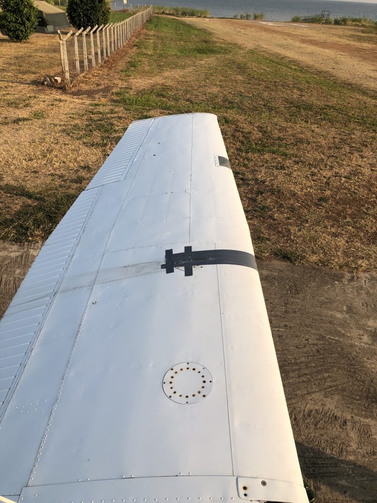
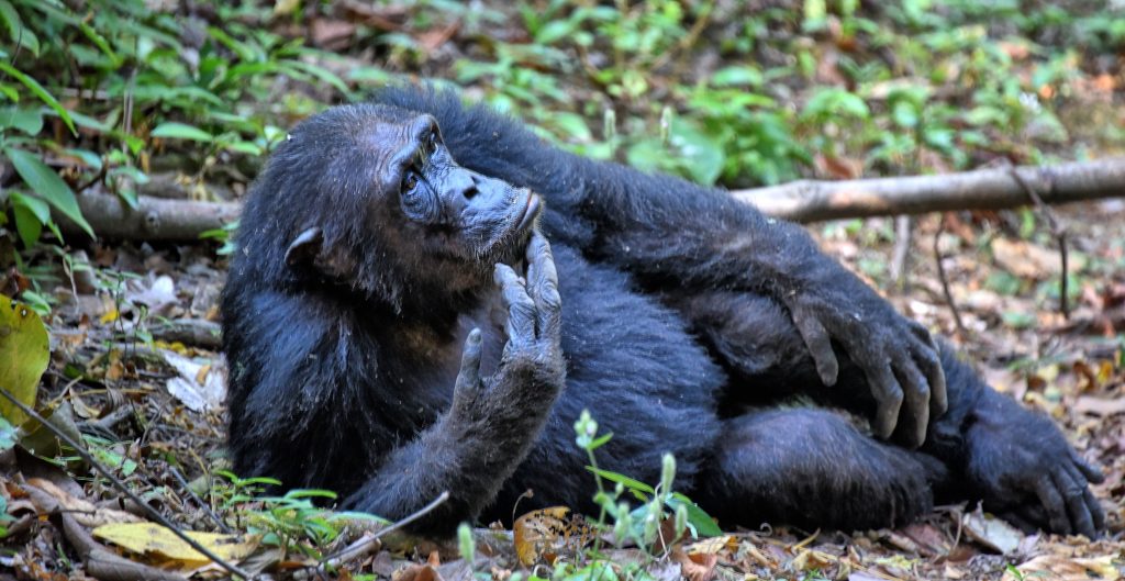
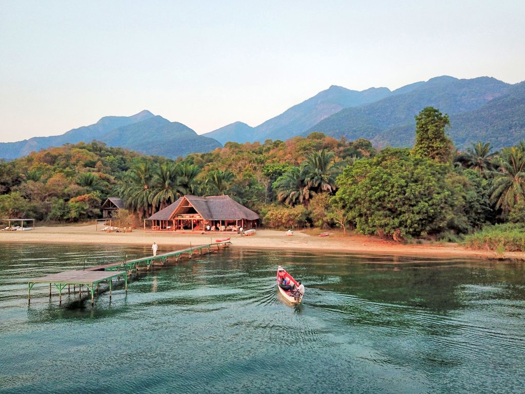
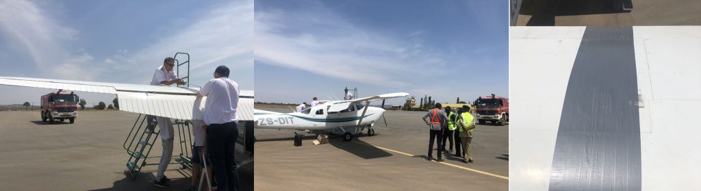
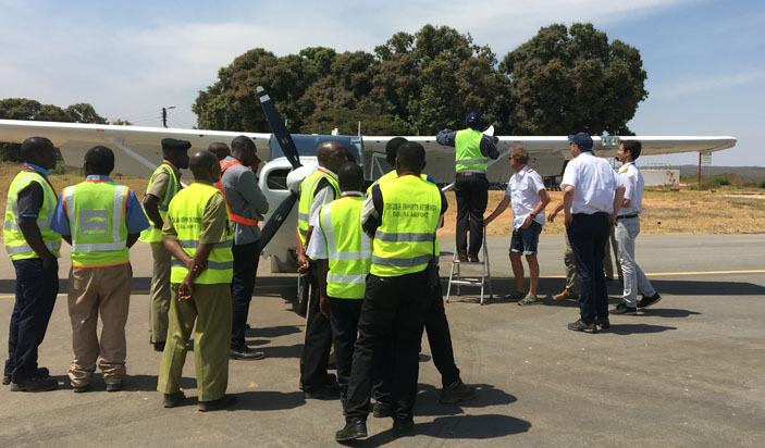
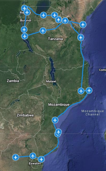
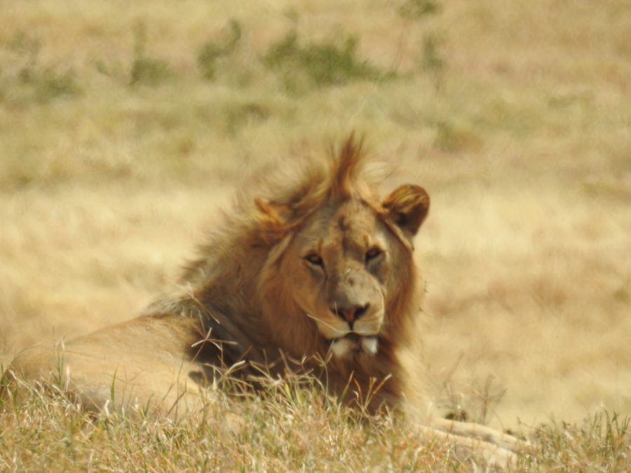
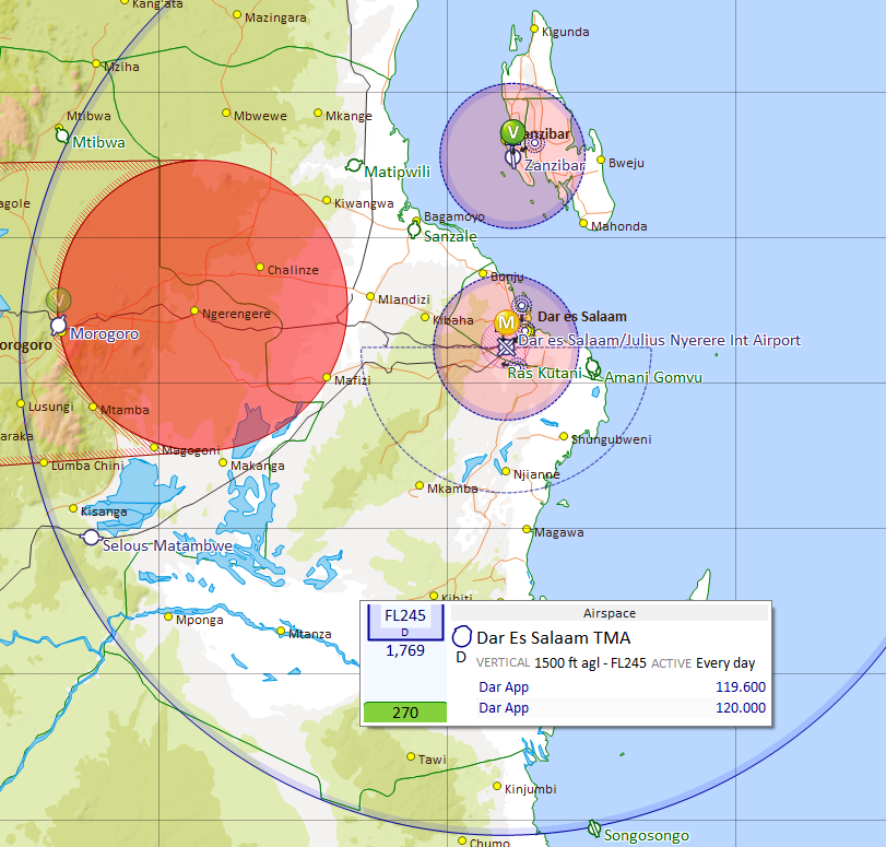
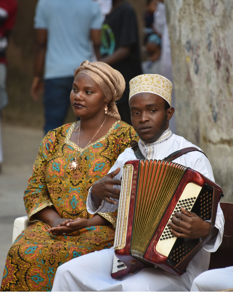
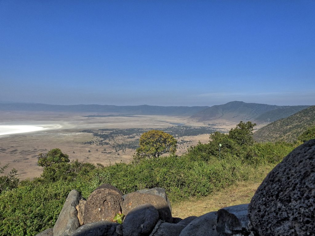
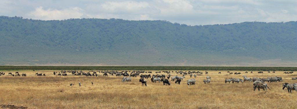
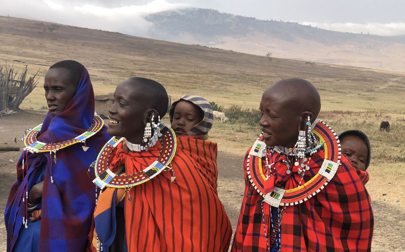
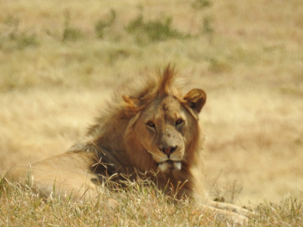
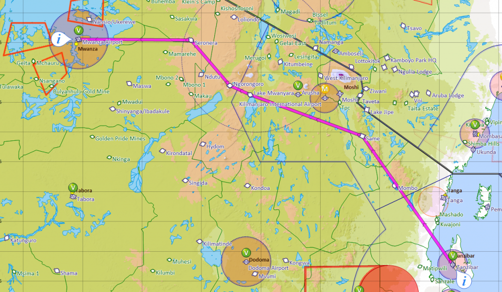
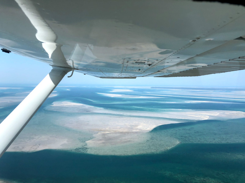
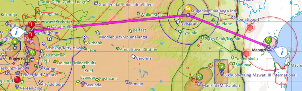
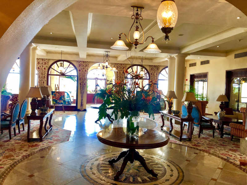
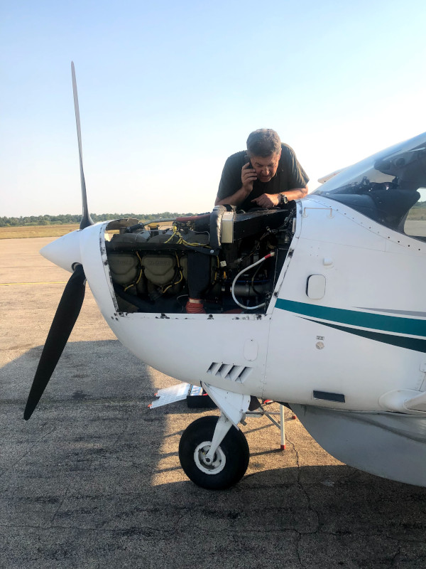
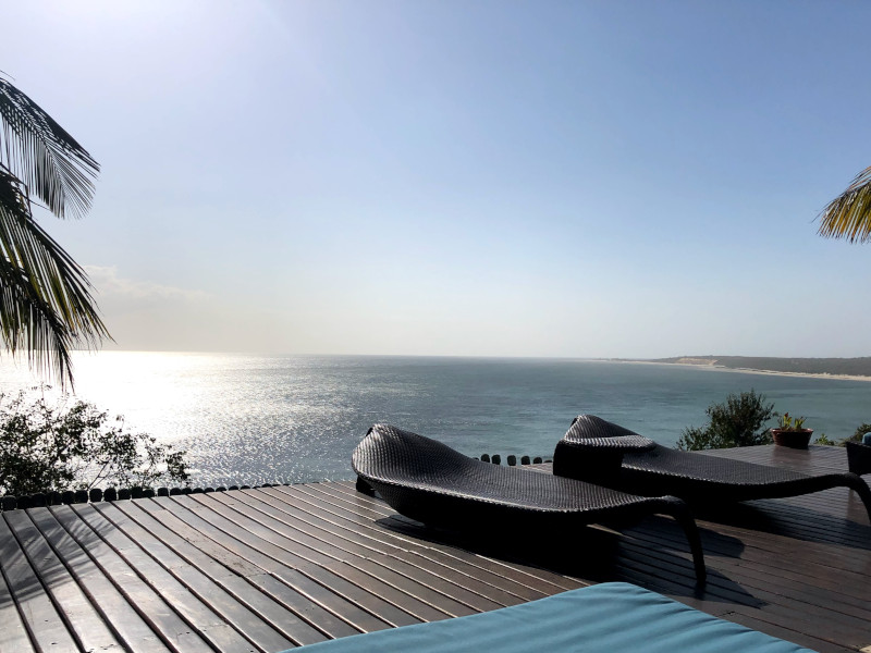
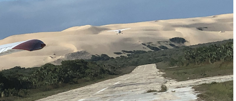
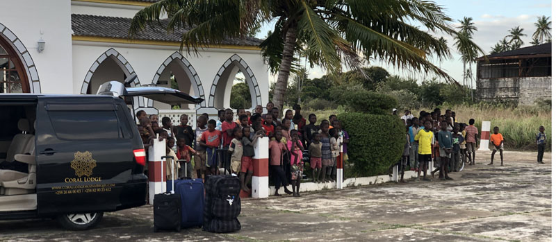
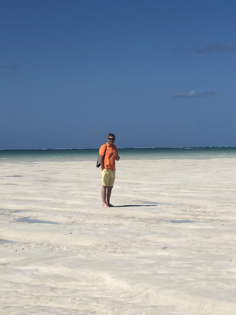
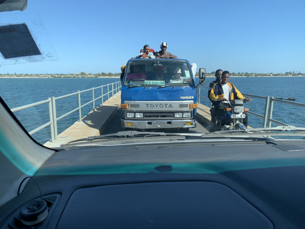
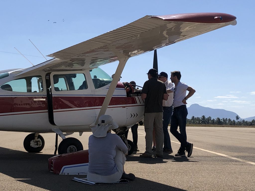
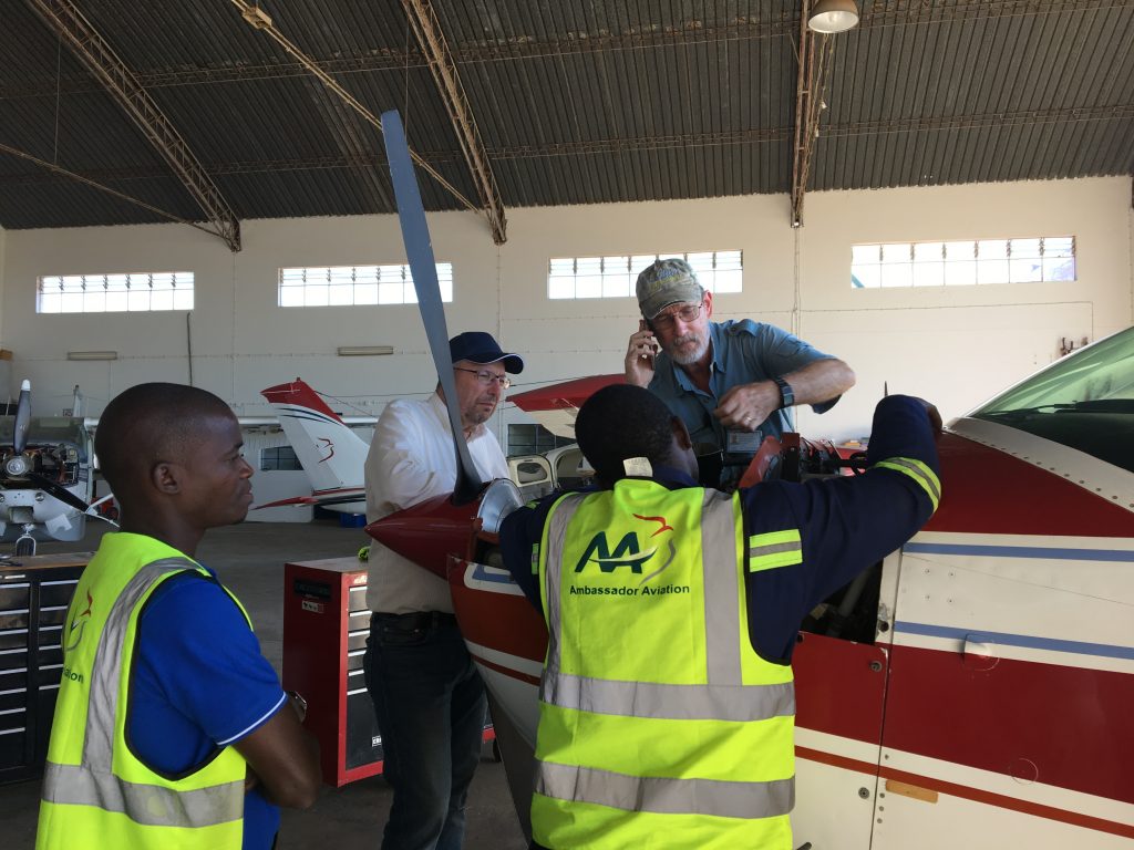
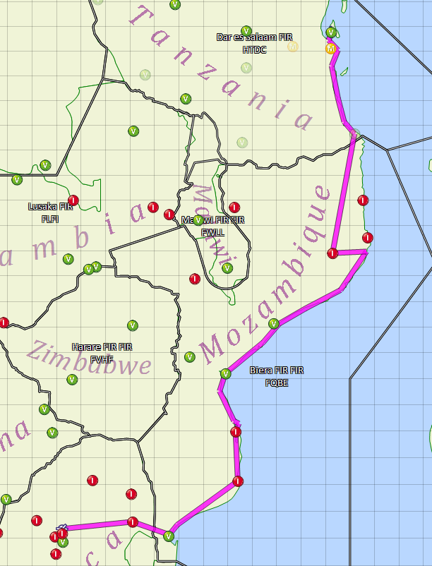
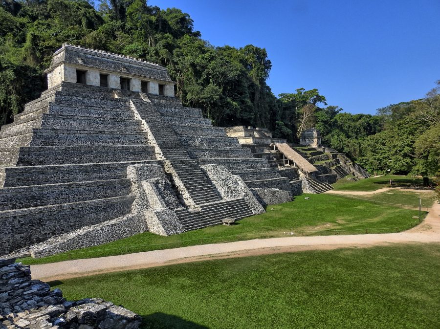
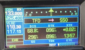 Next day, we flew to McAllen, TX, to meet about half of the group. Mighty tailwinds made it possible to make that flight without a stop, but we wanted to stretch our legs, perhaps also grab a bite and decided to land in Fort Stockton. Coming in on short final I saw barriers on the runway, at about one third. I added power to go over, but the rest of the runway looked fine, so we landed. It turns out there was indeed a NOTAM for runway resurfacing, luckily only the first third of it. Lesson learned: RYFN (Read Your Freaking Notams). Airport was deserted, so we took gas and a granola bar and left.
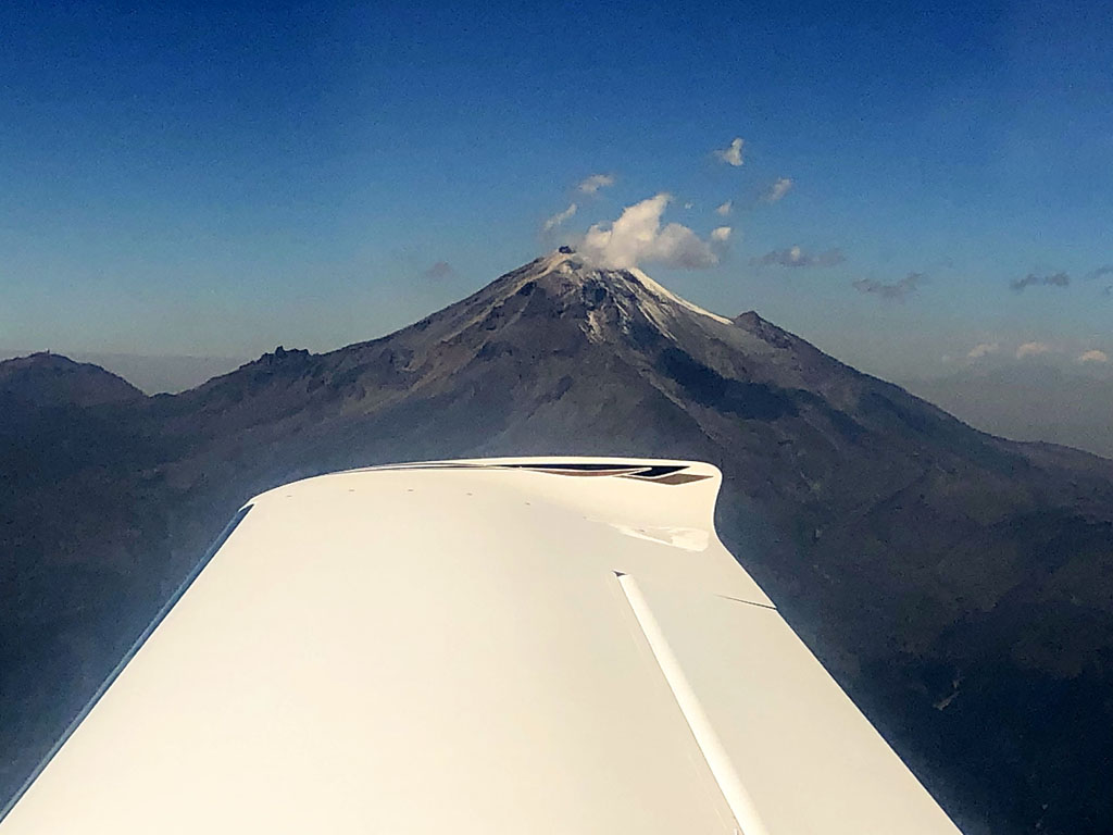 There isn’t much to say about McAllen, other than it is a convenient launch point for Mexico and allowed us a direct flight to Oaxaca, our first destination. On the way, we could admire Citlaltépetl volcano, the highest peak in Mexico.
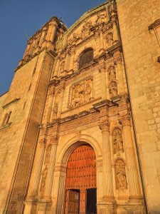
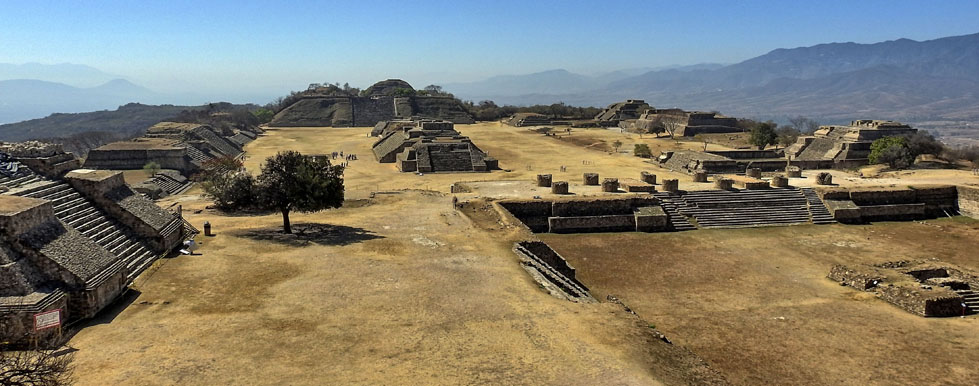
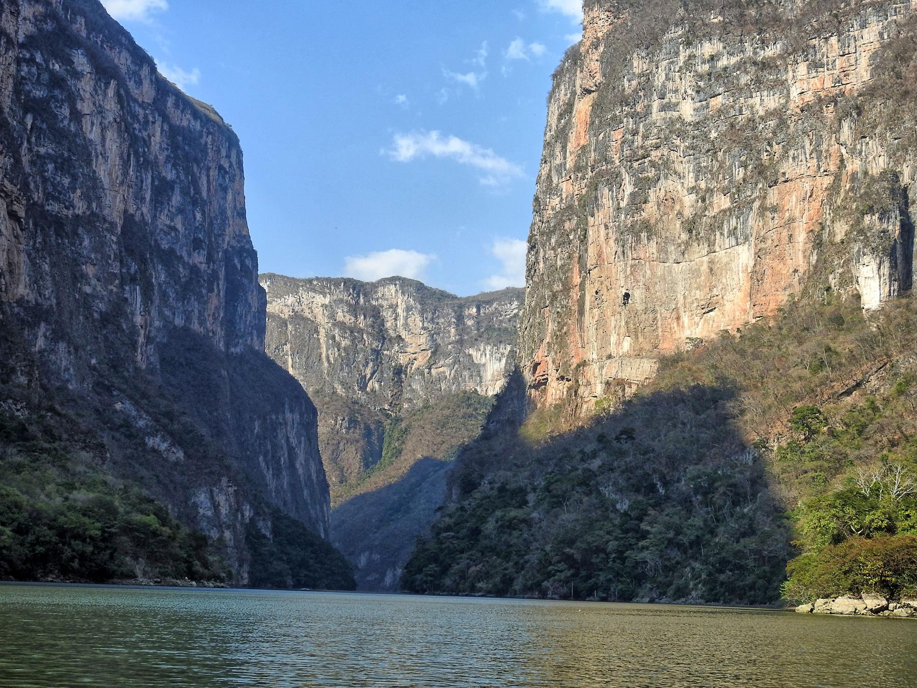
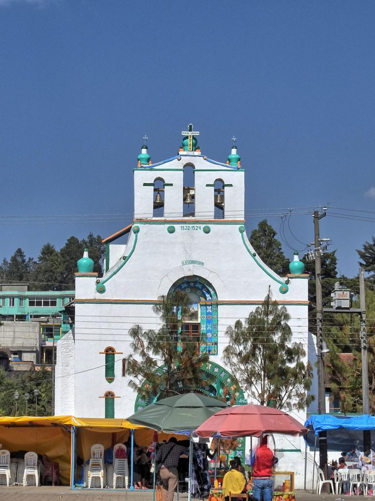 The most interesting and intriguing place to visit is actually 6 miles outside of the city, the Tzotil town of
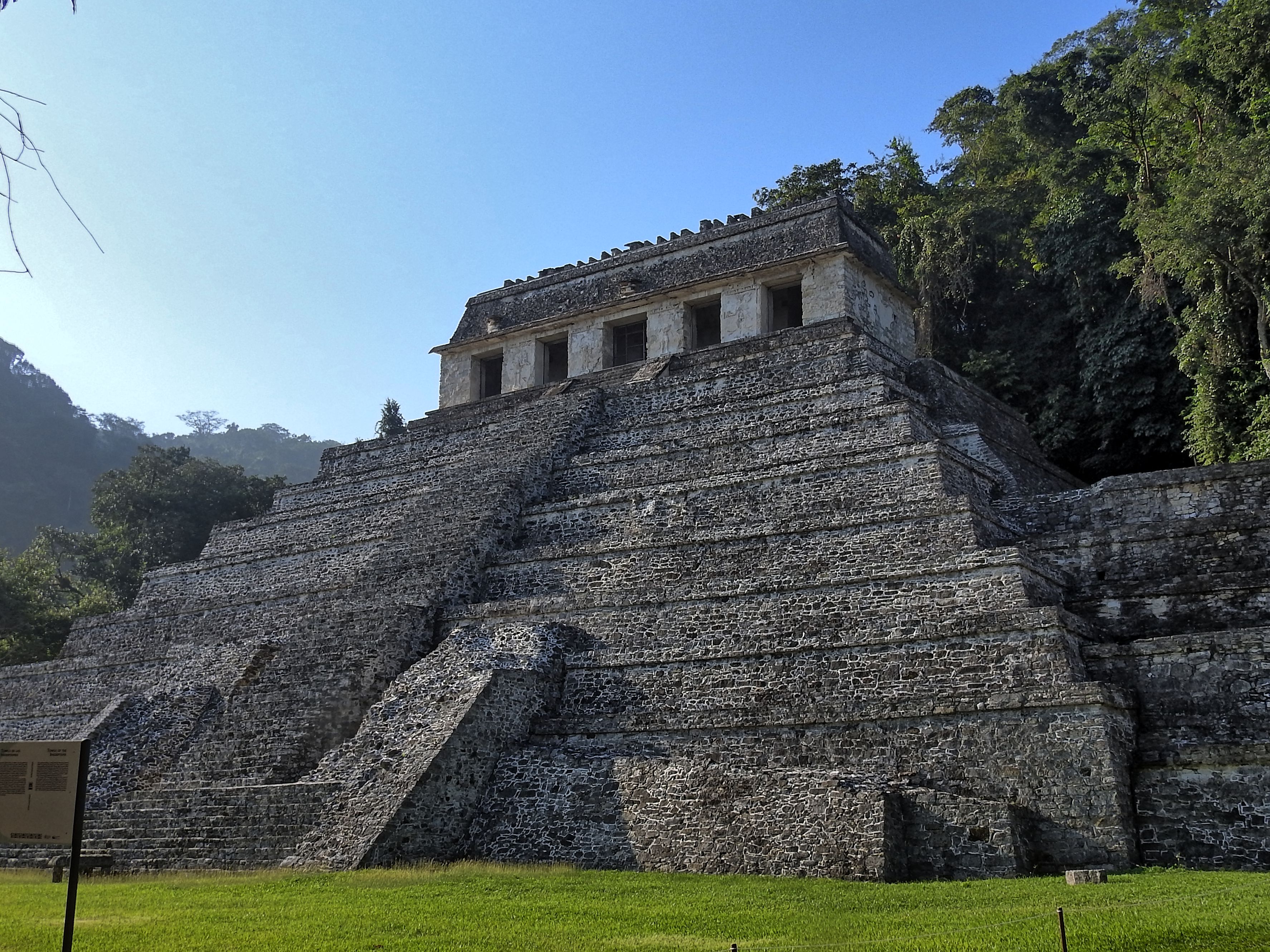
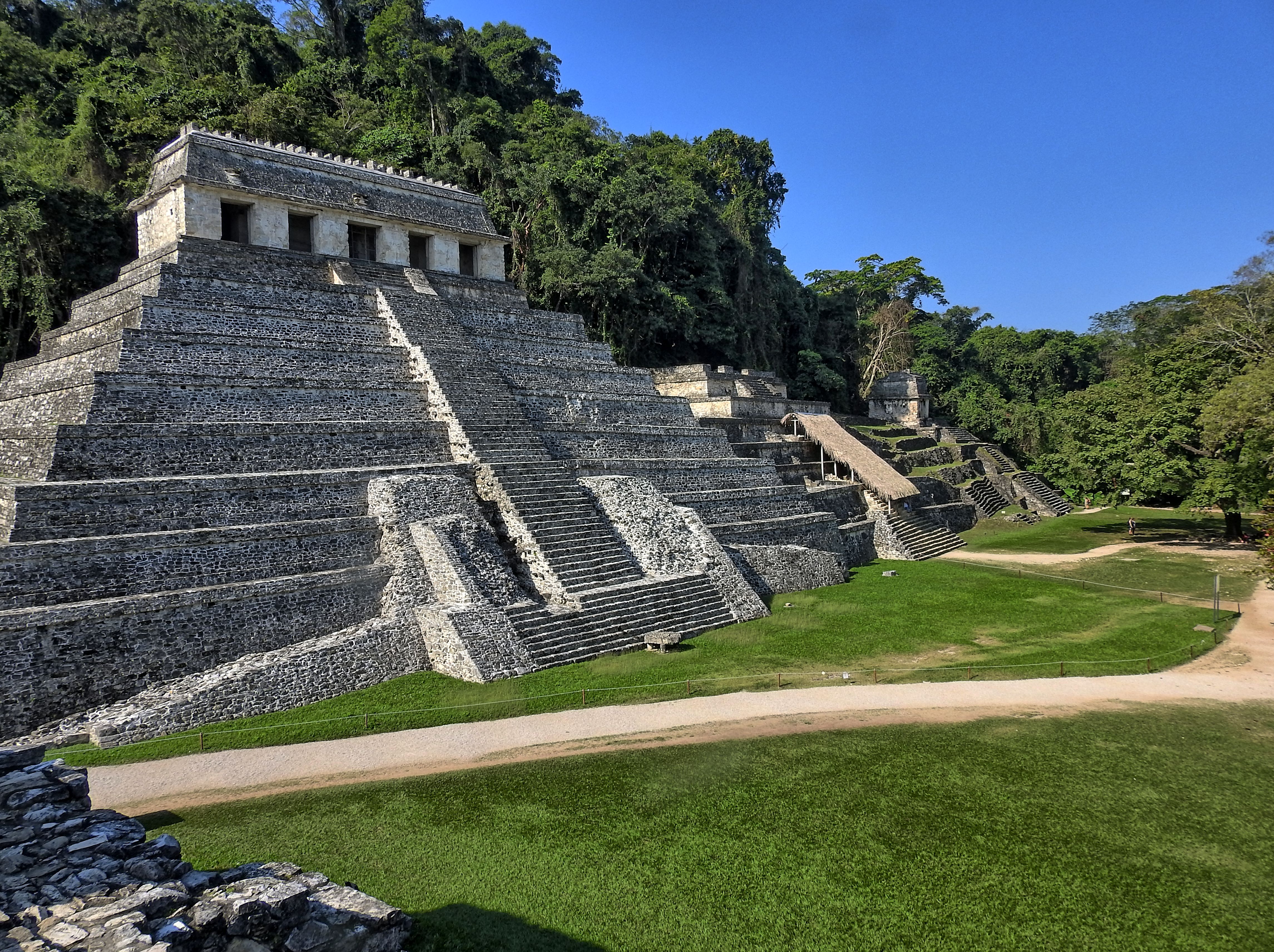
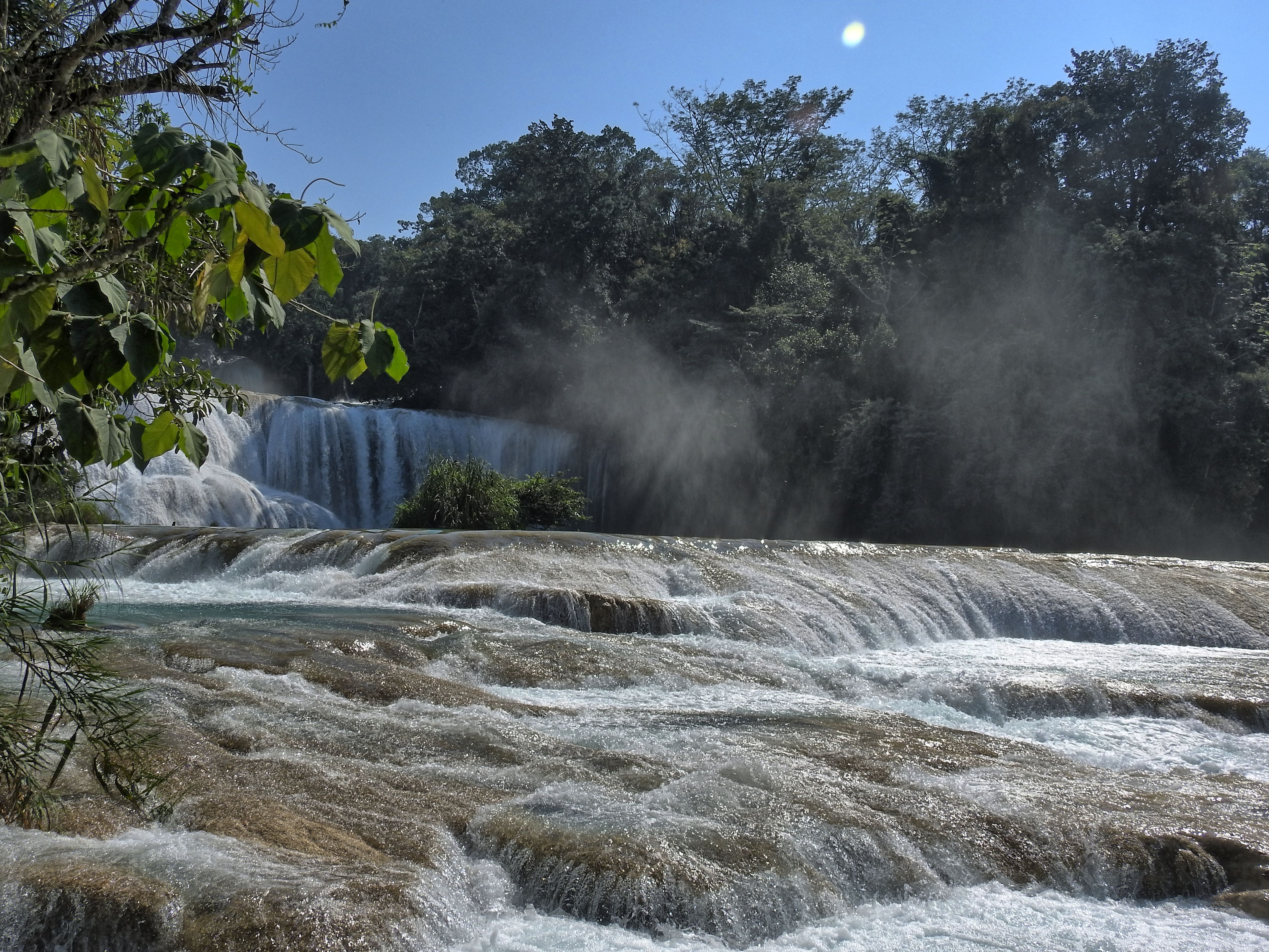
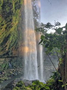
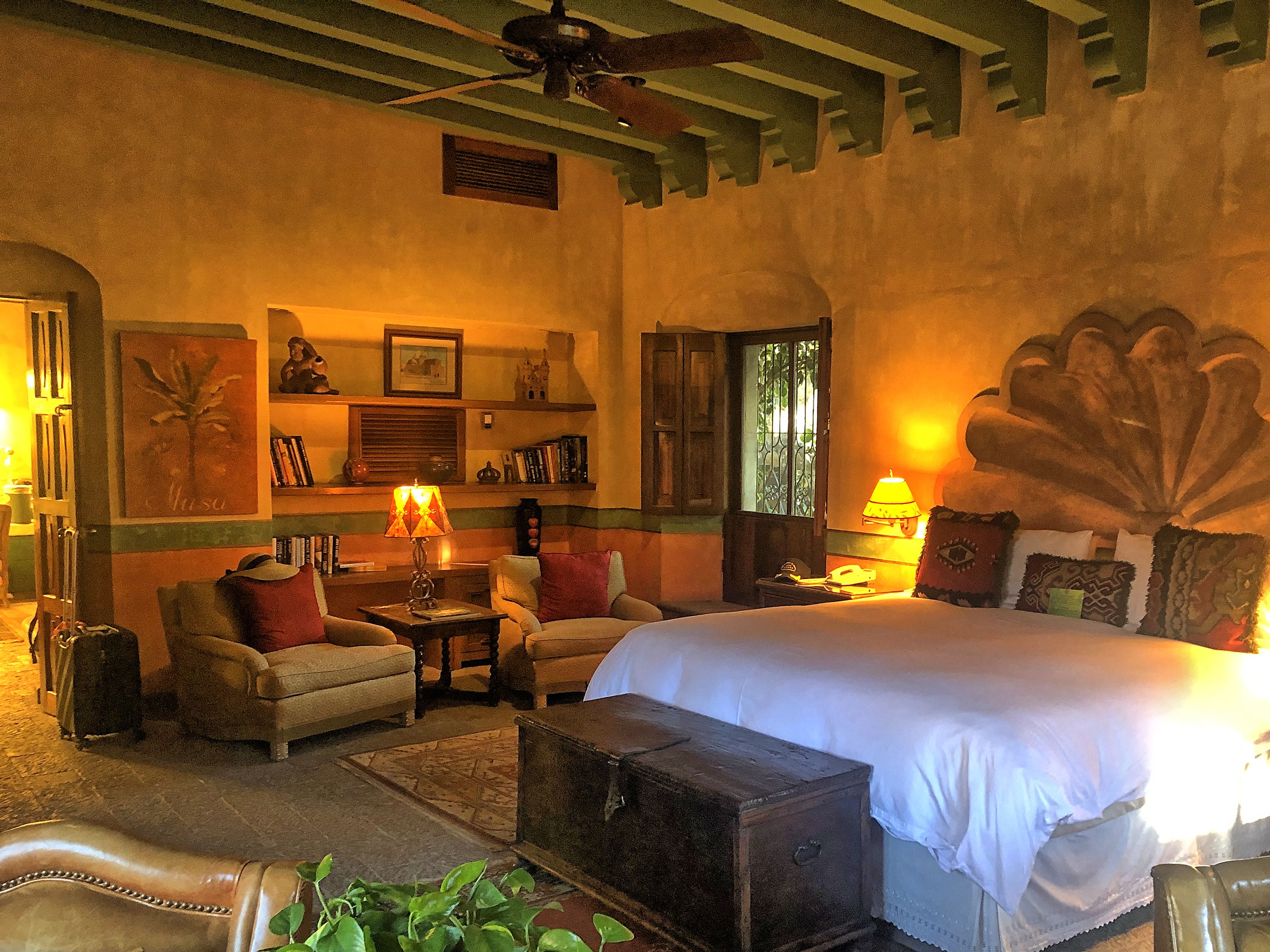
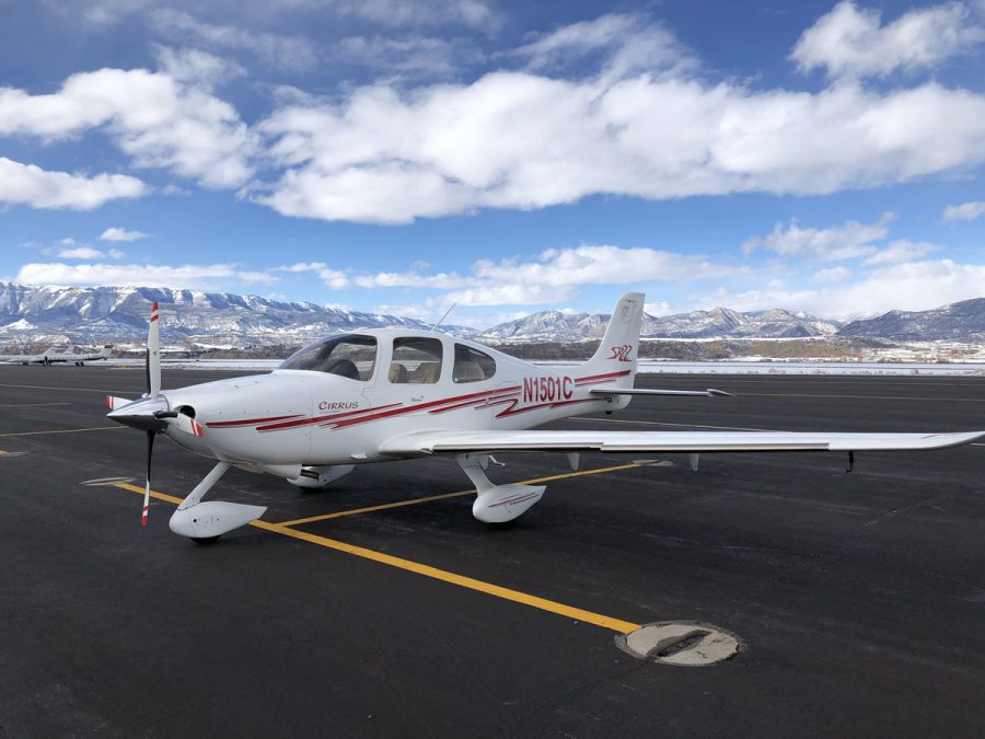
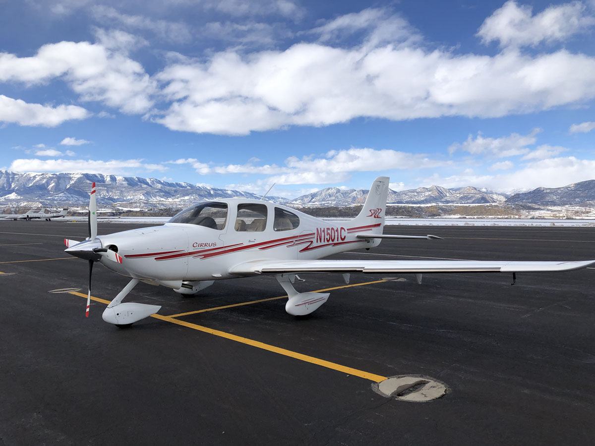
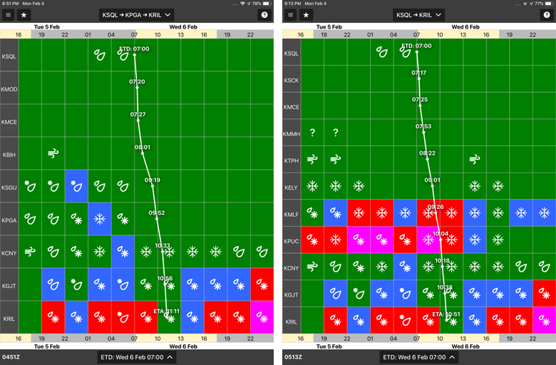
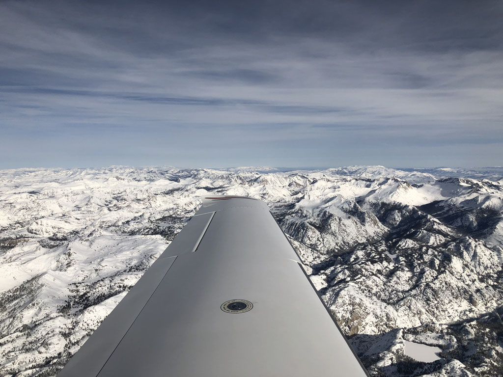
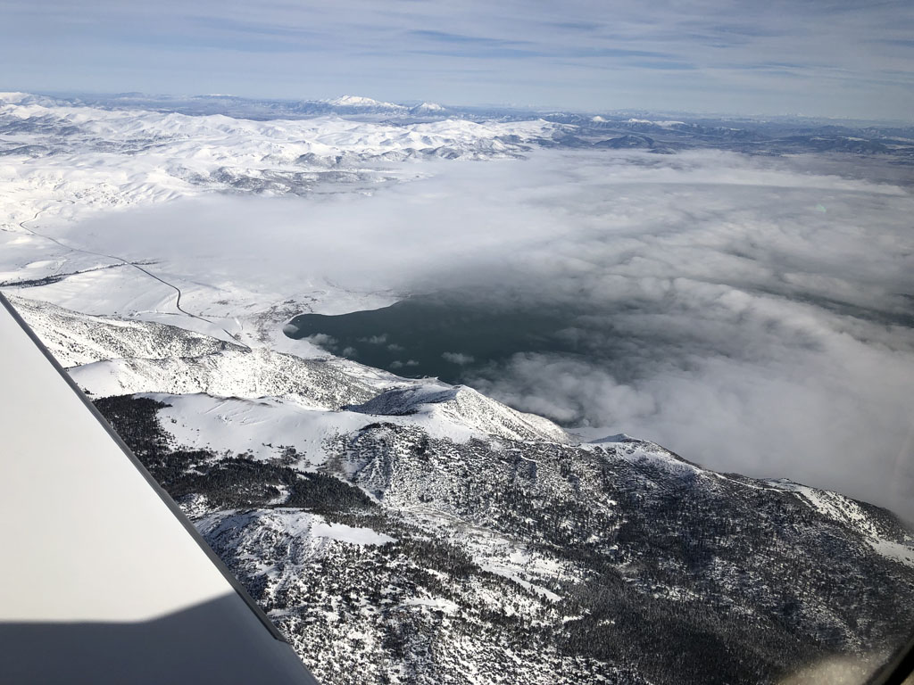
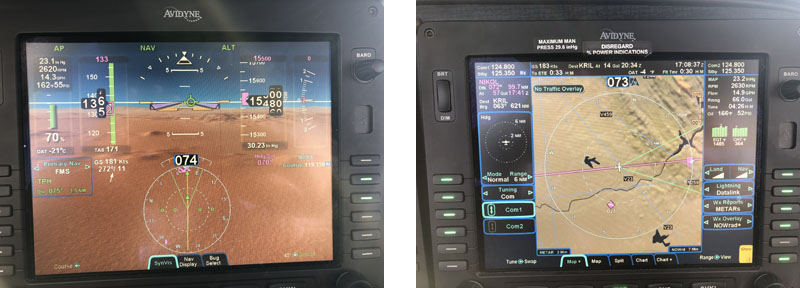
 With synthetic vision, well thought layout, MFD with traffic and weather, digital autopilot (DFC100) and a keyboard to enter waypoint and frequencies instead of twisting knobs as on than contemporary GNS430, it was very much ahead of time.
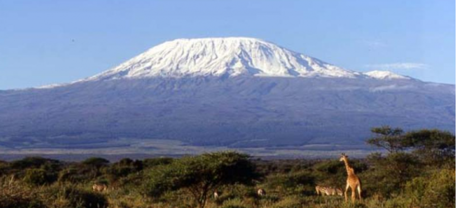
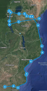
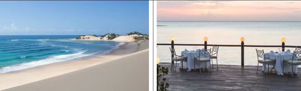
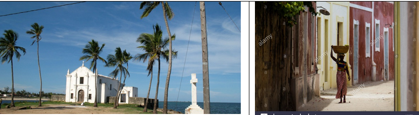
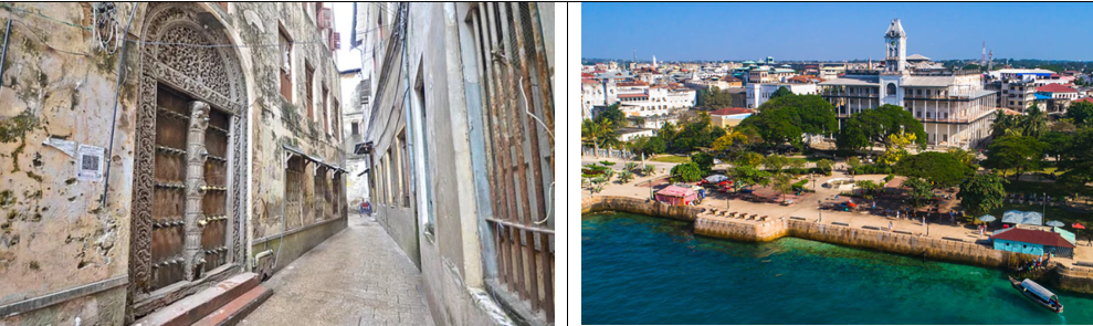
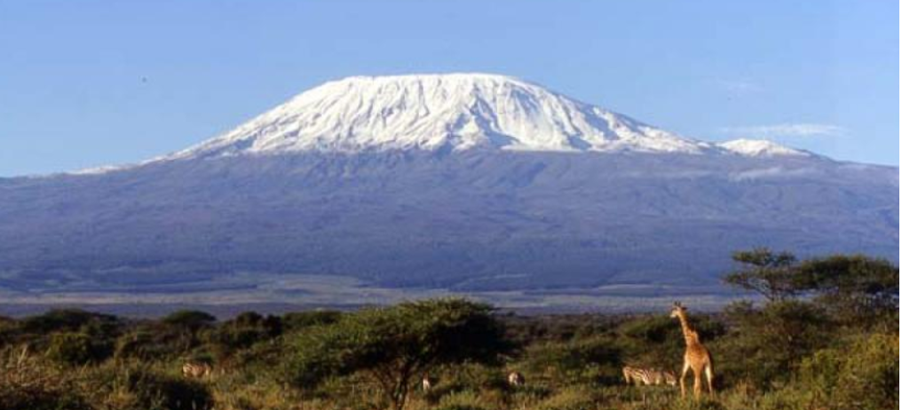
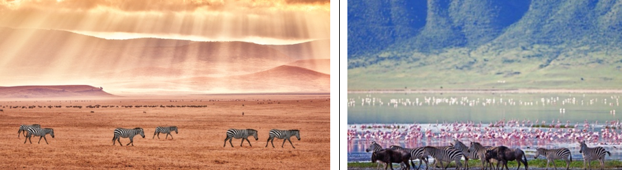
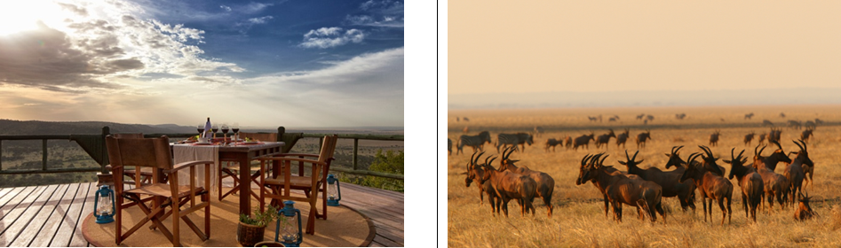
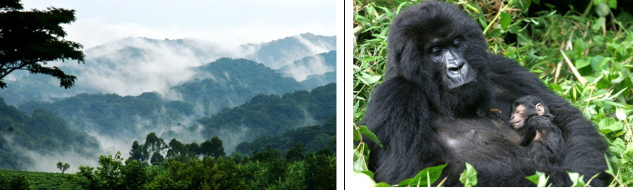
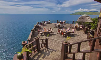 Time to return to Rwanda and fly back into Tanzania for an overnight stop in Kigoma, relaxing with unparalleled views on the Lake Tanganyika, before following the lake shore next day for a flight to Mahale.