From High Up

Flying and Travels

Mexico City — At Last!

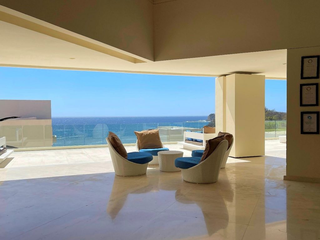
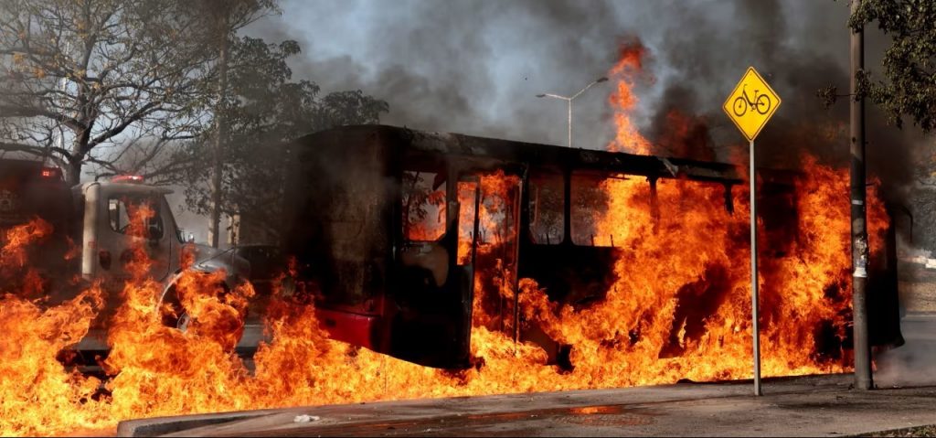
We were sitting around the table, drinking afternoon margaritas at Hacienda de los Santos, my favorite place in Mexico, when someone exclaimed, “Oh, crap,” loudly enough for everyone to stop their conversations and look up. He came to me to show me the iPad with a “Mexico on edge following drug lord’s killing” title in big letters, accompanied by a picture of a bus on fire.

Some 10,000 soldiers have been deployed across 20 of Mexico’s 32 states to maintain order following the killing of Nemesio “El Mencho” Oseguera in a military operation about 130km (80 miles) from Guadalajara city on Sunday, according to the article.

Schools in Guadalajara and several other Mexican cities were closed on Monday.  At least 74 people were killed, including 25 National Guard officers, in the operation that killed the cartel boss, and the subsequent violence over the killing of the 59-year-old drug kingpin claimed another.

Armed gunmen open fire in Guadalajara airport after drug lord El Mencho was killed by the military, according to the third article.

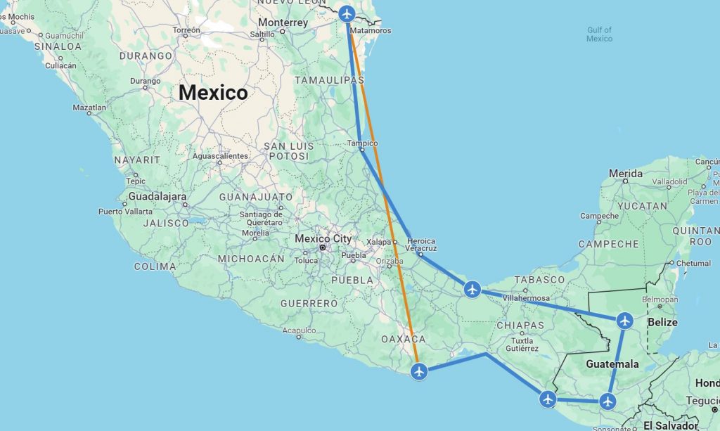
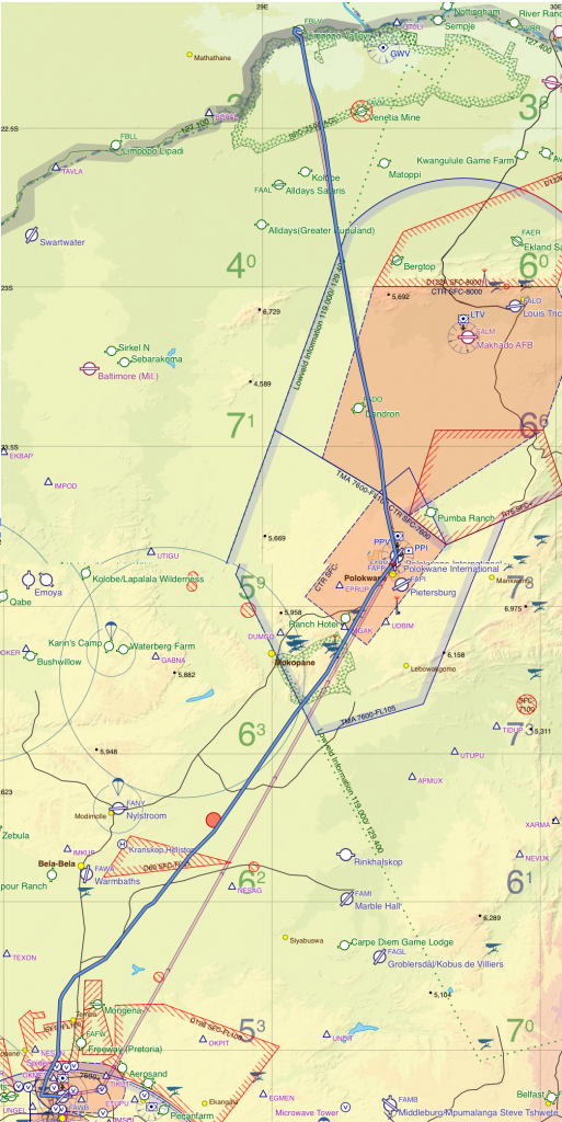
We were supposed to fly to Mexico City the next day, and then to Guadalajara. For the last 12 years, I’ve been organizing annual Cirrus flying trips to Mexico and Central America, and we have had 12 airplanes signed up. In a situation like this, as with any flight emergency, the first rule is not to panic. Since no immediate action was necessary, I decided to finish my margarita before diving into the news. Apparently, the violence was concentrated in the state of Jalisco, and specifically in Guadalajara and Puerto Vallarta. Mexico City was not affected, so after thoroughly checking, we decided to continue the flight there and figure out Guadalajara later.

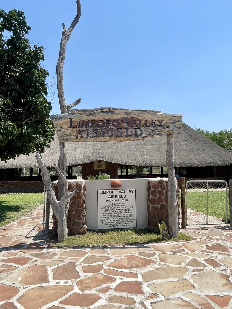
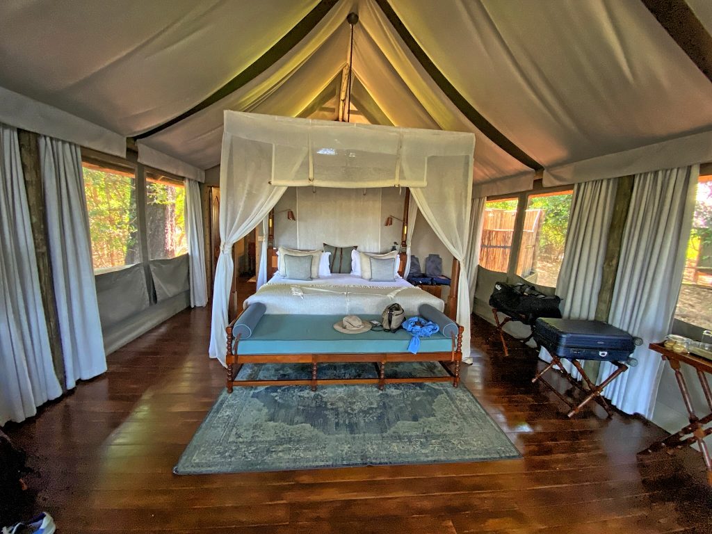
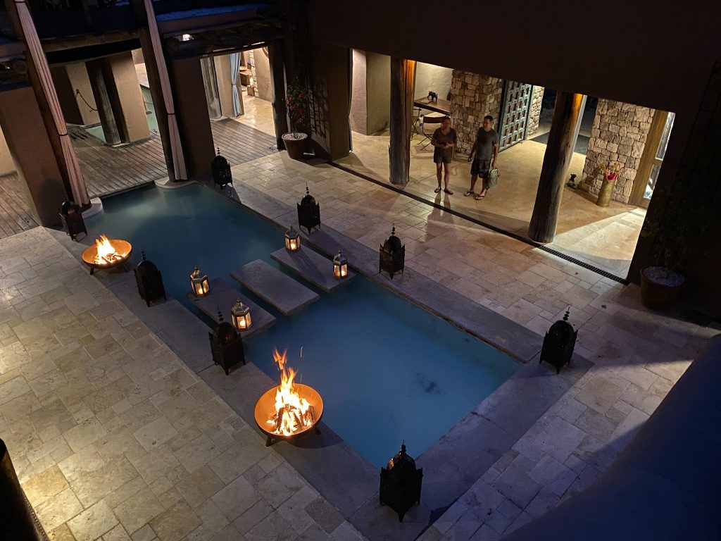
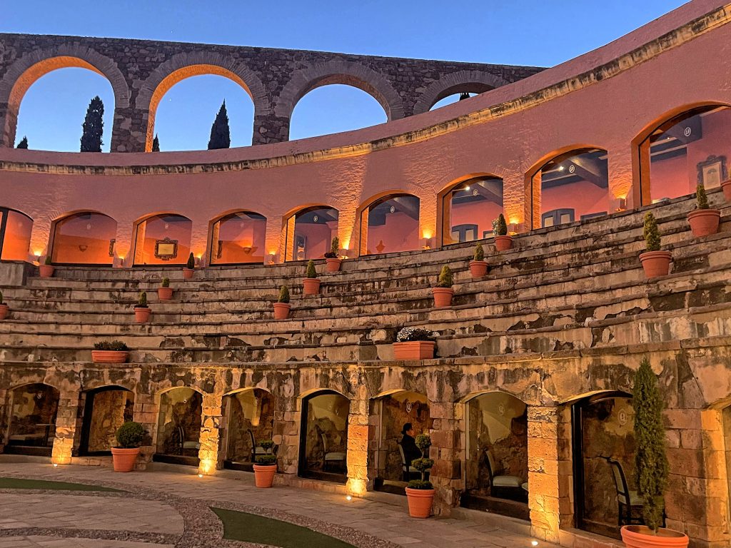
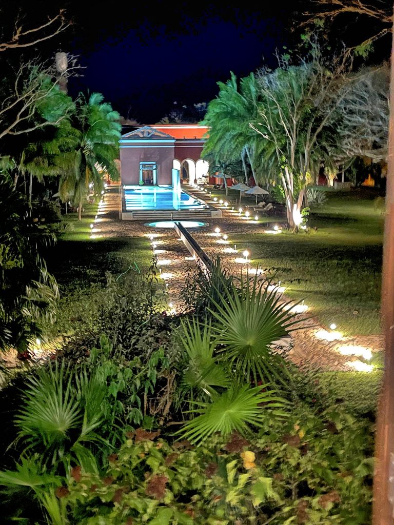
Hacienda de los Santos is located in Alamos, Sonora —a place so magical, we keep coming back for our annual Cirrus group flying trips. The Hacienda was crowned Conde Nast Traveller Winner in Mexico back in 2021 and has since won multiple other awards.

Dinner in Hacienda de los Santos

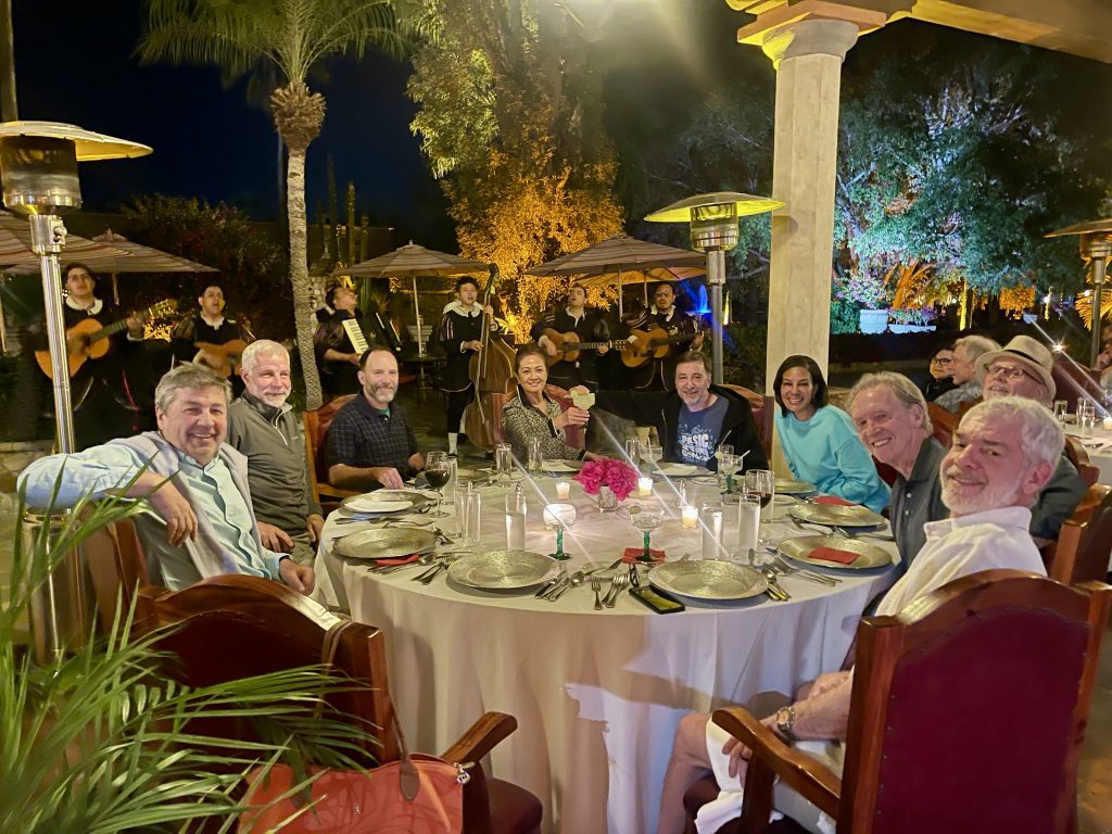
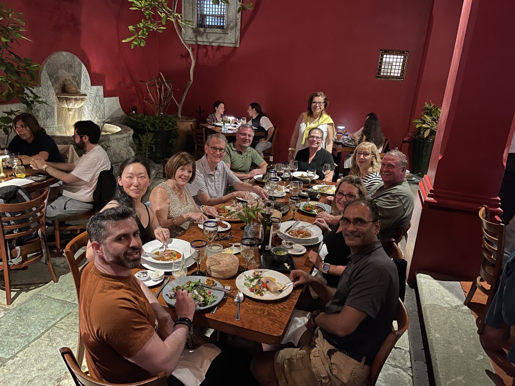
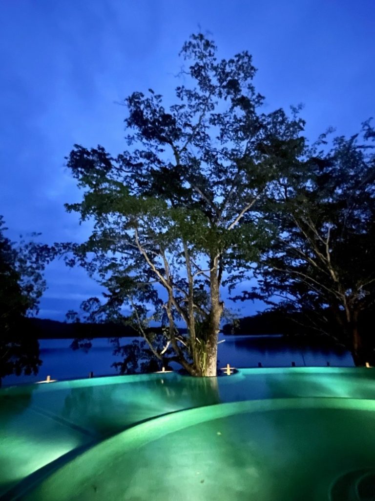
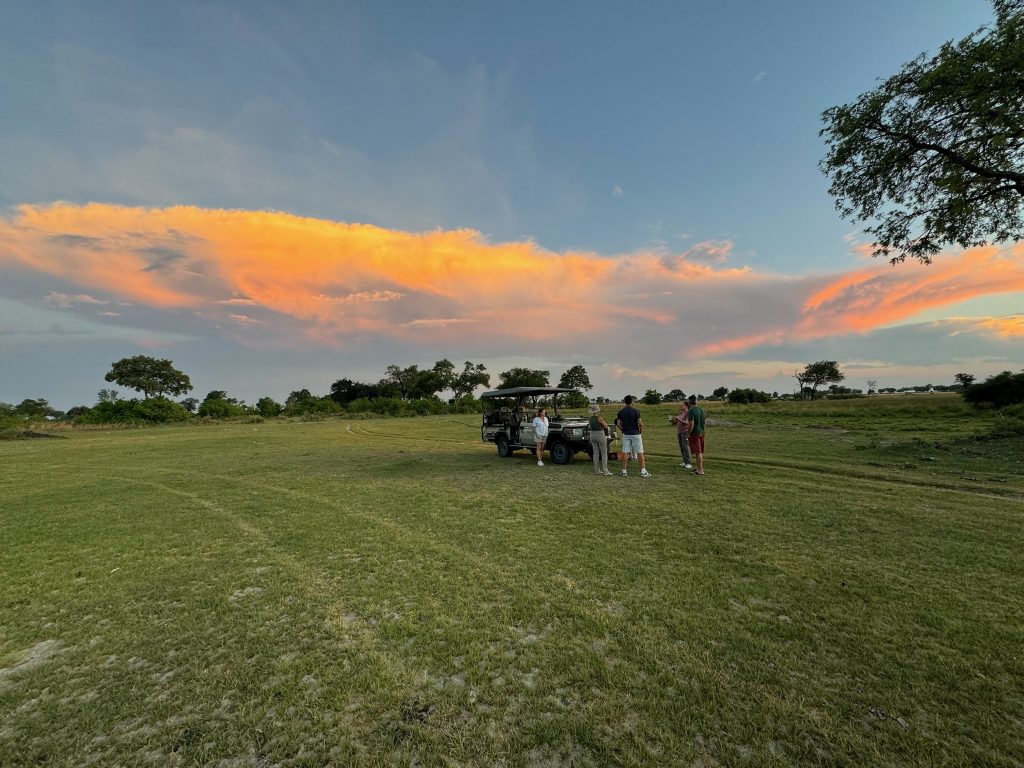
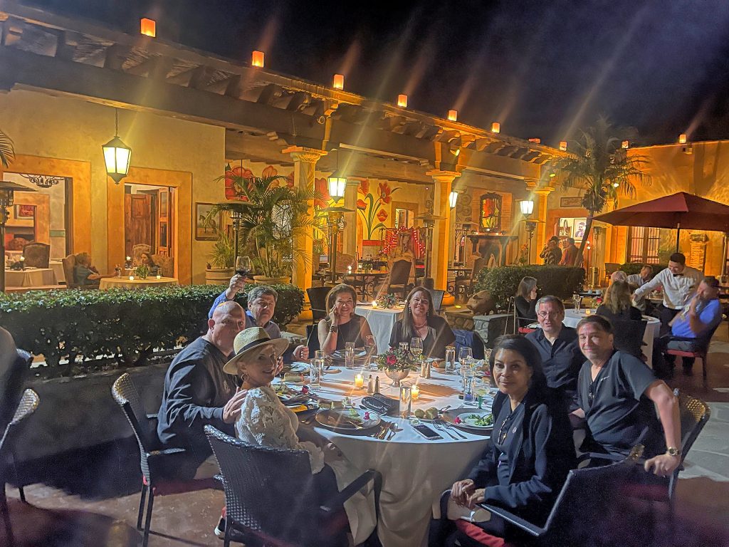
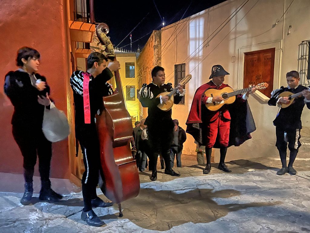
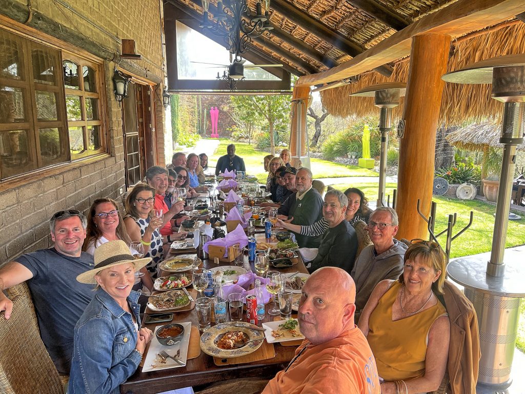
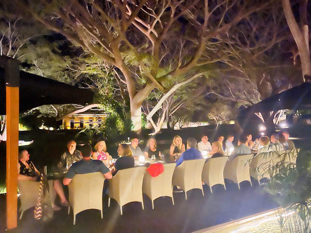
A great three-course dinner under the stars, at round white cloth tables, with a local students music group playing Mexican songs, with margaritas and wine was a fantastic way to get to know each other at the beginning of the trip. Jim Swickard, the Hacienda owner, is a tequila collector, so this was not a typical sugar-cane based margaritas, but rather pure agave based enchanting drink.

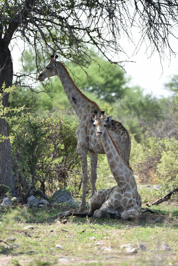
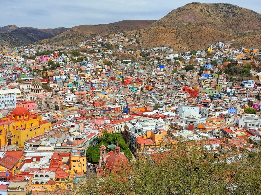
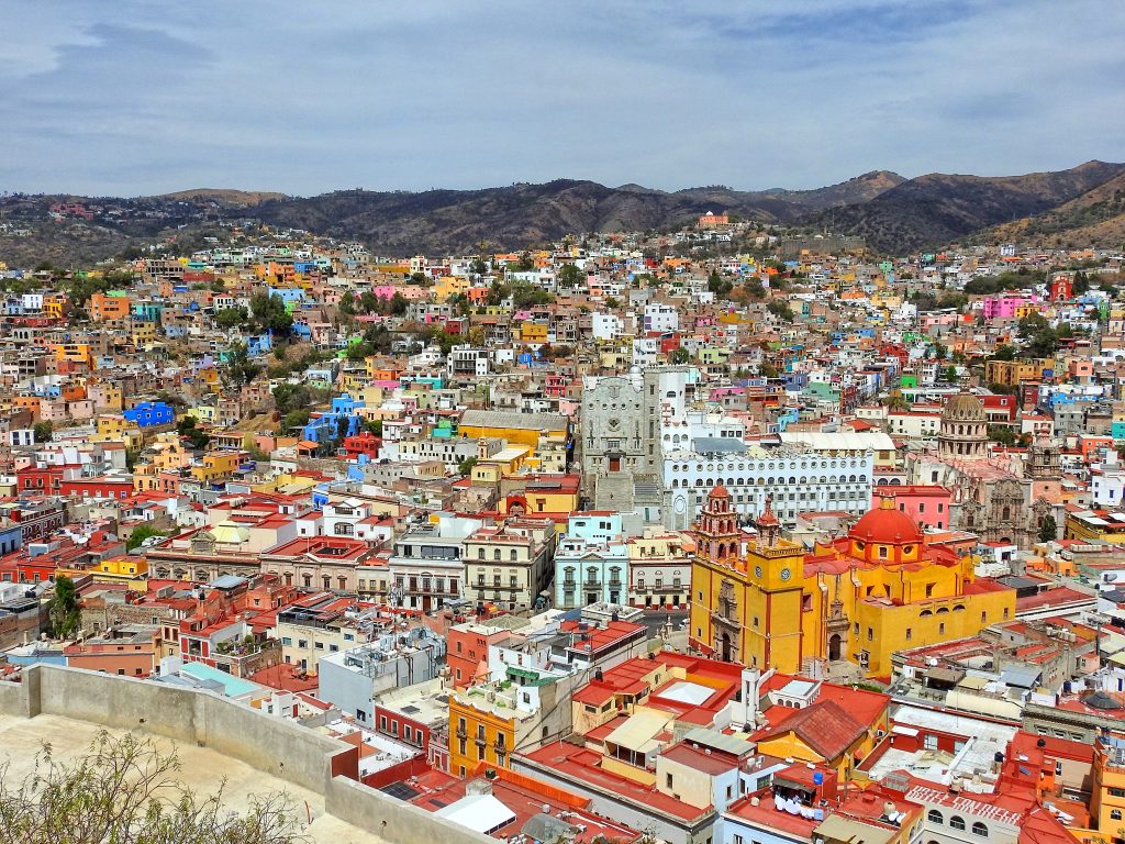
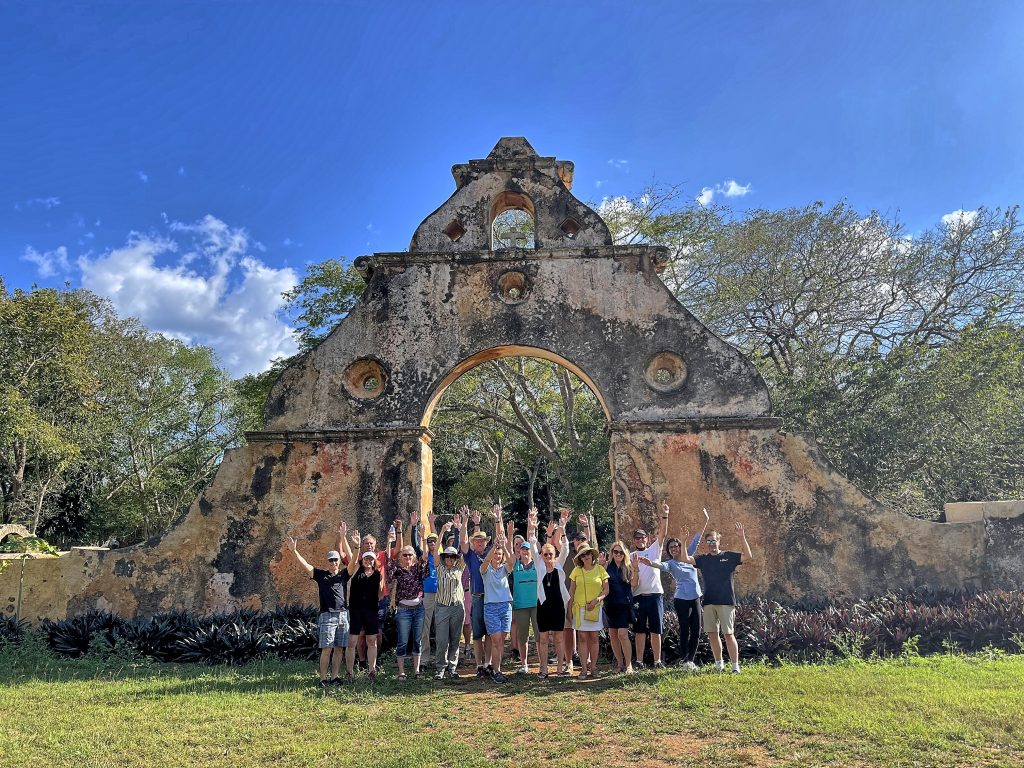
The city of Álamos itself, founded in 1681, is a living museum of Spanish colonial architecture. With nearly 200 buildings declared National Historic Monuments, it earned the title of Pueblo Mágico, joining the ranks of Mexico’s most charming towns, such as San Miguel de Allende and Taxco. Once the silver capital of the world, Álamos has long been a crossroads for missionaries, explorers, and dreamers—and walking its cobblestone streets feels like stepping back in time.

Copper Canyon overflight

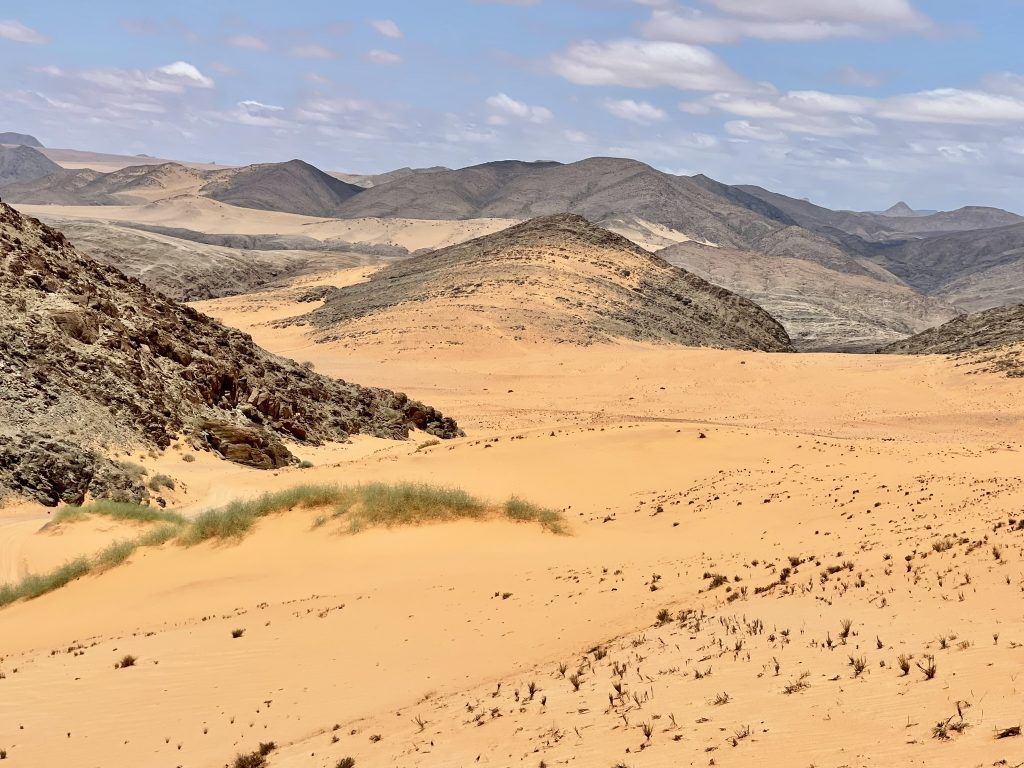
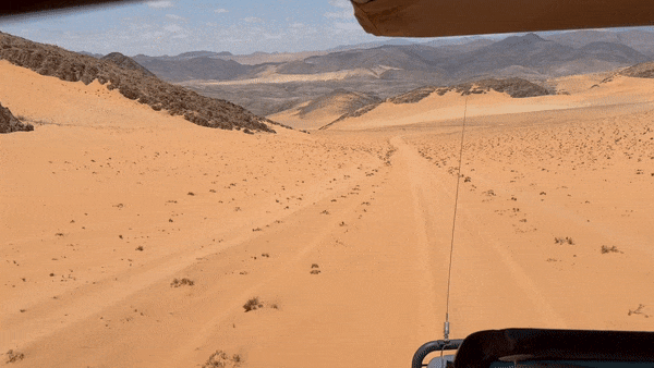
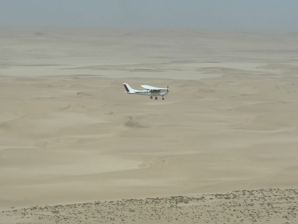
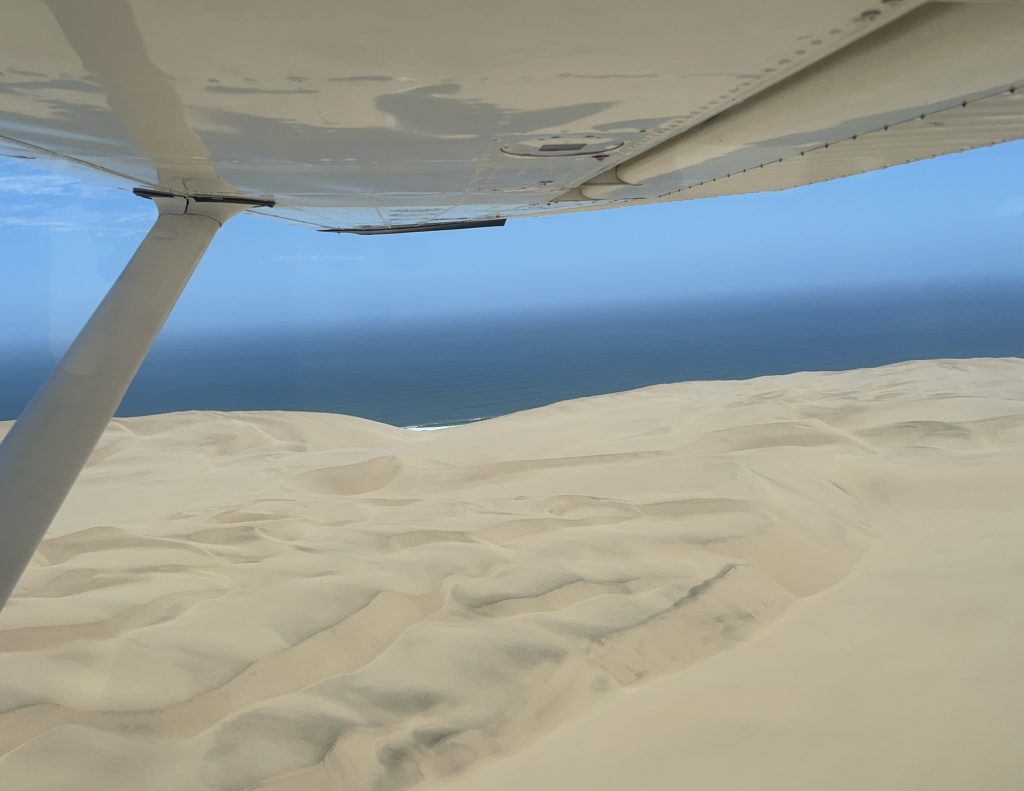
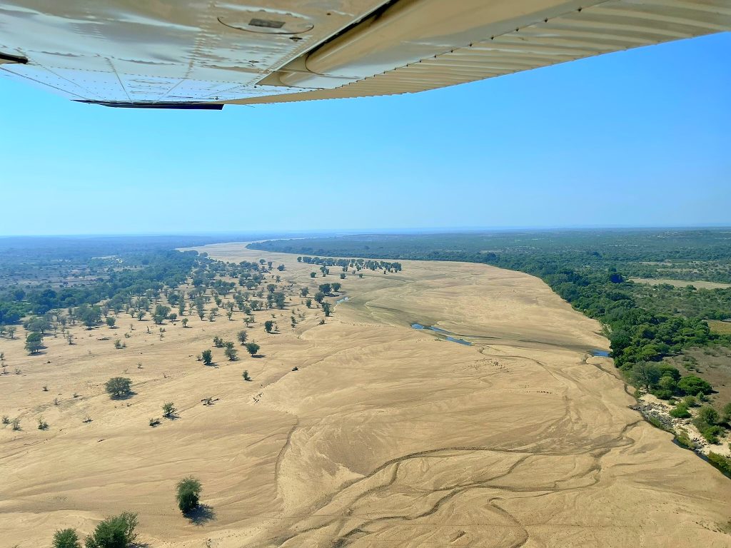
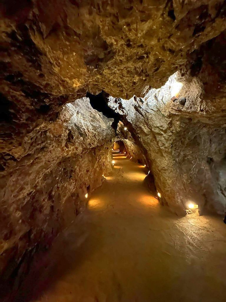
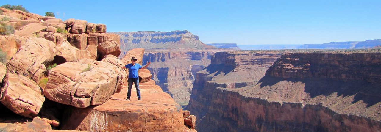
The flying highlight of a visit to Alamos is an overflight of Barrancas de Cobre, or Copper Canyon, a jaw-dropping system of six canyons carved into the Sierra Madre Occidental. Comparable to the Grand Canyon, Copper Canyon is nature on an epic scale. I was leading the flight of six airplanes and started by heading towards Baseachi Falls, an 800-foot waterfall, before continuing to Creel and entering the canyon, descending below its rim for magical views of its copper-green walls, following Rio Fuerte as it flows towards the Sea of Cortez.

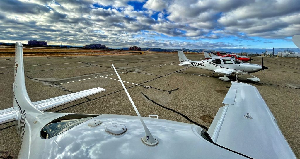
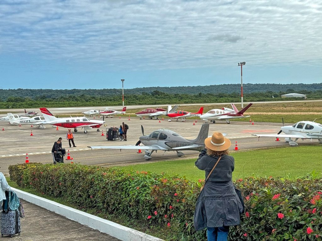
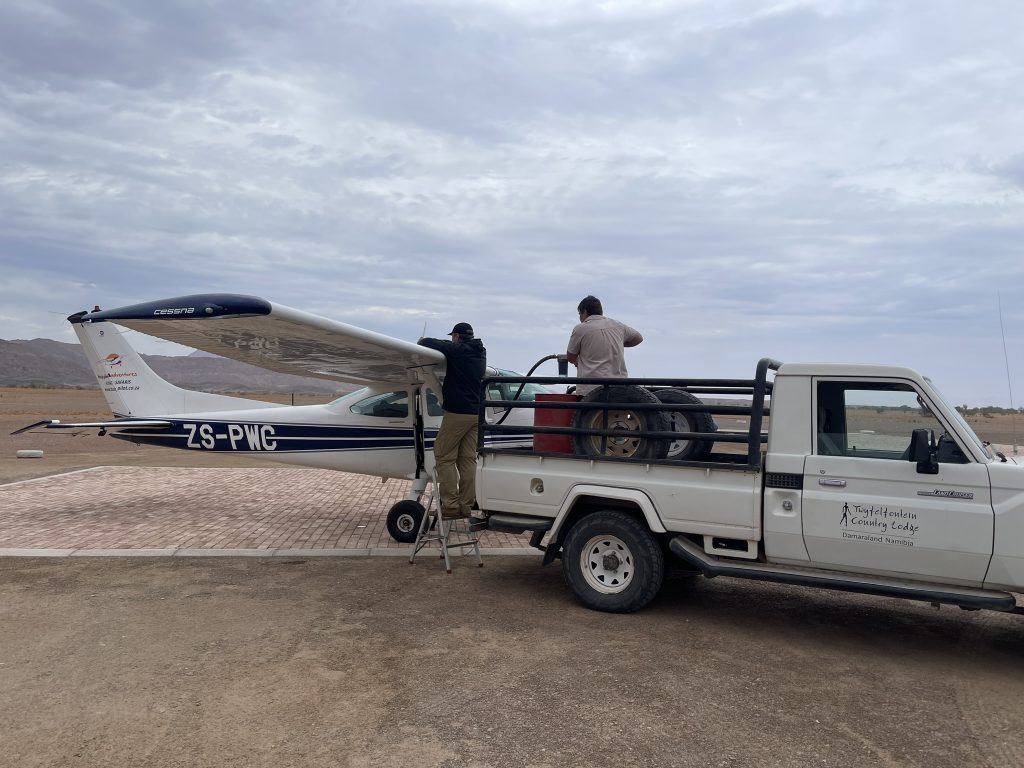
Alamos doesn’t have fuel, and with the Copper Canyon overflight, we needed a fuel stop to reach Mexico City, 700 miles away. Mazatlan is a great beach town, and it also has a very efficient airport. We called a week ahead to ensure they had fuel and were prepared for our Cirrus invasion. The fuel stop was as efficient as it could be in Mexico, where it always involves a review of documents in the commandante’s office, paying landing fees, filing a flight plan, and hailing a fuel truck. Flight plans are filed in person by submitting paper forms that I prepared for everyone. You would be out of luck if you didn’t have them pre-printed, because airports don’t provide blank forms.

Cirrus group in Atizapan

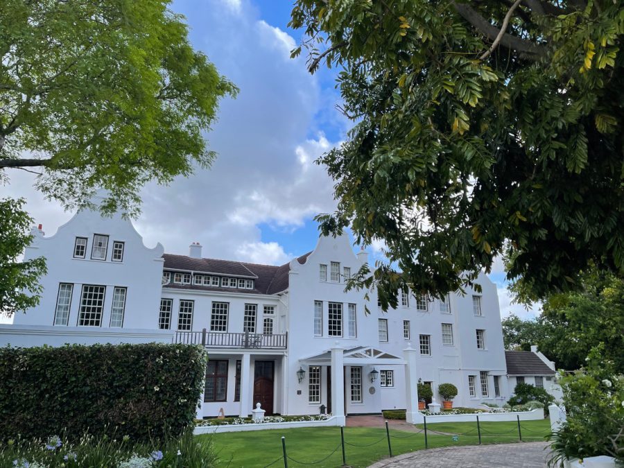
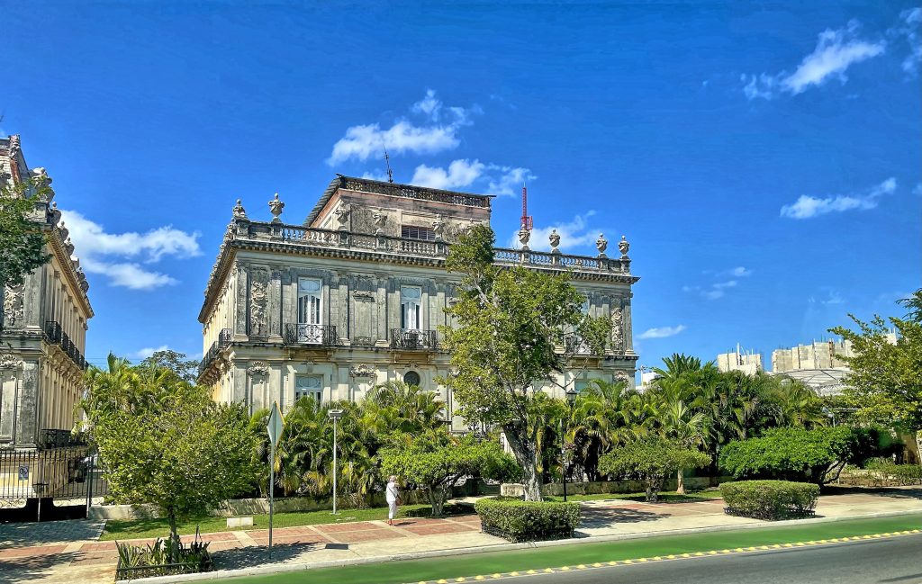
Atizapan (MMJC) is a GA entry airport into Mexico City. It is theoretically untowered, but don’t be surprised if you are cleared to land. Oftentimes, you will need to decide whether to land on the upsloping runway 22 with a tailwind or the downsloping runway 04 with a headwind. I contacted the Monarch FBO before arrival, and they put me in touch with Moises Sacal, the CSIP based at MMJC, who helped us immensely prepare for the arrival and was present in the tower to guide us to landing. Héctor Martinez and the whole crew of Monarch FBO were fast, efficient, helpful, smiling, and welcoming. We boarded buses to drive to our hotel, Casona, in the Roma Norte neighborhood.

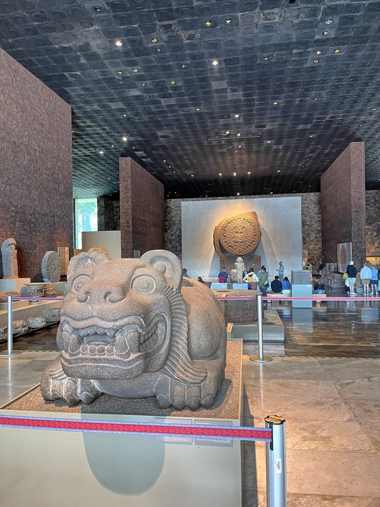
The next day, we began with a guided tour of the Anthropology Museum, which houses significant archaeological and anthropological artifacts from Mexico’s pre-Columbian heritage. The museum is home to the world’s largest collection of ancient Mexican artifacts, spread across 23 rooms. Some of the most iconic Mesoamerican artifacts discovered to date are here, including the Stone of the Sun (the Aztec calendar stone) and the Aztec Xochipilli statue. Although it was largely insufficient, 2.5 hours was all we had to visit that magnificent location.

Anthropology Museum

After a lunch in Azul Restaurant and a quick visit to the Centro Historico, we were ready to return to the hotel. We made a dinner reservation at Contramar, the famous seafood restaurant, only a 5-minute walk from our hotel. The restaurant lived up to its reputation, the food was fantastic, and although they crammed us a bit around a table, we had a great time.

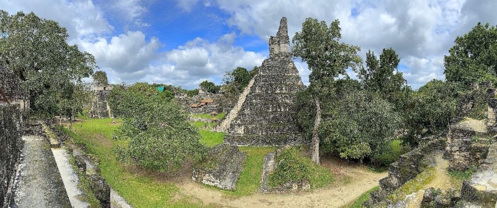
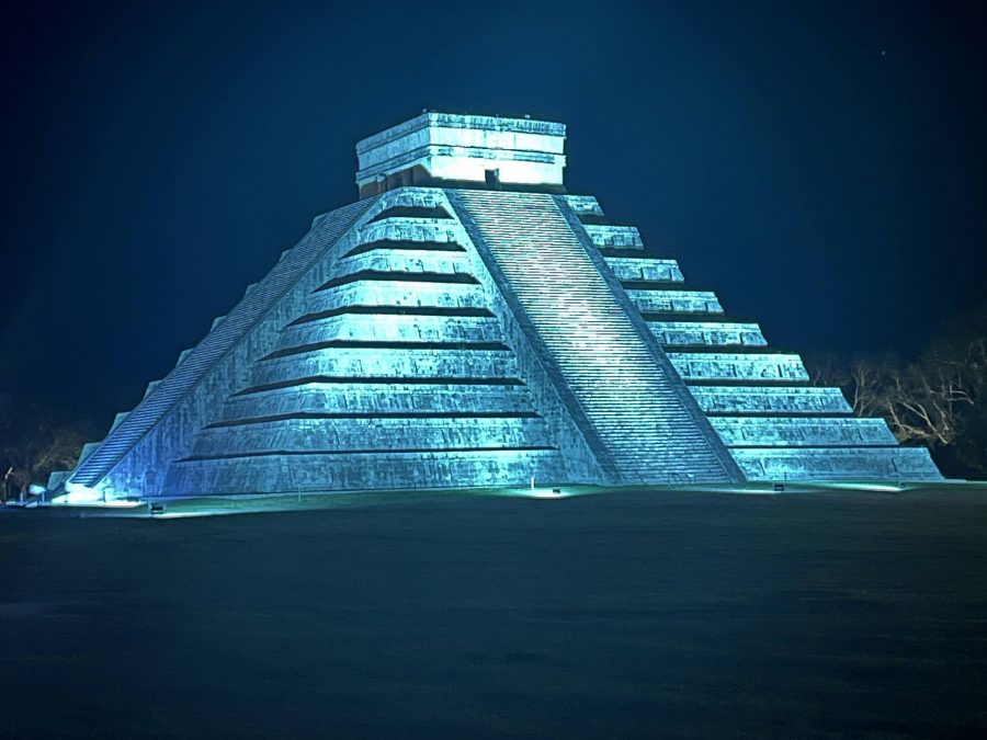
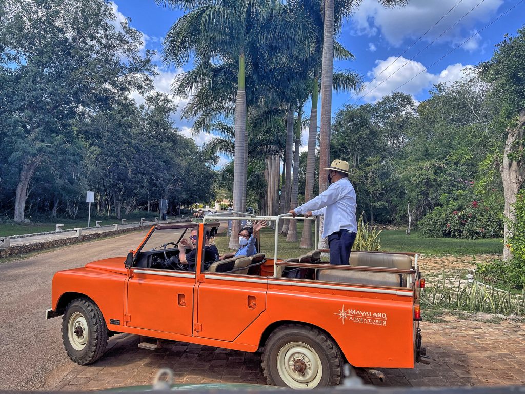
The next morning, waking up was brutal; the bus picked us up at 5 am for an hour drive to Teotihuacan. Although close to Mexico City, Teotihuacan was not a Mexica (i.e., Aztec) city, and it predates the Aztec Empire by many centuries. At its zenith, perhaps in the first half of the first millennium (1 CE to 500 CE), Teotihuacan was the largest city in the Americas, with a population estimated at 125,000 or more, making it at least the sixth-largest city in the world. Our destination and the reason for the early-morning ride was a hot-air balloon compound, where, after waiting for close to an hour in bitterly cold morning air, we boarded the balloons.

Hot air balloons over Teotihuacan

I originally planned to overfly the Teotihuacan site in our airplane, but the balloon is definitely the better way to do it. You float in silence, punctuated only by puffs of burning gas to inflate the canopy, and have the time to admire 360° views around. Balloon operator skills seem unbelievable to this powered aircraft pilot. Without any directional control, they can guide the aircraft to fly where needed and safely land in an open area between houses, trees, and power lines.

After landing and a morning coupe of champagne, we visited the site on foot. We walked the Avenue of the Dead, towards the Temple of Quetzalcoatl and the Pyramids of the Sun and the Moon, which are all laid out on geometric and symbolic principles.

Following an early-afternoon return to the hotel and a much-needed siesta, we met Susana, our guide for the evening and a food journalist, for a culinary walking tour through the neighborhoods of Condesa and Roma to savor unforgettable flavors—from classic street food to bold, innovative creations and celebrated drinks. We started at Maizajo, a Michelin-starred taqueria known for its signature corn tortillas, and continued at Castacán, another culinary wonder from Contramar chef Gabriela Cámara. We ended the evening splitting the group between a wine bar and a cocktail bar.

Xochimilco canals

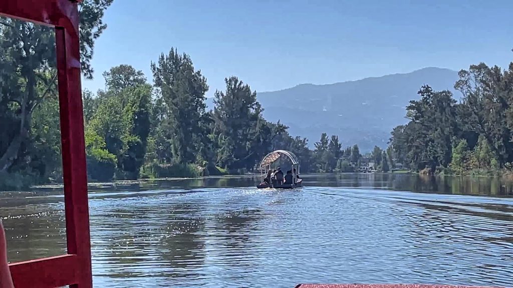
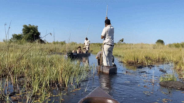
The following day, a bus took us to Xochimilco, a borough of Mexico City. Xochimilco is best known for its canals, remnants of an extensive lake-and-canal system that connected most of the settlements in the Valley of Mexico. It is variously described as the Mexican Venice, a cultural booze cruise, and even a youth club on water. The gardens are actually called chinampas, and far from floating, they’re islands constructed by the local population in pre-Hispanic times. They’re held together with the roots of trees, so though they’re man-made, they’re created entirely from natural resources.

We spent a wonderfully calm hour floating on a barge along the canals, pushed by trajineros, who used long poles to navigate the shallow waterways, before disembarking at one of the barrios for lunch under a canopy and an interesting lecture on local agricultural techniques and the history of Xochimilco.

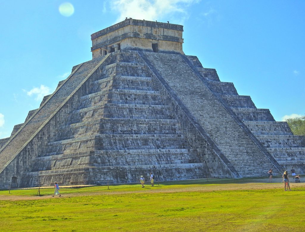
After returning to the hotel, we held a group meeting to discuss the next steps. While the US media continued to show and describe dramatic events from a few days ago, in reality, the violence had abated. However, our itinerary included an excursion outside the city to the town of Tequila. It is a very picturesque region, with fields of agave plants, and included visits to tequila distilleries, but it was outside of the city. Since there was still a possibility that cartels might stage road blockages, we decided to change the program and skip Guadalajara altogether.

When planning the trip, we wanted to reserve a table at another famous Mexico City restaurant, Rosetta, but that proved surprisingly difficult. They insisted that the whole group choose one and only one main dish, a requirement that I’ve never met anywhere else in the world. I think they didn’t want to host a group and did everything in their power to discourage us, but it takes more than that to have a group of pilots give up. I booked 6 reservations under 6 false names, each for 4 guests, all at almost the same time. It was fun to find ourselves at the restaurant and exclaim, “What a surprise, Tim!” The dinner was correct but far from as extraordinary as the restaurant’s fame would have you believe.

Before the trip, I contacted Daniel Vogel, president of FEMMPA, the Mexican equivalent of AOPA, and he joined us for dinner at Contramar. Daniel recommended the Casa Madero winery in Parras de la Fuente, close to Torreón. Established in 1597, this is the oldest winery in Mexico, or in fact in North America, and with its own runway. We spent the preceding two days contacting the hacienda San Lorenzo, which is part of the winery, and discussing our possible arrival. This included several emails, phone calls, and WhatsApp messages, but by Thursday, we had everything arranged. After discussing it with the group, the decision was made to fly there.

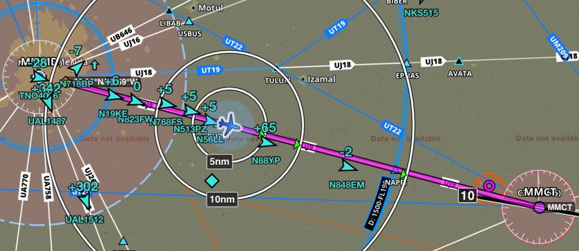
A year ago, the Mexican DGAC (equivalent to the FAA) decertified almost all untowered airports in the country. There is an obscure distinction between private airports and private airports with third-party services. To obtain that later status, an airport has to apply for a license and pay a fee. Needless to say, the vast majority didn’t do so. While officially, Alamos airport is closed to all except those based there, in practice, flight plans to Alamos are accepted at most airports in northern Mexico. I was pretty sure that Hacienda San Lorenzo (MM37) didn’t have the license, and was thus concerned that we wouldn’t be able to file a flight plan with it as a destination. But then, this being Mexico, anything was possible. Recall that down there, all departures from towered (or pseudo-towered, such as MMJC) airports require a flight plan. Plan B was to fly to Torreon and change it in flight.

Dinner at Hacienda San Lorenzo

Departure from Atizapan on Friday was quite an experience, and we would never have been able to get out without absolutely amazing help from the Monarch FBO.  I do not use handlers or FBOs when flying by myself in Mexico, but with a group, it is practically a must. We first had to drive to the operations office to present all our documents, including the AIU (permit) we obtained in Ciudad Obregon, insurance, airplane registration, airworthiness certificate, pilot certificate, and medical certificate. After a local official verified that, we had to call the Mexico Center to dictate the flight plan. This is similar to what we used to do in the US when filing flight plans with FSS, because Atizapan is officially untowered. At a towered airport, you show the flight plan to an employee in the operations office, who enters it into the computer so the tower can see it. The good news was that no one objected to our destination, so we could legally fly to Parras.

Cirrus fly-by

The flight to Parras was just 2.5 hours, and I had an opportunity to do a close pass by another airplane. We agreed to that in advance, and we both got great shots. I jokingly refer to this as “a G3 overtaking a G7,” but, of course, the G7 was flying at a pre-agreed lower airspeed. G3 with a turbo-normalized engine, such as mine, is still faster than G7, just not that much. Landing in San Lorenzo, some pilots had trouble locating the runway; small hills hide the final approach to runway 28.

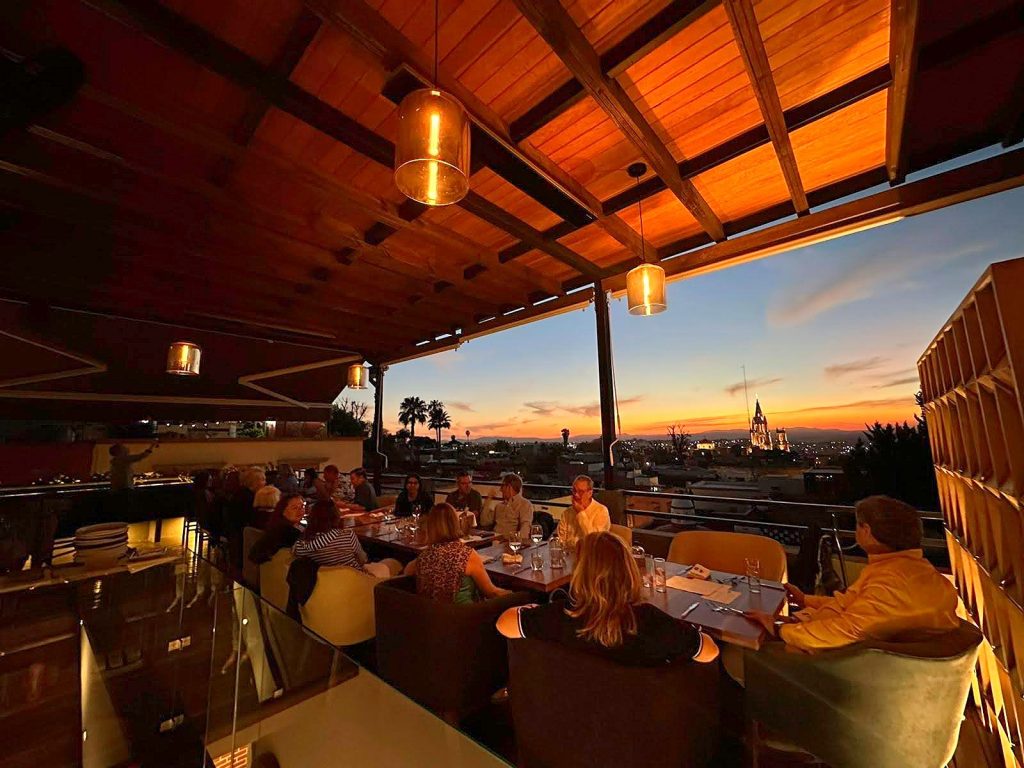
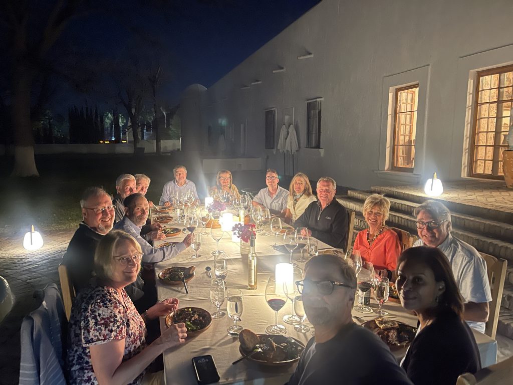
A dinner at a table outside in the evening, a quiet night with stars and excellent local wines, was magical; we needed an evening of calm after the hustle of Mexico City.

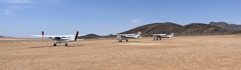
The next morning, the group split, with two airplanes flying back to the US and the remaining ones continuing to Creel, a relatively new airport at the top of Copper Canyon. First, we flew to Torreon, where I pre-arranged handling with the Platinum FBO. I sent them all the documents and our flight plans ahead of time. They pre-filed them before we even got there, and helped the two international flights clear customs and immigration. It was as smooth as I wish all airports were, and reasonably priced, at least for domestic flights.

Hotel El Mirador by Balderrama

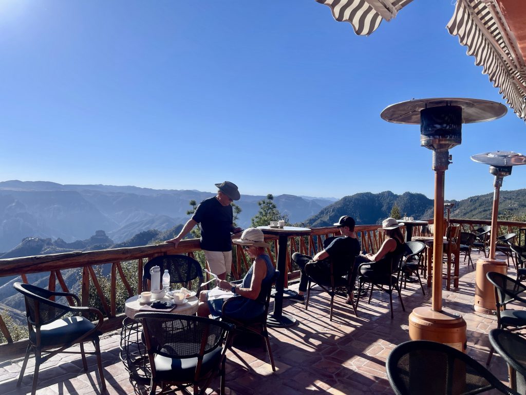
The airport in Creel was constructed over a dozen years ago, but it was later discovered to be built on native land, and the local tribes promptly sued. The settlement was reached ten years later, and the airport is supposed to attract commercial flights and many more tourists. As of now, there are no commercial flights, and the terminals are empty. They have fuel, but it is not an Airport of Entry; therefore, you cannot fly there directly to or from the United States. It took us a couple of days of emails, phone calls, and WhatsApp messaging to reach the El Mirador by Balderrama hotel and arrange transportation between the airport and the hotel. The hotel is situated in a picturesque location, and seeing the Copper Canyon from the ground level was a whole new experience after seeing it from the air.

To exit Mexico, we flew to Puerto Penasco (MMPE), another airport built in hopes of a major tourist boom and many commercial flights, with none flying there at present. It is a very fast and efficient place to enter or exit the country, and if not for the oppressive heat, it would be a very nice stop.

Our Mexico adventure ended; despite ominous beginnings, we managed to navigate safely, have fun, discover new places, and make new friends. If you’ve never flown south of the border, an organized trip such as ours is the perfect way to spread your wings. We take care of all the logistics, permits, flight plans, set up the itinerary, reserve hotels and restaurants, and arrange transportation and guides, while you enjoy flying.

The Land of Pura Vida

Trip itinerary

I always loved flying long distances and to different countries. Last year, we flew to Guatemala, so it was natural to look further south for this year’s adventure. Unfortunately, neither El Salvador nor Nicaragua have the tourist facilities that we wanted. Honduras was an option with the island of Roatan, but we ultimately decided to fly to Costa Rica.

ChatGPT says that in Costa Rican culture, Pura Vida is a way of life that embodies a laid-back, positive, and optimistic attitude. It’s used as a greeting, a farewell, a way to say thank you, or simply to express that everything is going well. It reflects a philosophy of enjoying life, being grateful, and staying relaxed, no matter the circumstances. The phrase has become a symbol of the country’s friendly, welcoming vibe and the natural beauty and simplicity of life in Costa Rica. I’ve been to the country three times already, and I can confirm that ChatGPT is right.

A while back, we decided to limit the number of airplanes in our group to 12 to reduce the processing time at airports we land. In 2024, Mexico changed regulations for private flights. Previously, an entry permit was valid until the end of the calendar year; now, it is valid only for 6 months. While previously you were getting it upon arrival, now they want all the documents sent 2 days earlier. Which doesn’t change anything because they only start preparing it once you show up. With typical Mexican efficiency, they don’t publish email addresses where these documents are to be sent. They also began to enforce their own version of APIS, except that they still couldn’t build simple online infrastructure to enter the data. Instead, you are supposed to email a monstrously formatted Excel spreadsheet to a central email address and to local Airport of Entry (AOE). Of course, emails to local AOEs are not published. All of that makes me want to avoid Mexico as much as possible. Unfortunately, our airplanes don’t have the range to hop over it.

Oaxaca

We had participants flying in from the West and East Coasts, so McAllen, Texas, seemed the best place to meet before heading South. We departed from home on Friday morning, to a pouring rain and met part of the group in Sedona, where we spent the night.

Ramp in Sedona

There is a great FBO, McCreery Aviation and Cirrus Service Center on the field, and we prefer that town to the alternative, Brownsville. We had only 11 airplanes in the group because the 12th had last-minute issues that prevented him from participating. Our first stop was Oaxaca, Mexico. One airplane was an SR20, and the pilot felt uncomfortable stretching his range on his first international flight, and rightly so. To help, I accompanied him and arranged for an informal handler to facilitate our entry into Mexico in Tampico. These individuals are present at Mexican airports and charge a $100-$200 fee cash for walking pilots through different offices and collecting necessary stamps. It shows the absurdity of Mexican bureaucracy that something like this is needed.

All the others flew directly from McAllen to Oaxaca. We had a handler in Oaxaca; my previous experiences with group flights there were so bad that this was the only option. The handling costs were quite high for all the paperwork entering Mexico, but they did a superb job of whisking us through the airport, except for fuel. Fuel at most Mexican airports is handled by a government-controlled company, and they are notoriously underfunded. There are no self-service pumps anywhere in the country, and Oaxaca has one fuel truck servicing all of the airport. Given that it takes them about 15 minutes to service one airplane, it took almost 3 hours for all of us to get fuel. All of that under the scorching sun. The handler, Aeorosync, just shrugged at the complaints, “Not my problem.” I tried to explain it was, even if he didn’t have direct control over the fuel, because we were paying him, but the concept of customer service was lost to them. While Oaxaca is a fantastic city to visit and a convenient stop for flights to Central America, this is the last time I will bring a group over there.

We stayed in Quinta Real, which is located in the beautiful Santa Catalina de Siena Ex-Convent, located in the heart of the city. We walked a few blocks to the center, looking for a shop selling mole, and stumbled on a parade. Dinner was in a fantastic restaurant, Catedral, which served a mouth-watering variety of different mole-based dishes. During our previous trip, we were already in that restaurant in 2019, and the food tasted even better this time.

Dinner in Catedral

Overfly permits

The following day departure was fast, it was a domestic flight to Tapachula, a small town at the border with Guatemala. It is a sleepy little airport with grumpy personnel. We managed to get fuel and pass outbound immigration and customs checks without having to take our luggage out of the airplane through an ancient X-ray machine.

To overfly Guatemala and Nicaragua, you must apply for an overflight permit. El Salvador is the only country in Central America that realized that overflight permits are useless bureaucratic processes. These countries have no way to verify that the data I submit is correct, that my passenger and I are in the airplane, or even that the airplane is what I say it is. They don’t have the Air Force, so if I choose not to talk to them on the radio or ignore their instructions, there is nothing they can do to stop me from overflying their territory. Still, this is a group trip, and while I might be tempted to engage in such shenanigans while flying alone, I would never put others in that position, so I applied for permits.

I did that two weeks before departure, which turned out to be a mistake because Guatemala permits are valid only for 14 days. It took 3-4 iterations to submit the application and copies of required documents exactly as they wanted it, but I got permits for all the group. For Nicaragua, it was easier; they only wanted $100/airplane for the privilege of overflying their country. The positive side of the experience is that both countries replied to applications within a day and that the permits were valid for outbound and return flights. In case of Nicaragua, it was only for the specified dates, so if you change your mind when you want to fly back, it is another $100.

We had a handler in Liberia, and I highly recommend getting one; even if you fly by yourself, it saves an enormous amount of time. South of Mexico, you are in permit land, all the way to the South Pole, and handlers are essential. Aerologistica provides fantastic service. They waited for us upon arrival; the fuel truck was there; they whisked us through the immigration and customs via crew lines and packed us into buses for a ride to our first hotel. It took less than half an hour from landing to the bus.

Costa Rica

Casa Chameleon

Casa Chameleon at Las Catalinas is about an hour’s drive from Liberia on the Guanacaste coast. It is part of the recent development, including a modern village with shops and restaurants, timeshares and more hotels. Rooms are beautifully appointed, with small private swimming pools. Both restaurants at the property have similar menus, but we also went to the village for a great dinner at Hotel Santarena. Many activities are available, including sailboats, ATV rides, and zip lines, but we opted to simply relax in the hotel and take it easy.

After three nights and two full days, it was time to go. Our next destination, Hacienda AltaGracia, is located in the central part of the country, with jungle and mountains. There is an airstrip next to the hotel, but it is only 1,700’, which I felt was too short for us. Equally importantly, there is hardly a space to park one airplane, let alone 12. The hotel refused to let us land there, and I didn’t insist for the reasons above. If I fly to Costa Rica myself, I will definitely plan to land on that airstrip; it is doable with proper technique. There is a significant upslope, so it is effectively one way in, one way out runway, and once you are on short final, you are committed to land, there is no go-around.

Spa at Casa Chameleon

Instead, we flew to Tobias Bolanos or Pavas Airport (MRPV). There are two airports in San Jose, Costa Rica. The main international airport Juan Santamaría (MROC) is not very GA-friendly. Although I landed there in 2022, they were reluctant to accept and provide parking for 12 airplanes. It took over half an hour to hop over from Liberia to Pavas.

At Tobia Bolanos airport

This time, we had to wait longer to refuel, and they made us haul the luggage through X-ray machines before we boarded private charter flights to Hacienda Altagracia. We had three Cessna Caravans chartered. It was a short 20-minute flight, and the pilots were very skillful in putting the airplanes down on the short field, having done that thousands of times.

Hacienda AltaGracia is an all-inclusive luxurious resort located in Perez Zeledon canton in the central part of the country. Composed of beautifully appointed casitas, many with a private swimming pool, restaurants, spa, and stables, it is an ideal place to relax for a few days. Many optional activities include horse riding, canopy tree climbing, electric mountain biking, nature walks and hiking in the Talamanca mountains, ziplining, and many others.

February is a dry season in Costa Rica, but we had daily rains, and on the day of departure, it was low overcast with limited visibility. The plan was to board our charter flights back to Pavas, but the charter planes couldn’t land at the Hacienda airstrip in those conditions. After an hour’s wait, when it became clear that the weather would not improve, we had no choice but to board a bus for a ride back. What was supposed to be a half-hour flight turned into 4 four-hour bus ride, putting us significantly behind the schedule.

Acapulco

The departure from Pavas was relatively fast despite this being an international flight, and we launched at about 1 pm for a 3.5-hour flight back to Tapachula. The SR20 didn’t have enough range to fly from Pavas, so the pilot flew back to Liberia to top it off. We knew that Tapachula airport closes at 6:30 pm, in spite of being a mandatory Airport of Entry coming from the South. By the time he was ready to fly out, it was already 2:30 pm, and he had correctly chosen to stay overnight in Liberia. Nicaragua refused to accept his flight plan the next day because his permit was valid for only the specific date. It was too late to request a new one, so he flew G436 airway outside of Nicaragua FIR and outside of glide range to the coast.

Everybody else launched for Tapachula via Managua, but as soon as we were over Nicaragua, we got direct to a fix at the border with El Salvador. We arrived at the destination between 4:30 pm and 5:00 pm, and that is when the fun began. First, the immigration officer told us it was OK to leave the luggage in the airplane, then the customs officer insisted that we bring all inside and put it thru an X-ray machine. When we brought it inside, he promptly disappeared for half an hour. We chased him on the tarmac, and he reluctantly returned to affix the required stamps on our flight plans. It was already about 5:30 pm, so our next leg would be after sunset. Since there is no night VFR in Mexico, we were all filing IFR to Acapulco. This was when the commandante invented a new rule prohibiting single engine night IFR flight in Mexico. There is no such rule, but that didn’t prevent him from researching the topic for another half an hour before finally relenting and stamping our flight plans. We rushed to the airplane and managed to depart, followed by about half of the group. The 6th airplane received a clearance with instructions to taxi and hold short of the runway, and when he was there, he was instructed to taxi back to the ramp because the airport just closed. The remaining part of the group had to spend the night in Tapachula, and it is most definitely not a town you would ever want to visit.

It was the second time in my 20+ years flying in Mexico that I encountered such bad faith behaviors. I wish I could say, like for Oaxaca, that we will never return to Tapachula, but unfortunately, that is the only choice.

Our night flight to Acapulco wasn’t easy either; we had IMC conditions with icing at 14,000 and lightning around. It was also a very long day, but we arrived around 9:30 pm at a completely deserted airport. We arranged transportation ahead of time; the vans were waiting and hoped on for a 20-minute ride to Encanto Hotel.

Encanto Acapulco

We’ve been to Encanto in 2013, the idea was to visit Acapulco, but we fell in love with the hotel and didn’t leave for 4 days. It was designed by a famous Mexican architect, Miguel Angel Aragonés, and is truly an architectural marvel. We planned to visit with our group in 2024, but hurricane Otis devasted the city, and everything was closed. We promised ourselves we would return, and we did. You can still see the damage that the hurricane inflicted on the city, but the hotel was new, and we enjoyed a day of rest. This was the last stop of our trip, and some participants departed towards Texas, while a large part of the California group stopped for another day or two in Hacienda de los Santos. One pilot had to return earlier and flew from Tapachula via Cancun to Key West.

The weather throughout our trip was VFR, except for the night flight to Acapulco. Even there, we could have flown VFR remaining below clouds if it was day. Mexico has become more difficult, bureaucratic, and, in some places, outright hostile. As much as I used to be a chief apologist for Mexican chaos in the past, I now wish we had the range to overfly that country. After 35 hours of flight time and 5,600 miles flown, it was good to be home.

Organized trips like this one are a great way to spread the wings outside our
borders without the stress of dealing with different languages, different procedures and unfamiliar rules. Flying in a group is easier and safer. We communicate on an air-to-air frequency about any unexpected issues, interesting sights or ATC directions. A camaraderie develops during
flight debriefings, which invariably take place in a bar and often persist well
after a trip is completed.

New Zealand Flying Adventure

This is the first blog entry describing our flying in New Zealand. The second part contains practical information for pilots, such as license validation and differences compared to flying in the US.

I was invited to a CPPP (Cirrus Pilots Proficiency Program) in November 2024 in Port Macquarie, Australia, to give a series of Cirrus Perspective training courses. It is a long flight from San Francisco, so we decided to stay a little longer and visit. While flying in Australia was tempting, New Zealand was on my bucket list for a long time, so we decided to head there. An obvious choice was to sign up for one of the Flyinn trips. They are based in Wanaka on the South Islands and offer three itineraries, 8, 11, or 19 days. Choosing that option would relieve me of many PIC responsibilities, but this is precisely what I find interesting in flying in different countries. Learning how they do things differently, airspace, radio phraseology, dealing with weather and countless other PIC tasks. It would also mean that we would always have another pilot in the cockpit, with my wife relegated to the back seat. Finally, while the itineraries are very well selected, I prefer to make my own choices. All that led me to choose a truly self-flying option.

Actual flights

Tauranga

Our trusty Cessna 172

The Tauranga Aero Club offers a well-equipped Cessna 172 for hire and handles license validation. ZK-TAI that we flew had a 180 hp engine, Garmin GTN750, G500TXi, and KAP140 autopilot. We arrived in Tauranga on a Monday, and on Tuesday afternoon, I had in my hands a validated New Zealand pilot license. Our original plan was to arrive there on Monday afternoon and launch for our trip on Thursday, but a weather system would make flights difficult on Thursday. The Aero Club graciously accommodated our schedule change request, and we were able to launch on Wednesday, ahead of the system.

Tauranga is a small town. We stayed in the Hotel on Devonport, which had convenient accommodations. We quickly learned that there wasn’t much to do, particularly on Mondays, our first day there; all the restaurants were closed, and the town was deserted. We finally found a pedestrian street with a couple of Chinese restaurants open, saving us from starving in the evening.

The first day showed already the need for flexibility when flying around in a light airplane. Our original plan was to fly to Nelson and spend a day there visiting Abel Tasman National Park. It was clear that if we did that, we would be stuck in Nelson for more than a couple of days and sailing in rain is not my idea of fun. I decided to head all the way down to Wanaka, which was our base on the South Island, to visit the area. It is a 530 nm straight line distance from Tauranga to Wanaka, fine in an SR22 but stretching both mechanical and biological limits in a 172. We needed a fuel stop in between.

Omaka is a grass-only aerodrome in the Marlborough region and home to a famous aviation museum. We launched for Omaka on Wednesday morning in fair weather and cumulus scattered layer between 4000 and 7000 feet. In a Cirrus, I would go on top without further thought, but in a 172, I decided to stay below, concerned that tops would rise higher. We flew West of Mount Ruapehu, a 9000′ volcano shrouded in clouds, and then had to navigate the military area around Ohaeka. I called Ohakea approach and requested “controlled VFR”, which is similar to flight following, and they cleared me through all of that at 4000. I was expecting a handoff to the Wellington approach, but they dropped me as soon as I cleared their airspace. Since I couldn’t go higher due to the clouds, we dropped below 2500 to cross the Cook Strait to the South Island. I should have requested “radar monitoring” for the crossing, where at least they look at you while you are below the controlled airspace. Approaching Omaka, I descended to 1500 to follow a transit route through Woodbourne class D.

Three intersecting grass runway in Omaka

Omaka has three intersecting grass runways, and only some have runway markings. When I dutifully arrived at 1500 over the field for an overhead joint, after making a couple of turns to figure out the wind, I became disoriented about which runway was which, so I continued to turn around. That didn’t help, and a pilot on the ground who wanted to depart asked, “TAI, are you planning to land?” To which I replied, “Sure, as soon as I figure out how.”

Aviation museum in Omaka

The aviation museum in Omaka is amazing and worth the visit. Many of the airplanes on display came from the collection of Peter Jackson, the director of Lord of the Rings. The museum also has exhibits from World War I and World War II. We didn’t have time for both, so we chose the first one. After a quick lunch at the cafeteria, we launched for the second leg to Wanaka.

Wanaka

The weather on the East Coast was broken and overcast, so I elected to follow the West Coast. The mountains were covered in broken cumulus layers, and we could only glimpse Mt Cook, the highest mountain in New Zealand, 12,200 feet. I started to be concerned about how we would cross the mountains towards Wanaka, but we found a path between clouds and mountains, followed a valley, and the Haast Pass to Lake Wanaka. New Zealand VNC charts have a very useful feature, where mountain passes are annotated with altitude, making flight planning easier in a low power aircraft.

Mt Cook

We landed in Wanaka and left the airplane with Twenty24 for 50 hours of maintenance; it was due for an oil change. This worked great because the weather was supposed to be unflyable for the next couple of days, with low ceilings and high winds, and the airplane was safely tucked in a hangar. Wanaka Car Rental left a car for us at the airport, with the keys on a tire, and we drove to our Airbnb. We originally had a reservation at the Moorings Hotel, but we had to change it after we changed our travel dates.

The next day, Thursday, it was indeed cloudy, and we drove for about an hour to Queenstown. After a short visit to this beautiful but quite touristy city, we signed up for Shotover River Jet Boats. It is a fun ride in a river canyon, blasting at 60 miles an hour a couple of feet from canyon walls. We got splashed a little, just enough to whet our appetites for lunch at Gibston Winery. The weather improved slightly on Friday, but not enough for sightseeing flights. We drove around lakes Wanaka and Hawea, walked by the famous Wanaka Willow tree, and visited Rippon Winery. In the afternoon, we signed up for another jet boat tour with Lake Land Wanaka on the Clutha River.

Wanaka Willow Tree

At last, Saturday brought some clearing weather. We drove to the airport and took off for a sightseeing flight of the Doubtful Sound. I flew over Lake Dunstan and into Nevis River valley, but the ceiling became overcast and lowering and I had to do a 180 back. Instead, we overflew Lake Wanaka and through “The Neck” over Lake Hawea.

Wanaka has great restaurants. We had a fabulous steak dinner at Tititea, an eclectic chef surprise menu at Kika, and amazing views of the mountains and the lake, together with great wine at Bistro Gentil.

Sunday was a great day. The weather cleared, and the lake was beautiful, with the mountains in the background. I hired a local flight instructor for a day of flying around. While I felt comfortable flying in the mountains, I wanted him to show me the best sightseeing spots. We flew around Mt Aspiring towards the coast, and I accepted the challenge to land at a cute, short 1300-foot airstrip at Neils Beach. It took me three go-arounds, being too fast or too high, before finally making it.

Neils Beach

The short field takeoff distance of 172 at max gross and 20°C on a paved runway is 860 feet, and the 50-foot obstacle distance is 1470. We were not at max gross, but the “paved” adjective shouldn’t be taken literally for that strip. There was a small mound at the end of the strip, which certainly wasn’t 50 feet high because we did clear it using a modified short field technique: rolling takeoff due to gravel, flaps initially up to minimize drag, and I dropped 10° flaps when close to the rotation speed.

From Neils Beach, we followed the coast to St Anne Point, which is the entrance to Milford Sound. It is impossible to describe how impressive the flight into Milford Sound is; the canyon’s vertical walls drop into the blue waters of the Tasman Sea. Luckily, the video camera attached to the wing worked and captured that flight. We landed at the airport and walked 10 minutes to a marina to board a small cruise ship. We wanted to see the sound from the sea level as well. These cruises are relatively short, only about 1.5 hours, and we returned to the airport for the flight back.

Flying into Milford Sound

When planning our trip, we considered doing another cruise at Doubtful Sound, landing at the Te Anau Manapouri airport. That, however, would be a full-day affair with buses and boats. Instead, we settled on the overflight of Doubtful Sound on the way back to Wanaka. While less impressive than Milford Sound, Doubtful Sound is worth visiting, and I was happy we could see it from the air. We continued over Lake Wakatipu, which has great views of Queenstown.

Doubtful Sound

Nelson

This was the end of the South part, and on Monday, we took off from Wanaka for Nelson, in the North part of the South Island. Crossing the mountains, we had fantastic views of Mt Cook, and the Cessna climbed smartly to 7500, which was sufficient to cross back to the West Coast via Lake Tekapo and Sealy Pass. I had enough fuel, but we had plenty of time, and I decided to land in Hokitika to top it off just in case and to stretch the legs. That was a fortuitous decision because we found out later when departing Nelson that the fuel pump over there was broken.

Parking in Nelson

Nelson is a mid-size airport with commercial service, but GA parking is on the grass. The concept of FBO doesn’t exist in New Zealand, and if you expect a Signature-like well-equipped lobby with coffee, vending machines, and rental cars, you will be disappointed. I chose a rental car company that was a quarter-mile from the parking area. I left the airport through a simple pedestrian gate, picked up a car, and drove to the town.

We were staying at Tides Hotel in downtown and left to find a restaurant for dinner, forgetting that this was again Monday. At 6 pm, the town was deserted, and everything was closed. After half an hour of walking, I suddenly saw a human being walking half a mile away. Not everybody was dead, after all! We still managed to find a funky dinner place at Boat Shed Café.

Boat Shed Cafe

The next day, we drove for an hour to Kaiteriteri Beach and boarded a catamaran for a full-day cruise in the Abel Tasman National Park, all the way to Towers Bay and the famous Split Apple Rock. We were again lucky with the weather. The morning was warm and sunny, but clouds came over in the late afternoon. That made us pleasantly hungry for an excellent dinner at Hopgods.

Wellington

Our original plan was to fly from Nelson to Blenheim and then continue to Wellington, but due to the advanced start of our trip, our reservations at the Hotel d’Urville in Blenheim were for two days later, and the hotel didn’t have availability earlier. Instead, we decided to brave the crossing of the Cook Strait four times instead of two and flew to Wellington.

Refueling at Wellington Aero Club

Wellington is the capital of New Zealand, and the airport has commercial traffic. A US pilot would expect a nicely equipped and expensive FBO, but Wellington doesn’t even have any GA parking. I called the Wellington Aero Club a day ahead, and they graciously offered to put our Cessna in their hangar. If you google wind in Wellington, you will find entries such as:

Because of its location in the Roaring Forties and its exposure to the winds blowing through Cook Strait, Wellington is the world’s windiest city, with an average wind speed of 17 mph.

The Kiwi capital is extremely windy. It’s not just reputation. Some days, especially in October, you might have problems walking on the street.

It wasn’t that bad when I was landing; the wind was 20G32 at 20° from the runway, and I managed a decent touchdown. I was happy to leave the Cessna in the hangar, though. The pilots at the Aero Club were great. They first pulled a bunch of other airplanes from the hangar to make space for our TAI, and we chatted about flying in New Zealand and the United States.

In Wellington, we booked the Naumi Hotel downtown, right on Cuba Street, which has plenty of restaurants. We got a large, beautifully equipped room on one of the top floors, with glass walls on two sides. After an authentic Italian lunch, we went for a walk on Cuba Street, and Ania did some shopping. We had a great dinner at a nearby Turkish restaurant.

At Weta Workshop

The next day, we took Uber to the cable car and walked down to the town via the botanical garden. In the afternoon, we drove to Weta Workshop, which is famous for making props, costumes, and creatures for many films, including Lord of the Rings, Chronicles of Narnia, King Kong, and Avatar.

Blenheim

On Thursday, we jumped into our Cessna and flew from Wellington back to Blenheim, landing at the Omaka airport again, this time with much less confusion. There is no Uber in Blenheim, but there are two taxi companies; they picked us up at the airport and drove us to the Hotel d’Urville. In the afternoon, we went for a walk in town and found a great wine-tasting place, Fidelio Café and Wine Bar, located in an old train station. Next to it, there was a Visitor Center, and we booked a wine-tasting tour for the next day.

Hotel d’Urville in Blenheim

I wasn’t particularly impressed with wines in the Otago region, so I was a bit apprehensive about the Marlborough District, particularly since it is known for its Sauvignon Blanc, which isn’t my favorite grape. The short version is that I was wrong. We visited Lawson Dry Hills, tasting their unexpectedly interesting Sauvignon Blanc, Clos Saint Clair where we had lunch, No 1 Family Estate and their champagne methode traditionelle, Gibson Bridge Vineyard and their outstanding Pinot Gris. It was good that our guide was driving the car; otherwise, we probably wouldn’t find our way back to the hotel.

This was our last flying stop, and it was time to return to Tauranga. We crossed Cook Strait one last time and followed the coast before veering inland. Mount Ruapehu was again covered in clouds; we flew around it and along the west shore of Lake Taupo. Landing in Tauranga felt like returning home, probably more for ZK-TAI than for us, and we were sad to say goodbye to the little Cessna, who took care of us during that time.

A short hop aboard a New Zealand Air flight brought us to Auckland, where we stayed overnight and then flew back to Sydney in the evening.

Flying in New Zealand for FAA pilots

This blog entry about New Zealand includes my remarks about flying in New Zealand from a US FAA-licensed pilot perspective. Another blog entry described our flights in New Zealand.

License validation

You must have a local pilot license to legally fly a New Zealand-registered aircraft. Assuming you have an FAA pilot certificate, you can convert it to an NZ license or apply for license validation. The first route is longer; it involves things like FBI background checks, but you end up with an un-expiring certificate, although you still need a flight review and a medical exam every 2 years. You have to start the process a few months before your visit, and the process is very well described in the 2021 Guide to Converting US PPL to NZ PPL. License conversion requires a valid NZ medical certificate, so you must visit a local doctor. A simpler solution is license validation, where you have private pilot privileges (no instruments) for 6 months. To validate your license, you must do a flight review with an NZ instructor and submit an application to CAA. Your FAA medical certificate is recognized. I didn’t think I would be flying again in NZ in the next couple of years, and after that, I would need a flight review anyway. NZ medical is much more involved that FAA one, and I would need to do it again when visiting in future. For these reasons, I chose the simpler license validation process.

Validation permit

I arranged airplane rental from Tauranga Aero Club and they replied immediately with all the instructions how to prepare the license validations. Due to weather, I had to change my itinerary and dates, and they were also very accommodating, changing the dates without any problems.

I met my instructor on Monday, and we spent the morning reviewing the airspace, regulations, radio procedures, and available documentation. In the afternoon, we went for a flight to perform the required classic maneuvers, stalls, steep turns, and slow flight. There are a few more, such as low flight, 200 feet over the ocean with some maneuvering, but nothing extraordinary. Any competent FAA pilot would be fine executing them. On Tuesday, we took a second flight to several nearby airports. One was untowered, where I practiced the infamous “overhead joint”, and the other towered to practice radio phraseology. The flight school submitted my application, and I got the license validation on Tuesday afternoon. If you are relatively well prepared, have read ground material ahead of time, and are proficient in Cessna 172 (assuming that’s what you will fly), you will have no trouble validating your license in 1.5 days.

Validation flights

Differences with the US

Airspace

Unlike in the US, there is no class E in NZ, and you need clearance to enter controlled airspace C or D. The controlled airspace blankets the whole country, starting at the surface near towered airports, at lower altitudes in the vicinity of them, and higher altitudes over mountains. For example, to fly over the Cook Strait separating North and South Island, you need to be below 2500 to remain clear of Wellington class C, or you can call them to request “controlled VFR .” For most North Island, controlled airspace starts at 6500 or lower. The concept of VFR traffic flying with no contact with ATC in the same airspace as IFR traffic is foreign there.

After setting that all up, they must have realized that flying around surface-based controlled airspace is quite inconvenient for pilots, and pilots requesting controlled VFR is burdensome for controllers. So they came up with the idea of transit routes, where you don’t need to talk to anybody while in a controlled zone, as long as you follow prescribed routes, which sometimes might also be larger areas. They have yet to come to the next logical conclusion: to turn these transit routes into uncontrolled airspace.

An idea that makes sense is the Mandatory Broadcast Zone, or MBZ. Entering such an area in uncontrolled airspace, you are required to make position reports at the specified intervals, by default, every 15 minutes. Typically, airports located within MBZ have the same tower or CTAF frequency. A Common Frequency Zone, or CFZ, is similar, but position reports are optional.

The country is divided into QNH zones, so you know you don’t need a new altimeter setting as long as you remain in one.

Overhead joint

Standard overhead joint

This seems very strange to US-based pilots, and it is a method to enter traffic pattern at an untowered airport. When you read the CAA-published procedure, you will scratch your head about how that could possibly make sense. It sort of does if you realize that the main objective is to arrive at an airport and look at the windsock to determine which runway to use. Once you do that, you descend on the non-traffic side to the pattern altitude, cross over to the traffic side over the departure end of the runway, and enter downwind. It is hard to believe that this is safe when many airplanes are in the pattern, and indeed, some busy, untowered airports, such as Wanaka, recommend against an overhead joint. That procedure originated in the UK; they do a lot of weird things over there. Keep in mind that there is a variant of the overhead joint for right hand traffic.

Radio phraseology

When talking to ATC, your first call is just the facility’s name and your call sign. I always throw in good morning or good afternoon, which seems to be appreciated. When they acknowledge you, you state
• Your position with reference to the closest waypoint and your attitude
• Number of people on board (for example, two POBs)
• Name of ATIS information and QNH
• Squawk code
• And finally, your request

It took me one or two tries, and it became easy. The airplane I flew had an assigned and fixed squawk code, which was weird for this US-based pilot, but it seemed normal down there.

For all of you raised on inches of mercury, QNH is the altimeter setting in millibars.

Your request may be “request controlled VFR” if you want flight following or “request instructions to join” if you are landing at a towered airport. The implication is that you will be joining the traffic pattern. When crossing the Cook Strait in uncontrolled airspace below 2500, you may request “radar monitoring” so that Wellington’s approach tracks you on radar while you cross the Strait. You will definitely be out of glide range.

Resources

You will need an EFB; two recommended to me were Avplan EFB and Oz Runways. I chose the first one and was happy with that choice. In addition to the VFR charts (called VNC for Visual Navigation Chart), Avplan includes information about airports extracted from AIP (Aeronautical Information Publication). AIPs are published for all countries part of ICAO, including the USA, although it is virtually never used in the FAA-land. In New Zealand, AIP provides detailed information about all airports, including aerodrome diagrams, operational data with available facilities, ground movements, and VFR arrival and departure procedures; you will definitely need to review that information in detail before landing at any airport.

In addition to AIP, Avplan also includes CAR (regulations, our FARs), ACs (Advisory Circulars), and GAP (Good Aviation Practice Booklets), which is pretty much all you will need.

Preflight is an excellent website for weather briefings. It has the usual METARs, TAFs, wind, cloud, and precipitation forecasts. Unknown in the US but quite useful are GRAFOR (Graphical Aviation Forecast) charts, which provide regional synoptic weather forecasts. For longer-term forecasts, I was checking METVUW precipitation forecasts. Windy is also quite useful as it has global coverage and allows you to choose the underlying numerical model for a complementary look at forecasts.
Filing flight plans directly from Avplan EFB is possible, but you can also do it on the IFIS website. Similarly, as in the US, you want to file a VFR flight plan for search and rescue reasons. Unlike in the US, it is activated when you file it. Just remember to terminate it before or after arrival to avoid unnecessary SAR efforts. You can do it by radio, on the website, or by phone by calling Christchurch information. I ended up setting up an alarm on my phone to remind myself about it. Certain large airports require filing a VFR Tower Flight Notification, which is convenient to do on the IFIS website.

The New Zealand FAA, called CAA, publishes a lot of useful information, and I read quite a few Good Aviation Practice Booklets. These booklets discuss airspace, radio, mountain flying, operations at specific airports, such as all large commercial ones, Milford Sound, and many other topics.

Summary

I like the challenge of flying by myself in foreign countries and learning about local differences, so the license validation route was naturally preferable for me. You will be able to follow that approach if you are a current and proficient pilot. An alternative, hiring a local CFI for the duration of the flight or using the services of a company such as Flyinn, which puts an instructor in the right seat for all flights is a valid alternative for those who want to enjoy flying without having to worry about weather, airspace, radios and all other PIC responsibilities. I wanted to choose my own itinerary, change it if needed or desired, and not have another pilot in the cockpit at all times.

Land of Volcanos

“You entered the country illegally”, said an immigration officer to Amy, when we were leaving the country. Definitely not something you want to hear when departing Guatemala, a small Central American country that our group visited for 6 days.

These used to be Cirrus-only trips, which started as COPA trips, but over time became independent. This year, we had 8 SR22s, two SF50s, and one Piper Malibu. Although Tino, the Piper owner used to fly a Cirrus, so he didn’t feel completely out of place. We limit the group size to twelve airplanes, but the twelfth developed a last-minute medical issue and grounded himself as PIC, which didn’t prevent him from joining us in Tikal traveling on commercial flights. My wife Ania and I organized already 10 of these trips, until then to Mexico, this was our first venture to Central America.

Departure

Our first stop, Tikal is a Mayan archeological site located in the Eastern part of Guatemala, close to Belize. To get there, our group met in McAllen, TX on a Saturday afternoon and departed on Sunday morning for our fuel stop in Minatitlan, Mexico. In January 2024, Mexico changed its entry procedures, which could create significant havoc when a group of 11 airplanes arrives at the same time. Before departure, you must send the required documents to the Airport of Entry. These include airplane airworthiness certificate, registration, pilot and medical certificates, copy of insurance policy, and the so-called LOPA. If you google that term, you will find out that it is Layout of Passenger Accommodations and it is an engineering diagram of the aircraft’s cabin interior that includes, but is not limited to, locations of passenger and flight attendant seats, emergency equipment, exits, lavatories, and galleys. Right, for a SR22! With typical Mexican efficiency, they don’t publish email addresses where this should be sent, you are on your own treasure hunt to find it. In addition, you are supposed to send to Mexican immigration services a monster Excel spreadsheet, which serves as an APIS entry document. And resend it “30 minutes prior to door closed”. I highly recommend joining Baja Bush Pilot or using the services of Flashpass.net to help navigate that madness.

Group trip itinerary

In this case, since we organized the trip, we had a local contact in Minatitlan, to whom we sent all documents and who arranged for the so-called Autorización de Internación Única to be prepared. You would think that since AIU is Unica, it is for one entry into Mexico, but no, it is valid for multiple entries during 180 days. At least for now, it might change by the time you read. While our AIUs were all ready, the handler we used didn’t think about preparing our necessary exit documents since we were only stopping for fuel and continuing to Guatemala. Most countries have a concept of a “technical stop” for refueling, where the airplane occupants do not leave the airport, and which allows to skip entry/exit immigration procedures, but not Mexico. It would be foolish to skip the required administrative tasks and associated fees, wouldn’t it?

Altogether, we spent a little over two hours in Minatitlan and departed for Mundo Maya airport in Guatemala. Most of us flew both legs under IFR, the weather was making it preferable, but one pilot was not instrument-rated and managed to get through VFR. Our handlers were very efficient at Mundo Maya and we breezed through immigration and customs very quickly.

Tikal

Our first hotel was called Las Lagunas and consisted of beautifully decorated individual bungalows on a small lake next to Lago Petén Itzá. We arrived there in the late afternoon and stayed in the hotel for dinner to launch a visit to Tikal the next day.

Las Lagunas Boutique Hotel

Tikal site dates back to 1000 BC, at the peak of its glory, around 750 AD, it was home to at least 60,000 Maya and held sway over several other city-states scattered through the rainforest from the Yucatán Peninsula to western Honduras. At that time, “downtown” Tikal was about six square miles, though research indicates that the city-state’s population may have sprawled over at least 47 square miles. Today much of the city is still buried under the forests and overgrowth, but what has been excavated shows an elaborate and huge ancient Maya city with beautiful, crumbling temples and ruins around every corner.

We started the visit at the most spectacular attraction of the city, the Great Plaza, home to palaces, ceremonial buildings, stelae, carved altars, and the two giant pyramids known today as Temple I and Temple II. The magnificent Temple I is 154 feet high, dedicated to Lord Jasaw Chan K’awil who died in the year 734 AD. Also known as the Temple of the Great Jaguar, the impressive structure had its pyramid added approximately 10 years following the death of the king.

Tikal archeological site

Believed to have been erected in the year 700, the adjacent Temple II, known as the Temple of the Mask, was constructed on the orders of Kasaw Chan K’awil. Deciphering the hieroglyphics in the structure, it is believed that Lord K’awil had the temple built for his wife, Lady 12 Macaw, although no tomb or human remains have been discovered inside. Lady 12 Macaw’s pyramid reaches 125 feet to the sky overhead. It is precisely oriented toward the rising sun, giving visitors an unparalleled view of the rest of the city and the surrounding jungle.

With private guides, we toured Complex Q and R, Temples I, II, III, and IV, Plaza Central, Central and North Acropolis, and Mundo Perdido.

Lake Atitlan

The following day, we drove back to the airport and departed for a short 150 nm hop to Aurora airport in Guatemala City, before boarding a bus to drive to Lago de Atitlán as it’s known in Spanish, which is one of the most beautiful lakes in all of Central America and is surrounded by three massive volcanoes – Tolimán, San Pedro, and Atitlán. The lake has an area of 50 square miles, and the color of its waters varies from deep blue to green. Formed approximately 84,000 years ago as a result of a volcanic eruption, it is 4,500 feet above sea level, with a length of 12 miles, and a depth of up to 1000 feet, making it the deepest lake in Central America. The shores of the picturesque lake are dotted with Indian villages, with the main towns Panajachel, Atitlán, and San Lucas.

Lake Atitlán

Aldous Huxley, author of Brave New World wrote in his travel book Beyond the Mexique Bay published in 1934, “Lake Como, it seems to me, touches on the limit of permissibly picturesque, but Atitlán is Como with additional embellishments of several immense volcanoes. It really is too much of a good thing.”

We stayed in Casa Palopó, an exceptional hotel that is part of the prestigious Relais & Chateaux, and had dinner in the hotel.

Casa Palopó – Relais & Chateaux

The following day, we met our private guide at Casa Palopó dock for a boat ride to experience the Maya culture and impressive views the lake offers. We visited San Juan La Laguna, learned about traditional dye with natural colors at the textile workshop, and visited the local art galleries.

Antigua

This was already the fourth day in Guatemala, and we boarded a bus again for a ride to Antigua, the ancient capital of the country. Founded in the early 16th century, Antigua served as the capital of the Captaincy General of Guatemala for 230 years. It survived natural disasters of floods, volcanic eruptions, and other serious tremors until 1773 when the Santa Marta earthquakes destroyed much of the town. At this point, authorities ordered the relocation of the capital to a safer location region, which became Guatemala City, the county’s modern capital. Some residents stayed behind in the original town, however, which became referred to as “La Antigua Guatemala”.

Santa Catalina Arch – Antigua Guatemala

The city was revived in the mid-1800s, as a center of coffee and grain production. Now, the city’s cobbled streets — arranged in an easy-to-navigate grid, with views of the imposing Volcán de Agua to the south and the twin peaks of Volcán de Fuego and Acatenango to the west — are lined with farm-to-table restaurants, contemporary art galleries and design studios. We stayed in one of the best hotels in Antigua, El Convento Boutique Hotel.

The pattern of straight lines established by the grid of north-south and east-west streets and inspired by the Italian Renaissance is one of the best examples in Latin American town planning and all that remains of the 16th-century city. Most of the surviving civil, religious, and civic buildings date from the 17th and 18th centuries and constitute magnificent examples of colonial architecture in the Americas. These buildings reflect a regional stylistic variation known as Barroco Antigueño.

We explored the city with a private guide. The walking tour focused on the city’s history, cultural trends, and restoration efforts. We saw the City Hall Palace, Fountain of the Sirens, Royal Palace, visited San Jose Catedral and its ruins, and learned about Maya archeology at the Maya Jades Museum, completing the tour at the best museums in town at Paseo de los Museos.

The following morning we took a bus for a short drive to Finca Filadelfia for a group-guided visit to one of the oldest and most established coffee estates in Guatemala. We were able to follow the path of the coffee bean from the nursery to a cup and concluded with an educational tasting.

In the afternoon, we had an opportunity to visit Pacaya Volcano National Park and a horse ride up the volcano with a plan to watch incredible views, which unfortunately didn’t materialize due to clouds.

Return

This was our last day in Guatemala, and it was time to launch for a return trip and that is where Amy ran into a snag of illegal entry. My wife Ania who is fluent in Spanish was next to Amy and learned that the problem was that Amy didn’t have an entry stamp in her passport. We called our handler who in turn called people in Tikal, who called the airport there. The immigration people at the Mundo Maya said that indeed, they ran out of ink, and couldn’t stamp Amy’s passport, but not to worry, it was properly recorded in the immigration authorities’ computers. The officer in Aurora didn’t want to hear any of that, no stamp, no entry. That particular dance took about half an hour, at which point everybody was yelling at everybody, and finally the stubborn official gave up.

When you enter Mexico from the North, you don’t have to land at the first Airport of Entry, you can continue to any airport along your route of flight. That is very different when coming from the South, your options are limited to Tapachula and Cozumel, and from where we were, the former made sense. Our AIUs were received without problems, but they still asked us to haul our luggage to the office for an X-ray machine inspection. We arrived on a Sunday and Mexico just started applying special $150 weekend fees for immigration services, despite the airport being open and staffed 7 days a week since the beginning of time.

Our original plan was to spend a couple of nights in Acapulco, in the spectacular Encanto hotel. We made a group reservation and paid a deposit back in September, but then Hurricane Otis ravaged the city in October and destroyed the hotel. Nobody was answering phones or emails anymore, the airport was closed, and it was a disaster area. We made a new reservation at Secrets in Huatulco, which was nice, but far away from the elegance of Encanto. This was our last group stop and after two nights in Huatulco, everybody launched individually for flights back home.

Secrets Huatulco

Organized trips like this one are a great way to spread the wings outside our borders without the stress of dealing with different languages, different procedures, and unfamiliar rules. Flying in a group is easier and safer, we communicate on an air-to-air frequency about any unexpected issues, interesting sights, or ATC directions. A camaraderie developed during after the flight debriefings, which invariably take place in a bar, often persists well after a trip is completed.

Hasta el próximo año.

Group airplanes on the ramp at Mundo Maya

Namib desert

Onguma was the end of the first half of trip, where the focus was on animals. We were now starting the second half, where the landscape was playing the major role and the first leg was a flight to Hartmann Valley with a refueling stop in Ondawanga. Landing at a dirt strip in the middle of nowhere, in a desert, with imposing mountains around was surrealistic – the airstrip had a toilet with running water, soap and the guide who greeted us already had cold drinks and some snacks ready for us.

Hartmann Valley airstrip

We drove for an hour to Serra Cafema lodge, which is located at the Kunane river, a border between Angola and Namibia.

This was the farthest we were from departure and the most remote. The lodge has eight bungalows over the river with a large bedroom and a living space.

As elsewhere, the staff is incredibly attentive, and since everything is included, if you ask for something and they have it, you will get it. When you arrive, you are always greeted by all the staff singing welcome, cold towels, and a refreshment drink. When you leave, there is an a cappella goodbye song.

In the afternoon, we went for a boat ride on the river. The blue mountains on the Angola side, yellow and gold of the desert and the green vegetation along the river create an incredible contrast. Our sundowner was actually on the Angola side of the river, I suppose it was an illegal entry without immigration control!

Next morning, we boarded ATVs for some fun driving over the dunes and climbed up to see incredible views over the Kunanu river, which is flowing down in a deep canyon.

In the afternoon, we visited a nearby village of Himba people. The Himba have clung to their traditions; the women are noted for their intricate hairstyles which and traditional jewelry, and men and woman wear few clothes apart from a loin cloth or goat skinned mini skirt, they rub their bodies with red ochre and fat to protect themselves from the sun which also gives their appearance a rich red color.

I would love to stay one more day in Serra Cafema, this would be an ideal place for a 3-night stay in the middle of the trip. However, we had to follow our itinerary and the next morning we departed for an hour drive back to the airplanes, take off and low-level overflight of the river and the lodge towards the ocean. We followed the coast at a few hundred feet southbound. At that altitude, we could see thousands of seals sunbathing on the beach and I was struck by the realization that we are hundreds of miles from any civilization. Yes, we had PLBs and satellite messengers to send distress messages in case of problems, but it was far for certain that anybody would come to our rescue in that remote part of the world if we had any problems. This was Skeleton Coast.

Bushmen of the Namibian interior called the region “The Land God Made in Anger”, while Portuguese sailors once referred to it as “The Gates of Hell”. On the coast, the upwelling of the cold Benguela current gives rise to dense ocean fog for much of the year. The winds blow from land to sea, and rainfall rarely exceeds 0.4 inches annually. In the days before engine-powered ships and boats, it was possible to get ashore through the surf, but impossible to launch from the shore. The only way out was by going through a marsh hundreds of miles long and only accessible via a hot and arid desert.

Finally, we reached Hoanib River dry bed, and we followed it inland towards Hoanib Skeleton Coast Camp, which we overflew before continuing towards the airstrip. I did a low-level pass to check the strip and winds and was relieved to see cars and people waiting for us. Half an hour later, the camp staff welcomed us with a song, cold towels, and drinks. After lunch, we retired for a siesta to wait out the worst of the heat.

I was thinking why somebody would build a camp in a place like that, and it occurred to me that the answer was the river. With a desert all around, animals are naturally confined to the river and while at that time of the year it was dry, we could still see lions, elephants, and giraffes. A sundowner at the top of a hill offered us an unspoiled 360° view around.

Hoanib Skeleton Coast Camp illustrates why the prices at such lodges are so high. There is more staff than guests, the place is so remote that it takes full day for a supply truck to drive dirt roads from Windhoek once a week with supplies, before continuing for another two days drive to Serra Cafema and everything needs to be brought in.

While the camp had fuel in drums, we already had a pre-arranged drum waiting for us in Twyfelfontaine, an airstrip 95 miles to southeast. We launched there two days later, flying a low pass over the camp first. Landing at FYTF we found a similar situation as in Shindi, the airstrip was there, but nothing much more. In fact, there was a road nearby and after a while a car passed, then another, which stopped to ask us if we needed anything. We explained that we were supposed to get fuel there and he called the guy who had fuel, who showed fifteen minutes later. He said he didn’t know anything about pre-arranged fuel, but luckily, he did have a drum of avgas and he would bring it. I have no doubts that Andrew from Bushpilots did order the fuel, but again, this is Africa. Our mistake was not to call the fuel people before departing from Hoanib, we didn’t even have the number. In Africa, you should always call the next stop to advise about arrival and inquire about fuel. Half an hour later the guy showed up again with a drum on a truck and a manual pump, but no metering device. We used dipsticks to split it more or less equally between three airplanes, each taking 66 liters from a 200-liter drum, or little more than 17 gallons.

This was enough to get us to Swakopmund 140 miles south. I was a bit embarrassed approaching FYSM, two miles out I still couldn’t make the runway. It is simply delineated by white markers but otherwise has the same color as the surrounding desert, so it wasn’t obvious to see. We quickly topped off and continued southbound to follow the coast.

Abeam the Tsauchab River dry bed we turned inland towards the Kulala Lodge airstrip. It was hot and bumpy, we were tired, so we flew there directly planning to do sightseeing overflight on our way back. A guide waited for us at the strip with cold drinks, which was a godsend given the temperature and we embarked on a fifteen minutes’ drive to the lodge.

The next morning, we departed for the main visit, in fact the main reason we came back to Sossusvlei. In 2017, after completion of our flying tour of South Africa, Zimbabwe, and Botswana, we flew commercial to Windhoek, rented a car, and drove to Sossusvlei. A local outfit was offering a scenic overflight of the area, which we did, and this is when I promised myself that we would return to the area, this time flying ourselves. That promise was fulfilled 6 years later.

Formed 55 million years ago, the Namib Desert is the oldest desert on the planet. The dry bed of the Tsauchab River is surrounded by orange and red sand dunes, the highest of which, the Big Daddy dune, is 325 meters (1,070 feet) high, and this is what we planned to climb the next morning. There is a 66 km road from Sessreim gate to a Sossusvlei area, but the last 6 km is open only to 4 WD vehicles. We stopped closest to Big Daddy and walked about a mile to the start of the climb. As soon as we started climbing, I realized that I wouldn’t be able to go all the way up. You are climbing a sand path and for each step up, you slide half a step down. After the first half an hour, I gave up and decided to walk back to the parking lot.

If you do decide to climb Big Daddy, you should start early in the morning, leaving the camp before sunrise, be in excellent physical shape and bring plenty of water. The three other people in our group continued the climb and got to about ¾ to the summit. You go up following the ridge of the dune, in fact I doubt it would even be possible to climb the face, but the descent consists of sliding down the face, all the way to Deadvlei, a white clay pan with dead camel thorn trees. The trees have been dead for 800 years, but the extremely dry climate prevents decomposition. I walked around the dunes to Deadvlei to snap few pictures of the very famous landscape.

The next morning it was time to start flight back.  Sossusvlei was our last 2-nights stop and it was a long 1,000 miles flight back to Wonderboom. The first leg was the most spectacular, flying low over the valley, below the dune summits, we could admire the landscape from 200’ AGL. I couldn’t climb Big Daddy, but I did overfly it, which was certainly easier. We continued towards the ocean, hoping to see the spectacular coast I remembered from the last visit. The sand drops about 100-200’ feet with a steep incline to the ocean and if you had a misfortune to wreck a ship in the area, you could swim to the tiny beach at low tide, but you could never climb up the incline. Unfortunately, that day, the coast was covered with low level clouds and we couldn’t see it. We continued southbound towards Luderitz asking ourselves a question how the weather was there. Flying an approach wasn’t really an option given airplane instrumentation and the closest alternates were too far given our fuel. Dropping through the clouds over the ocean would be putting excessive faith in the QNH (altimeter) setting. We ended with a much less stressful option, simply calling Windhoek Information, and asking about the weather in Luderitz, which was severe clear. Even at low altitude, radio coverage over Namibia is very good.

We topped it off in Luderitz, but we had a little trouble calling to file a flight plan, which was mandatory given we were crossing back to South Africa. Very nice people in the operation office escorted me to the tower, where I could meet the controller and file our flight plans. The long flight to Upington was uneventful and uninteresting. After landing, we quickly topped off, completed immigration and customs formalities without having to remove bags from the airplane and flew another 50 miles to Dundi lodge for an overnight. The lodge is next to Augrabies Falls, so we drove there to have a look. It was OK, but nothing that would demand a detour. The last segment of the trip included a stop in Kuruman to refuel and a repeat of past scenarios. A deserted airport and no cell phone service. Luckily, a car showed up curious what that noise was about and he called the person responsible for fuel, who showed up half an hour later. Credit card machine was out of service, and we paid cash in USD. The other two Cessnas climbed to 9,500 on the 280 miles last leg back to Wonderboom, but ours steadily refused to pass 7,500. Finally, after few updrafts we got there also and enjoyed smooth 130 knots sailing back.

Landing at FAWB was uneventful and we completed our 3,000 miles, 32 hours flight time tour around Botswana and Namibia. It felt as if we left Wonderboom just yesterday, the time passes very quickly with so many things to do. It was a wonderful trip, a wonderful group of people and we didn’t have any unpleasant surprises.

Few lessons learned if you are thinking about doing a trip like that.

  1. Cessna 182 is an ideal aircraft for flying in Africa. If you are used to a Cirrus with all automation, autopilot, and speed you will need to reset your expectations.
  2. On the flip side, our trip was about 1/3 of the price of a Cirrus trip organized by Flight Academy, which was shorter (4 stops vs 7), and we stayed in top notch luxury lodges.
  3. Navigation is mainly direct-to on GPS, with panel mounted portable GPS receivers and iPad with Skydemon.
  4. Always call ahead to the next stop to advise about ETA and ask about fuel at each refueling stop.
  5. You should know how to file a paper flight plan, including everything in the Remarks section for border crossing.
  6. Outside Johannesburg, radio is simple. At Wonderboom, you need a detailed briefing to know what to expect.
  7. Botswana doesn’t require permits, but Namibia does and you need to arrange that ahead of time.
  8. Cell phone reception may be variable, a satellite phone would be convenient.
  9. Travelling in a group, even if small, is much more fun. It is lonely up there in the middle of the sky hundreds of miles from any civilization.
  10. It is hot in November. Lodges are slightly less expensive, but the temperature is much higher than in winter.

This was our third trip. I would love to come back, but we have still so many other places to fly in the world. If I burned Jet-A, I would plan an Africa circumnavigation, but it is a bit complicated with avgas.

Enjoy this compilation video from Namibia

Botswana and game rides

We arrived to Johannesburg on Wednesday evening to meet with our friends, who will be flying with us that epic adventure. It has been a tradition since previous trips to start the afternoons with a gin and tonic and we immediately resumed that activity, when we met at Opikopi Guest House.

The next morning, we drove to Wonderboom airport for airplane checkout and a refresher on local procedures. South Africa has a vibrant GA community and Wonderboom is a very busy airport. Local procedures and phraseology are different than in the US and it took me some time to recall how to do and say things from four years ago. For example, on the first call to ATC all you say is: Wonderboom  ground, ZSPWC, good morning and you wait for the call back ZSPWC Wonderboom, good day, go ahead to say your request: ZSPWC is a Cessna 182, 2 crew, 5 hours of fuel, parked at south hangars, request taxi instruction for a flight to Pretoria general flying area 1, elapsed time 1.5 hours.  You first get departure instructions PWC runway 29 in use, QNH 1020, after departure right turn route 2 miles west of the power station. You read it back and get taxi instructions Taxi foxtrot, enter 06, turn right up bay 29, report ready for departure. When you tell them you are ready after runup, they tell you to taxi on bravo, report at holding point runway 29 and then switch you to the tower. Finally!

Coupled with South African accent, the unfamiliar phraseology is initially intimidating, but the controllers are nice and helpful.

When you fly from a controlled airport to a controlled airport, you need a flight plan. Our first leg on Friday was from Wonderboom to Polokwane, which is an Airport of Entry, to clear immigration and customs. South Africa has a website https://file2fly.atns.co.za/, where theoretically you can file flight plans. Half of the time, you can’t log in to that website, the other it times out when you try to file anything. It is truly completely useless. By a stroke of incredible luck, we managed to file flight plans to Polokwane, but this was the only time during the whole trip when it worked.

The chart above is from SkyDemon, a very nice EFB that we were using to fly in Africa. It has good VFR charts, although user interface is very different from Foreflight I am used to.

We were told that we needed to take all the bags from the airplane in Polokwane to clear customs. We did, but if I had to do it again, I would just take one light bag. We entered the terminal, paid landing fees, and went through security including the X-ray machine and emptying the pockets to be able to exit it back to our airplanes.

After trying to file our flight plans online, I finally called their equivalent of FSS by phone and filed it that way. It was necessary since this was an international flight to Limpopo Valley in Botswana.

FBLV is located right after the border, there is a small open area for arrivals, we paid our landing fees, got the passports stamped with a smile by a very bored immigration officer and boarded a Landcruiser for an hour drive to Mashatu Euphoria lodge. It was incredibly hot, likely about 45° (113°F) and it literally hurt when the hot air was hitting your face during the drive in an open car.

Euphoria Villas is a high-end lodge with 8 luxury villas. When I posted on COPA forums about our experience, somebody asked me if it is a good as “Four Seasons”. The huge difference is that you have only a few people in the lodge, the first night it was only us, and the staff that are going out of their way to make sure that we have anything we want. It is all inclusive, lodging, meals, drinks and game drives and it is incredibly beautiful, situated over the Mali river. At this time of the year, the river is dry, but as we went on game drives, we saw an incredible number of animals. Elephants, giraffes, impalas, lions, leopards, cheetah, ostrich, we stopped the car every five minutes and all you could hear was the click-click of cameras. This was our third trip to Africa, and except for Ngorongoro crater in Tanzania, this was the most incredible game sighting we ever had. The next day, we had two more game drives and I started to be concerned that I only had one SD card in my camera.

The typical day at a lodge starts with a wakeup call at 4:30 am. You come over for coffee and a light breakfast at 5:00 am and leave the lodge for a game drive, while it is not yet incredibly hot. You stop somewhere during the drive, for a coffee and a snack and come back around 11:00 am for lunch and siesta time during the hottest time of the day. At 4:30 pm, you have the “tea time”, which in our case should really be called “gin and tonic time” and board the cars for the afternoon drive. When the sun sets down around 7 pm, you have “sundowner” drinks in a spot with incredible views before returning to the lodge for dinner.

Sundowner drink

It cools down after sunset and it is an incredible experience to have dinner outside under stars with very little light around.

The following day we launched for our second leg. We first did a low-level overflight of Limpopo River, which is the border between Botswana and Zimbabwe. I flew at about 100’ AGL over the river dry bed, knowing there is exactly zero risk of any power lines or bridges crossing the river.

Limpopo River dry bed

We continued to Matante airport to refuel. This was fast, we filed a paper flight plan in the office, but the landing fee office was closed on weekend, so we just left our information for invoicing. The next leg had us flying to Shinde lodge airstrip, which is in Okavango delta, a vast inland delta formed where Okavango River flows into a tectonic trough, which prevents it from continuing toward a sea. All the water reaching the delta evaporates or transpires.

Before leaving Mashatu, we called Shinde camp to update our ETA to 2 pm. We landed a bit early, at 1:30 pm and there was nobody on the strip to meet us. At 2:00 pm, there still was nobody and we started to formulate backup plans. You must remember, this is Africa, and you just do not start randomly walking through the grass, a pride of lions might enjoy you for dinner. We thought we would take one airplane, take off, look for the lodge and buzz it to alert them about our arrival. The backup to backup was to walk a dirt road which seemed to lead to some human structures. Of course, there was no cell phone reception, I sent text messages by satellite to the Bushpilot office in Pretoria so that they could call the camp, but I didn’t get any reply. Finally, as I was walking to the airplane, a car arrived. It turns out that they forgot about our arrival. It is Africa after all.

Waiting at Shinde airstrip

Shinde is a tented camp located on an island in the northern part of Okavango delta. Of course, “tent” is a misnomer, while the structure is wooden with fabric walls, the interior is luxurious with a large bedroom, in-suite bathroom with indoor and outdoor showers.

Shindi tented camp

That same afternoon we went for a game drive, and while we saw less animals than in Mashatu, the scenery was much different – it was more like savannah, with tall green grass and trees.

The next morning, we were awakened at 5 am by the delicious smell of fresh coffee brought to our tent. After light breakfast we launched to visit the delta in a makaro, a wooden boat traditionally made from a tree trunk, although now fiberglass is more common. It is pushed by a wooden stick because the water is never deep.

Boating in makaro

The routine was similar as in Mashatu, early wake up, light breakfast, morning ride with coffee and biscuits stop, return to camp, lunch, siesta, afternoon “tea” followed by another ride ending by a “sundowner” drinks, return to camp and dinner. During our afternoon ride in a power boat, we saw hippos soaking in the water. While hippos are herbivores, they don’t hesitate to attack when threatened and they can run at 20 km/h in the water and over 40 km/h on land.

The next day we had a long day of flying, first a short hop to Maun, to clear customs and immigration since we were leaving Botswana followed by a 3-hour flight to Rundu to enter Namibia, followed by a 1.5-hour flight to our destination, Onguma the Fort in the Onguma game reserve. We took one medium suitcase with us out of the airplane to customs, to show good faith, but I have an impression that nobody really cared. We filed a flight plan on paper in the office, since we were crossing the border and took fuel. While it was not strictly necessary to refuel both in Maun and in Rundu, the general rule of flying in Africa is that if there is fuel, you top it off. As much as Maun customs didn’t really care about suitcases, they did ask us to bring all of them to the office in Rundu. I had an impression that people there were embarrassed to have to ask us to haul our stuff inside, but they were told by their supervisors this was mandatory. They helped us carry suitcases and the inspection was purely for the show, simply sending luggage through an X-ray machine. Since we were flying domestic in Namibia and to uncontrolled field, no flight plan was necessary.

In the afternoon, it was time for a game drive in Onguma reserve followed by the traditional “sundowner”. Within a few minutes of leaving the lodge, we saw a pride of lions resting in shade, then giraffes and elephants.

The following day, we went for a morning game ride to Etosha National Reserve but decided to stay in the lodge in the afternoon to rest. Our general plan was half a day of flying, and one and a half days in a lodge, with two nights at each location. This is an intense schedule and if I were to do it again, it would throw in one or two 3-night stays to have more rest.

Onguma Fort

Onguma the Fort is a rather weird lodge, it looks more like a hotel in Morocco, but the suites were exceptional. We left airplanes at the strip in an open hangar with cement floor, so we couldn’t tie them down, we only put in chokes. That night, we had a splendid thunderstorm show with associated high winds and I was somewhat concerned about airplanes being blown out.

The following morning, we launched for a flight to Hartmann Valley with a refueling stop in Ondawanga. This was the end of the first half of the trip, where the main focus were the animals and game drives, and the beginning of the second half, where the scenery of Namib desert was taking the prime spot.

Africa, three times a charm

There is no question that I fell in love with Africa, perhaps more specifically with flying in Africa. During our first trip in 2017, we flew a Cessna 182 from South Africa to Zimbabwe and Botswana back to Johannesburg. We wanted to continue to Namibia, but originally it was supposed to be in a 172 and the limited range made it too sketchy, so we decided to hop over to Windhoek commercial, rent a car there, and drive. I of course managed to find an outfit offering scenic overflights of incredible dunes in Sossusvlei, and the views we’ve seen made me promise myself we would return.

We flew again in 2019 from South Africa, through Mozambique and Tanzania to Kenya, which was truly a trip of a lifetime and that just reinforced the idea that we have to come back.

So here we are again, impatient to fly back. Johannesburg is at UTC+2, in other words, 10 hours ahead of us in San Francisco, I thought it would be prudent to arrive a few days early to acclimate and we wanted to see Cape Town again, so we are flying there from the US and staying 3 days in a wonderful Cellars-Hohenort hotel in the Cape Town wine country, before taking commercial flight to Johannesburg. Together with 2 nights in Opikopi Guest Lodge in Pretoria, we will have a full five days to adapt. Click on the map below to see more details.

Our itinerary will take us from Johannesburg, Wonderboom airport to Mashatu game reserve in Botswana. We have to stop in Polokwane to exit South Africa, luckily Limpopo Valley airport in Botswana is an Airport of Entry. Our plan is to fly for half day, and spend 1.5 days, 2 nights in each lodge. The first stop is Mashatu Euphoria lodge. After that, we are flying to Okawango delta, with a fuel stop at Matante airport. We stay two nights in Shindi camp. The next flying day has us exiting Botswana, so we have to stop in Maun and enter Namibia in Rundu, before continuing to Etosha National Park, where we stay in Onguma Fort. Etosha is the end of the first half of the trip, where the focus is animals, we now be watching incredible views of Namib desert.

We will stop in Ondawanga, before continuing to Hartmann Valley airstrip and a short drive to Serra Cafema lodge, located on the Kunane river, which is the border between Namibia and Angola. From there, we will follow first the river and then Atlantic coast to Hoanib Skeleton Coast camp and then to Kulala Lodge in Sossusvlei. It will be now time to head back to South Africa, we will first stay at Dundi Lodge to see Augrabies Falls and then make a long flight back to Johannesburg.

In total, that will be close to 3,000 nm and probably around 30 hors of flight time. The itinerary is set up so that we spend one day flying and one day at the location, two nights at each lodge. We are flying in a small group of three airplanes, all Cessna 182, which is a perfect airplane for flying in Africa. We will be landing at many dirt strips and a Cirrus, while more comfortable, would be certainly less practical.

We are using the same company as before, Bushpilot Adventures to lease the airplane, arrange permits and make reservations. Experience has shown that it is very important to have somebody in the “back office” to follow the flight and be ready to help in case of any mechanical problems, which we had during our previous trip.

Cape Town

Cape Town culinary landscape rivals the best of them. Our first night, we were tired after 24 hours door-to-door trip and stayed in the Cellars-Hohenort hotel, un upscale lodging part of Small Luxury Hotels.

Beautifully appointed room with a terrace and views on the garden.

It was rainy and windy next day, we drove to the spectacular Cape of Good Hope, which was crowded and there was a line to take a picture in front of the panel with the name. We did that 4 years ago, so we skipped the line. In the evening we had reservation at the La Colombe restaurant. It wasn’t easy to get, because all online reservations required four people and nobody was picking up the phone. We finally left a message and the next morning at 2 am (that’s noon in Cape Town!) somebody called back. The reservation battle was definitely worth waging, the food was extraordinary.

Stellenbosch area is known for excellent wineries and we couldn’t skip a wine tasting drive the following morning.

We finished the day in the Potluck Club, remembering fantastic dinner we had at Test Kitchen 6 years ago. Test Kitchen doesn’t exist anymore, but the chef, Luke Dale Roberts opened other restaurants in Cape Town and Johannesburg, you should definitely visit them if you are there.

This was the end of lazy vacation time in Cape Town, the next day we are boarding a flight to Johannesburg, where our adventure begins.

Pueblos de Plata

Another year and the 9th trip to Mexico. We planned for 12 airplanes and ended up having that many, in spite of the very untimely AD affecting Continental engines, which caused one participant to drop out. I always encourage people to sign up for the wait list, because we invariably have one or two cancellations, sometimes the week before. This year was not different.

The theme of the trip was Silver Towns and we visited four of them. First Alamos, then Guanajuato, then San Miguel de Allende, to finish in Zacatecas. What an itinerary to accomplish in 8 days! This is truly Cirrus Life.

As is often the case, it didn’t start without troubles. Our initial meeting point was Tucson on Saturday, February 18, for a group flight to Ciudad Obregon and Alamos on Sunday. About 20 minutes from Tucson, I heard a bang and increased noise. After checking all engine parameters and aircraft control, I quickly determined this was a mushroom fairing that detached. I had the same thing happen 8 years ago, although with more noise. At that time it was under the main left gear, this time it was on the right side.


Nothing that can’t be fixed with some duct tape.

As soon as I arrived in Tucson, I learned that one participant who had arrived earlier on Saturday in Ciudad Obregon had a bad battery and couldn’t start the engine for a short flight to Alamos. Finding a battery on a Saturday evening is not an easy task, unless you know somebody who has it. I was already talking to Roger Whittier about my mushroom fairing, so I asked him if he happened to have a spare battery. He did have it in his hangar in Glendale. The next question was how to get that battery from the Phoenix area to Ciudad Obregon. That turned out to have an easy answer also, because one participant was planning to fly from Phoenix to Ciudad Obregon on Sunday morning. He graciously offered to drive to Roger’s hangar Saturday night to pick up the battery and fly it to MMCN on Sunday. Local mechanic installed it and we didn’t lose anybody from the group.

Alamos

We launched as a group of 9 airplanes from Tucson to Ciudad Obregon on Sunday morning. Two airplanes flew to Alamos on Saturday (one having the battery issue there), and one flew directly from Phoenix to MMCN also on Sunday morning. The flight would be unremarkable if not for overcast skies with low visibility, which forced us to stay low due to icing threats. One airplane, a Cirrus Vision Jet, could safely ignore overcast and icing and flew IFR over the top. In spite of having sent all documents ahead of time to the airport, it still took a bit of time to process everybody, The delay would be completely unacceptable in the US, but it was quite normal for Mexico. Alamos is only about 20 minutes from Ciudad Obregon, a flight we’ve done many, many times.

Dinner at Hacienda

In Alamos, we stayed in my favorite place in the whole country, Hacienda de los Santos. If you’ve never been there, pick up the phone and make a reservation right away. There is a 5,000′ paved runway in town, and it is only a 20-minute flight from MMCN, or about 2 hours from the US border. The first night we had a rooftop party to get to know each other, followed by dinner with live music both nights. A tequila class is one class that I am proud to have failed to graduate from, so I have to take it each time I am there.

Tequila class

After a day of relaxing, it was time to launch for the flight to Guanajuato/Leon airport, which takes about 3 hours. We stayed under an overcast for the first 30 minutes and then climbed to 14,500′ for a smooth sail to the destination. 

Guanajuato

Approaching MMLO, many of us had a GPS outage, I experienced it with one of the two units, but I already saw the airport and my iPad was still getting GPS reception.

An unpleasant surprise awaited us after arrival. In spite of calling ahead of time to ensure there is enough space on the ramp, we were told to park at the FBO. FBOs in Mexico are relatively new invention, but they pop up at all major airports with an intent to extract maximum cash from all visitors. This particular one did it to the tune of $380 for 3 nights parking without any other services. What is even more appalling is the airport personel that works hand it hand (or perhaps hand under the table) to force unsuspecting visitors to pay these fees.

The city of Guanajuato was worth the visit. We stayed in a small boutique hotel, Casa del Rector with beautiful views of the city, which is laid over hills and still has working silver mines. After a short walk, we were rewarded by a truly gourmet dinner at Costal Cultura Cafeteria.

Guanajuato

The next day started with a walking tour of the city, which was very pleasant because the center is pedestrian-only, most traffic is in tunnels beneath the city. The tunnels were initially built to prevent flooding of the nearby Rio Guanajuato from damaging the city, but now they protect it from traffic.

After lunch at Casa Valadez, we took a funicularto the top of the hillside to the Monumento Al Pipila for more views of the city. In the evening, we had dinner at another Guanajuato culinary gem, El Comedor Tradicional,followed by a unique Guanajuato experience, Callejoneada, which is a walking tour of the city accompanied by a group of musicians and artists, who enliven the way with traditional Mexican and Guanajuato music, typical dances, stories, and legends that are told throughout the tour.

Callejoneada

San Miguel de Allende

There used to be a dirt airstrip in SMA. Over ten years ago, the municipality decided to pave it, and it is now a nice 4,500-foot-long runway. Unfortunately, as is often the case in Mexico, somebody didn’t pay something, some paperwork was not completed, and some contractors didn’t do the job. The runway has remained closed since. You can admire it on Google Maps, but you can’t land there.

Two buses picked us up at the hotel for an hour ride to visit Santuario de Jesús Nazareno de Atotonilco, which is sometimes called, perhaps with only slight exaggeration, the “Sistine Chapel of Mexico.” After the visit, we enjoyed a leisurely lunch at Nirvana, an oasis of calm and delicious food 15 minutes outside of SMA,

Lunch at Nirvana

We were originally planning to stay in Live Aqua, a modern hotel near the center of the town. We negotiated and signed the contract, and pre-paid all of the rooms for the group, only to learn that our reservation was cancelled about a week before the departure. To their credit, the hotel helped find alternative accommodations at the Numu Boutique Hotel, a convenient although somewhat bland newly opened hotel that is part of the Hyatt chain. A formal opening ceremony was taking place during our stay there, with numerous officials participating, which I suspect had something to do with the cancellation of the reservation at Live Aqua.

Dinner at Terazza 48

We had a dinner at Terazza 48, the restaurant chosen for the fabulous night views of the city. The next morning we went for a short walking tour of the city with a guide, which was somewhat disappointing. The guide wanted to get over it quickly and wasn’t that interesting.

Zacatecas

It is a short one hour flight from Leon/Guanajuato airport to Zacatecas, but it is a long 1.5-hour bus drive from San Miguel de Allende to the airport, all thanks to the stupidity of Mexican authorities and the closed runway in SMA. We paid the exorbitant parking fee at MMLO and launched. Approaching MMZC we all experienced a GPS outage, It seems that this is a popular setup in many towns in Mexico, and we can only speculate about reasons. In any case, it is best to be prepared with alternative means of navigation and check your iPad; it seems to be less sensitive to jamming than the onboard avionics.

Quinta Real Zacatecas

Our excellent guides from Operadora Zacatecas picked us up at the airport and drove us to the Quinta Real hotel. We had dinner with friends with whom we flew together to South America, and we promised ourselves that we would repeat that trip in winter 2024. Last time, we flew as far as Ecuador, our next trip will be the circumnavigation of the whole continent, following the west coast through Colombia, Ecuador, Peru, Chile, and Ushuaia, and then returning via Argentina, Brazil, and Caribbean islands to Florida. What a trip!

The next day, we boarded an open-roofed bus for a guided tour of the town. Founded in 1546 after the discovery of a rich silver lode, Zacatecas reached the height of its prosperity in the 16th and 17th centuries. Built on the steep slopes of a narrow valley, the town has breathtaking views, and there are many old buildings, both religious and civil. The historic center of Zacatecas has almost completely preserved the urban design of the sixteenth century, taken as a basis for further development in the eighteenth and nineteenth centuries. 

After the tour of the center, we drove six kilometers to the town of Guadelupe, known for its silversmith center. We started by visiting the Templo de Guadelupe. and then the Museo de Guadelupe, an old Franciscan church with 27 permanent rooms; that is one of the most important Viceregal painting galleries in Mexico. Silversmith Center has a school for silversmiths and many excellent jewelry stores.

Mina el Eden

After lunch in a restaurant back in the center of Zacatecas, we drove to visit Mina el Eden, Exploration of the mine began in 1586, forty years after the founding of the city. Its heyday occurred from the 16th to 18th centuries, when production consisted mainly of silver, gold, copper, zinc, iron, and lead. Work in the mine stopped in 1960, due mainly to urbanization, flooding, and its proximity to the city. This original tourist attraction opened to the public in the early part of 1975, with some adaptations such as bridges, railway access, stairs, balconies, lighting, re-enactments of the mining, myths and legends. After exiting the mine, we boarded the Teleferico de Zacatecas, which crosses the city in just 7 minutes and offers one of the most spectacular panoramic views, to end up at Cerro de la Bufa,

Return home

It is 1336-mile straight line from MMZC to KSQL, 7.5 hours of no wind flight time, but we had strong headwinds all the time, so it was in fact 8.5 hours. If you add two stops, including one in Mexico, from leaving the hotel to getting home, it would be a 12-hour day. There was weather in the last 1.5 hours before home, but it still sounded OK.

Other than headwinds, the first two legs went without issue, even the stop in Ciudad Obregon took only about half an hour, those who fly there know it was fast. The last leg was from KCXL to KSQL, about 450 nm, almost 3 hours with 30+ knots headwinds. Weather was fine until Central Valley, but it was supposed to get nasty after Gorman. Ceilings 2000-3000 feet, tops 16,000 and icing starting at 4000. I fly a basic TKS airplane, so I need to treat the airplane as having no icing protection.

Other than headwinds, the first two legs went without issue, even the stop in Ciudad Obregon took only about half an hour, those who fly there know it was fast. The last leg was from KCXL to KSQL, about 450 nm, almost 3 hours with 30+ knot headwinds. The weather was fine until the Central Valley, but it was supposed to get nasty after Gorman. Ceilings range from 2000 to 3000 feet, with tops reaching 16,000 feet and icing beginning at 4000. I fly a basic TKS airplane, so I need to treat the airplane as having no icing protection.

On the ground, I took fuel (why not?), topped off with TKS, and did all of that in rain and cold wind. Sure enough, TKS spilled over the wing, and the fuel hose didn’t want to unwind, so when I finally got back into the airplane, I was cold, tired from a long day of flying, and ground activities. The thought crossed my mind that perhaps it would be smart to overnight in Salinas, but I was so close to home and still within my personal minima. I did that IFR flight from SNS to SQL hundreds of times, I knew I would be OK for the 15 minutes it takes at 6,000, even if I got light ice. I had outs if needed.

That all sounds like a careful analysis, right? Well, I filed, called ground, and taxied to the runway. Or so I thought.

In the mud

That’s my nose wheel in the mud, I did taxi into the grass area between two taxiways. We left the airplane, drove home (wonderful people at JetWest gave me a crew car), I returned this morning, and more wonderful people at Airmotive Specialties pulled the airplane out of it and cleaned that mud. Only luck prevented any damage.

This incident made me re-evaluate my personal minma with respect to length of light and fatigue. It was very clear to me that fatigue was the main factor in that incident, and I didn’t act on my symptoms.

2022 Viva Yucatan

This was the 8th time we set up a trip to Mexico and it was the most ambitious trip. Close to 2500 miles and it felt double, because my autopilot failed right after departure. Hand flying a Cirrus is not particularly pleasant, particularly for 30 hours. Our first destination was Brownsville TX, where we met most of the group. One participant elected to fly to Merida from Florida directly, but everybody else flew to KBRO. Initially, we were supposed to have 12 airplanes, but one had engine issues a week before departure, so they elected to join us in Merida flying commercial.

We left on Friday afternoon and flew at 17,500 to cross Sierras and landed at the North Las Vegas airport. Vegas is not our preferred location, but it is a convenient stop to spend the night. The autopilot failed during the initial climb and no amount of circuit breaker pulling made a difference.

Saturday morning didn’t start well. First, when walking to the airplane I noticed that I didn’t have my iPhone. A quick look at the Find My iPhone showed it happily travelling on a highway back to the city. I have to give it to Apple engineers that they thought about that scenario when they decided that answering a phone call doesn’t require a passcode. The taxi driver pick up and said he was “super busy” and didn’t know when he would have time to bring the phone back. A quick negotiations reversed his priorities.

Then I got a phone call from one participant, whose airplane sustained damage so much so that he wouldn’t be able to join. At that point, we already passed our cancellation deadlines, so we wouldn’t be able to provide him a refund. However, I planned to negotiate with hotels, hoping to recoup at least part of his cost.

We stopped for fuel in El Paso and after a delicious lunch at a local Subway launched for the 2nd leg to Brownsville KBRO, but not before receiving a message from another participant that his alternator 1 failed in flight. That is a required equipment per the Cirrus Kinds of Operation List, and we thought we would loose another airplane.


“Executive” terminal in Brownsville

Brownsville isn’t much of a town and I don’t think we will choose it again as a point of departure, in spite of its favorable southern location. Neither Uber nor Lyft had any cars, but we managed to call a local taxi company for a drive to a Courtyard. A local Olive Garden was too busy for our group and we ended in a burger joint.

Next day morning departure confirmed that ALT1 was definitely inoperative, but it turned out that the nearby McAllen had a Cirrus Certified Service Center, obviously closed on Sunday, but reopening on Monday morning. The pilot elected to fly there and in the meantime discovered that it was the field current jumper that snapped. A fix would be easy.

Everybody else departed for a three hours flight to Minatitlan MMMT. My usual stop for that itinerary is Veracruz MMVR, but with 10 airplanes, we needed a handler, so that all our paperwork and in particular multi-entry permits were prepared ahead of time. Few years back we didn’t do that and an entry through Oaxaca was taking hours. Assuming 30 minutes for one permit and 10 airplanes, you can easily see how long it takes if done serially. Veracruz handlers were ridiculously expensive, so we decided to switch to Minatitlan.

Passing through 5000′, I saw 40 knots headwind, but at 11,000′ it was only 12 knots. We were above overcast most of the time on an IFR flight plan. 25 miles from Minatitlan tower said “Below 8000, you are in uncontrolled airspace, cleared for VOR/DME runway 10”. Great, but what about that 6000 feet mountain that I could see on the charts? We managed to descend without hitting anything and executed a full VOR/DME procedure, with a teardrop course reversal in actual conditions. I was glad to be proficient with hand flying.

Our handler in Minatitlan did a splendid job and all processing was done in record time, less than an hour for all airplanes. And that is when we learned that the fuel truck was not working. The only fuel truck. A specialist was called and after half an hour, he managed to fix it. In the meantime, , e looked at other options, but we definitely didn’t have enough fuel to get to Merida.

Hacienda Temozon

Arrival to Merida was uneventful, we exited the airplane and were picked up by the arranged mini-buses, which drove us to the Hacienda Temozon. A margarita and a nice dinner later, we all went to bed early tired after a long flight.

On Monday a bus picked us at 9 am for visiting of Maya site in Uxmal. It was a 45 minutes drive for a guided tour of the impressively well restored ruins. The site is the most important representative of the Puuc architectural style, which flourished in the Late Classic Period (AD 600–900).

Pyramid of the Magician at Uxmal

Quite probably this style and the northern Maya lowland culture continued in full vigour for a century or so after the decline and abandonment of the southern Maya lowland centres such as TikalPalenque, and Uaxactún. After about 1000, when Toltec invaders arrived in Yucatán and established their capital at Chichén Itzá, major construction in the city ceased. According to Maya hieroglyphic records, however, Uxmal continued to be occupied and was a participant in the political League of Mayapán. When the league ended, Uxmal, like the other great cities of the north, was abandoned (c. 1450). Before abandonment, the ruling family of the city, like the Itzá of Chichén or the Cocom of Mayapán, was the Tutul Xiu.

Landrover tour

After visiting the site, we had lunch at a local restaurant and ended up with a Land Rover tour of the plantation and ruins of Hacienda Uxmal constructed in 1673.

On Tuesday, we again boarded a bus, which drove us to Merida, for a short tour of the city. Merida, capital state of Yucatan whose heritage is a rich blend of Mayan and colonial was founded in 1542 by Francisco de Montejo on the remains of the ancient Mayan city, called T’hó, which means 5 in the Mayan language.

A palace-house on Paseo Montejo

In fact, when he arrived, he found 5 Mayan temples surrounding a huge plaza and resembling the Roman ruins of the city of Merida in Extremadura, Spain, and therefore he adopted the same name. Merida of Yucatan. On our tour of the city, we drove along Paseo Montejo, which is a gorgeous tree-lined avenue stretching from the Santa Ana neighborhood ending with the grand and unmissable Monumento a la Patria. The incredible mansions are a reminder of the wealth that was in the Yucatan during the 19th century. At one point Merida was home to the most millionaires in the world, wealth created by processing and export of locally grown henequen, a fibrous plant from which twine and rope are produced. Our tour of the city ended with a lunch at the Kuuk restaurant.

Dinner at Chable

We returned back to Temozon after lunch to rest a little before our dinner escapade to Ixi’im restaurant at the Hacienda Chablé. Overseen by chef Jorge Vallejo (whose Mexico City restaurant Quintonil was named one of the World 50 Best), using organic, seasonal ingredients that are often sourced from the expansive on-site gardens; Ixi’im is lit up like a jewel box at night. Set among trees, the stone ruins of one of the hacienda’s buildings have been attached to a glass dining room lined with the owner’s 5000-strong collection of vintage tequila bottles.

Wednesday was a short flying day. We boarded again a bus, which drove us back to Merida airport. Departure formalities took surprisingly long considering it was a domestic flight and we all had flight plans prepared. A twenty minutes flight brought us the Chichen Itza airport.

Conga line of Cirrus flotilla on the way to MMCT

No paperwork on arrival, we boarded a bus to drive to Mayaland hotel for a check in and almost immediately returned to the bus to drive to cenote Ik-Kil. It is arguably one of the most beautiful cenotes of Mexico. The waters of Ik Kil were considered sacred by the Mayans who performed here human sacrificing to their rain god and archaeologists found there bones and jewelries.

Light show at Chichen Itza

We returned to the hotel for dinner and then drove for yet another attraction: Noches de Kulkulkan, an audiovisual presentation that describes Maya cosmogony, their particular vision about the origin of the planet and of humanity, as well as the history of this place which is one of the New 7 Wonders of the World. The light show was spectacular, pyramids gleaming in bright colors and ancient silhouettes alive projected on main pyramid side.

On Thursday morning, we departed the hotel for a visit proper of Chichen Itza ruins. Chichen Itza was named a UNESCO World Heritage Site in 1988. In 2007, the Temple of Kukulcán at Chichén Itzá has joined such famous architectural wonders as the Great Wall of China, Machu Picchu and the Taj Mahal on the list of the Seven New Wonders of the World. This impressive pyramid symbolizes the grandeur of the Mayan civilization. The greyish white colossus is 30 meters high and has exactly 365 steps to the temple at the top – this was also the number of days in the Mayan calendar.

Historians believe that Chichen Itza was founded and rose to prominence due to its close proximity to the Xtoloc cenote, an underground source of fresh water. The name Chichen Itza is a Mayan language term for at the mouth of the well of the Itza. The Itza were an ethnic group of Mayans who had risen to power in the northern part of the Yucatan peninsula, where the city is located.

After the visit, it was time for another quick flight to Cozumel. Our handler at MMCZ did a great job ushering everybody to exit and calling us taxi. A short ride to the El Presidente hotel brought us two days of sun, beach and do-nothing rest.

On Saturday night, we had a goodbye dinner at the Buccanos Beach Club hosted and invited by a COPA member, who splits his time between Florida and Yucatan. This was the end of the trip and everybody was returning home individually. We chose to stop overnight in San Luis Potosi, we never been to the city and make a second stop in Alamos, to spend a night in Hacienda de los Santos, our favorite place in Mexico.

Mexico 2022 group

Remember these problems I had with the magneto? I called the avionics shop who did the work on the airplane before departure and asked them is there anything I could do to debug the issue. They said the first thing they would try is to make sure that the autopilot was properly seated in the tray. Departing Alamos, I pushed the autopilot as hard as I could into the tray and everything returned to normal. 25 hours hand-flying the airplane and I could have loved it by a simple push!

Page 1 of 5

Powered by WordPress & Theme by Anders Norén